1941 Santander Fire
Santanderinos call it the Andalusian fire, and the nickname carries a dark humor. The blaze started on Cadiz Street and was finally stopped at Seville Street, as if the flames had traced a path between two of southern Spain's most famous cities before burning themselves out in the north. On the night of 15 February 1941, hurricane-force winds estimated at over 180 kilometers per hour tore across Santander, and a fire broke loose in the narrow streets of the old quarter. By the time the last embers were extinguished fifteen days later, the medieval heart of the city had ceased to exist.
A City Already on Its Knees
Spain in February 1941 was a country trying to survive. The Civil War had ended barely two years earlier, leaving the nation exhausted and impoverished. World War II made reconstruction nearly impossible, cutting off trade and international aid. Under Franco's regime, censorship suppressed news of the disasters that kept striking: ammunition dump explosions in Penaranda de Bracamonte and Pinar de Antequera, industrial accidents, infrastructure failures. Poorly maintained equipment and neglected buildings were the norm. Santander, a port city on the Cantabrian coast with a population of about 102,000, was as vulnerable as anywhere. Its historic center consisted of narrow streets lined with wooden-framed buildings and bay windows, a configuration that had survived centuries of Atlantic weather but was catastrophically suited to the spread of fire.
Fifteen Days of Flame
The triggering element was wind. A powerful atmospheric depression drove southeasterly gusts so violent that Santander's meteorological instruments were destroyed before they could record the peak speed. Estimates place the gusts above 180 kilometers per hour. The fire began on Cadiz Street and spread through the axis of the Puebla Vieja, engulfing the cathedral, the Rua Mayor and Rua Menor, then pushing toward the streets of La Ribera, San Francisco, Atarazanas, and the Plaza Vieja. Its boundaries traced an eerie outline: almost exactly the walled perimeter of the twelfth-century medieval town. Firefighters from Bilbao, San Sebastian, Burgos, Oviedo, Gijon, and Madrid arrived 24 hours after the fire started. By the 17th, calming winds helped suppress the main outbreaks, but embers continued to smolder inside ruins and collapsed buildings for two full weeks.
What the Flames Took
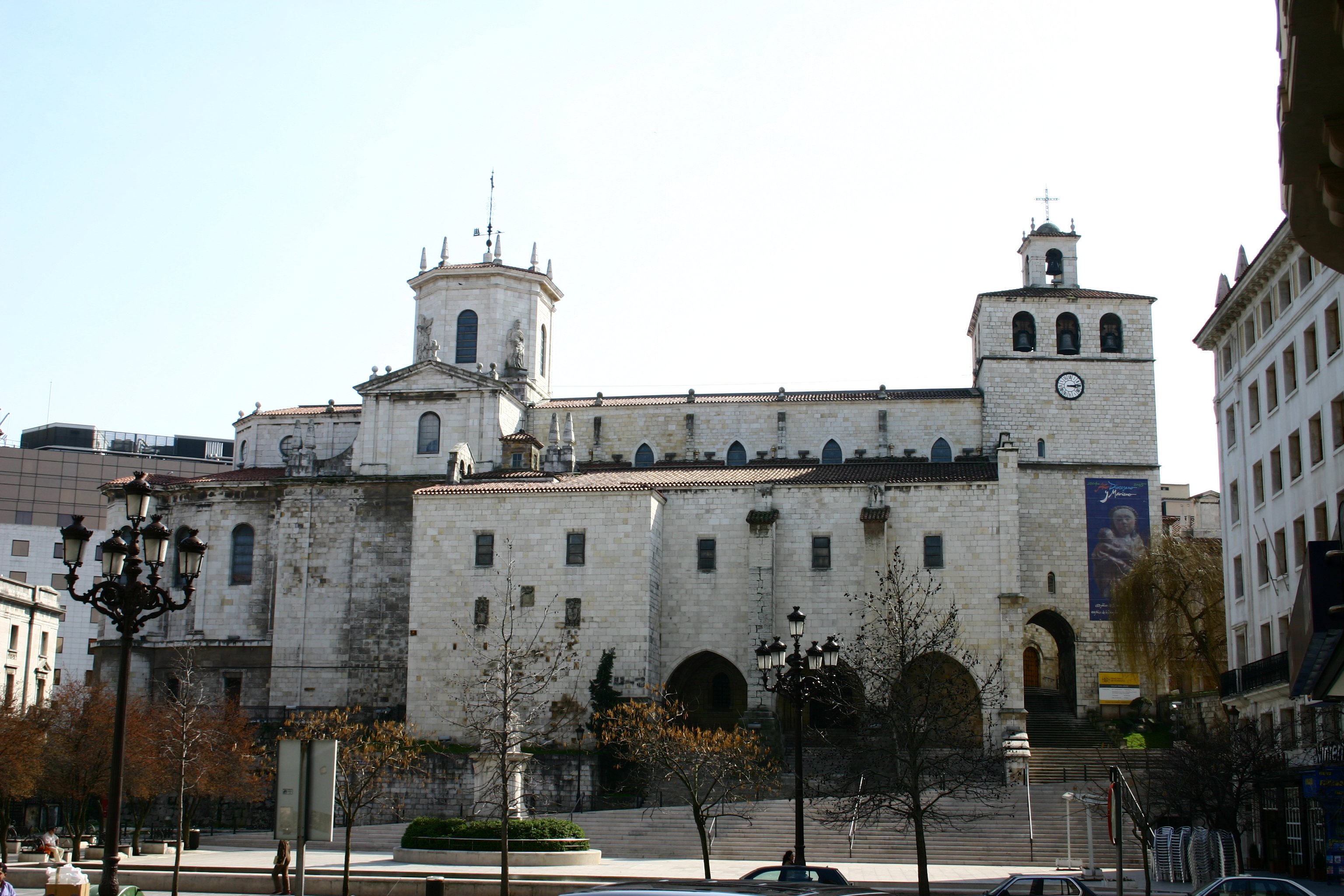
The numbers tell part of the story: 377 buildings destroyed, 1,783 homes lost, 508 businesses wiped out, 37 streets reduced to rubble across 14 hectares. The cathedral of Nuestra Senora de la Asuncion, the old Town Hall, the church of La Compania, and the palace of the Marquis of Villatorre were all destroyed or severely damaged. The headquarters of the regional newspaper El Diario Montanes burned. Approximately 10,000 people, roughly ten percent of Santander's population, lost their homes. About 7,000 were thrown into unemployment. Only one person died: Julian Sanchez Garcia, a firefighter from Madrid who succumbed to his injuries at Valdecilla hospital. But the material devastation was total. The fire destroyed an estimated 90 percent of the commercial premises in the city center, gutting the economic heart of Santander in a single weekend.
A City Rebuilt, A City Transformed
The reconstruction that followed was swift but selective, and it changed Santander's social geography permanently. The 115,421 square meters of vacated urban land in the physical center of the city represented an extraordinary opportunity for real estate development, and the Franco regime's priorities shaped what rose from the ashes. Wide boulevards replaced the medieval street grid, following the Ensanche model of orthogonal planning. The new Calvo Sotelo avenue was carved from the old Atarazanas street. Juan de Herrera Street was built as a commercial artery. The Plaza Porticada became the new civic center, housing the Civil Government, Treasury, and Chamber of Commerce. Working-class families who had lived in the old center were displaced to peripheral neighborhoods like La Albericia, Campogiro, and the Barrio Pesquero, housed in cheap, quickly built developments of notably low quality. By 1954 the reconstruction was largely complete, but the full rebuilding took twenty-five years.
The Fire's Long Shadow
Walk through central Santander today and the 1940s and 1950s architecture of the reconstructed center is immediately apparent, a stark contrast to the medieval character of other Cantabrian towns. The fire did not merely destroy buildings; it erased the physical record of centuries and replaced it with something designed to serve a different social order. The working classes were pushed to the margins. The commercial core was rebuilt for wealthier residents and business interests. In 2016, the seventy-fifth anniversary of the fire prompted a series of commemorations, photographic exhibitions, and the creation of a walking route through the affected area. The route traces the boundary of what the fire consumed, a boundary that, almost poetically, follows the walls of a medieval town that no longer exists.
From the Air
Located at 43.46N, 3.81W on the Cantabrian coast of northern Spain. Santander sits on a natural bay with its port and city center clearly visible from the air. The fire-affected zone corresponds roughly to the city center near the cathedral and waterfront. Nearest airport is Santander (LEXJ), immediately south of the city. Fly at 2,000-3,000 feet AGL over the bay for a clear view of the reconstructed center and its grid-pattern streets, which contrast visibly with the older neighborhoods that survived the fire.