1983 Borah Peak Earthquake
At 8:06 AM on October 28, 1983, the ground beneath central Idaho broke. A magnitude 6.9 earthquake, the largest in Idaho's recorded history, ripped a 21-mile gash along the western face of the Lost River Range. Two children died in Challis when a storefront collapsed on them. Eight states felt the shaking. And 150 miles east, Old Faithful geyser in Yellowstone began keeping different time, its eruption intervals mysteriously lengthened by forces traveling through the deep rock.
The Earth Splits
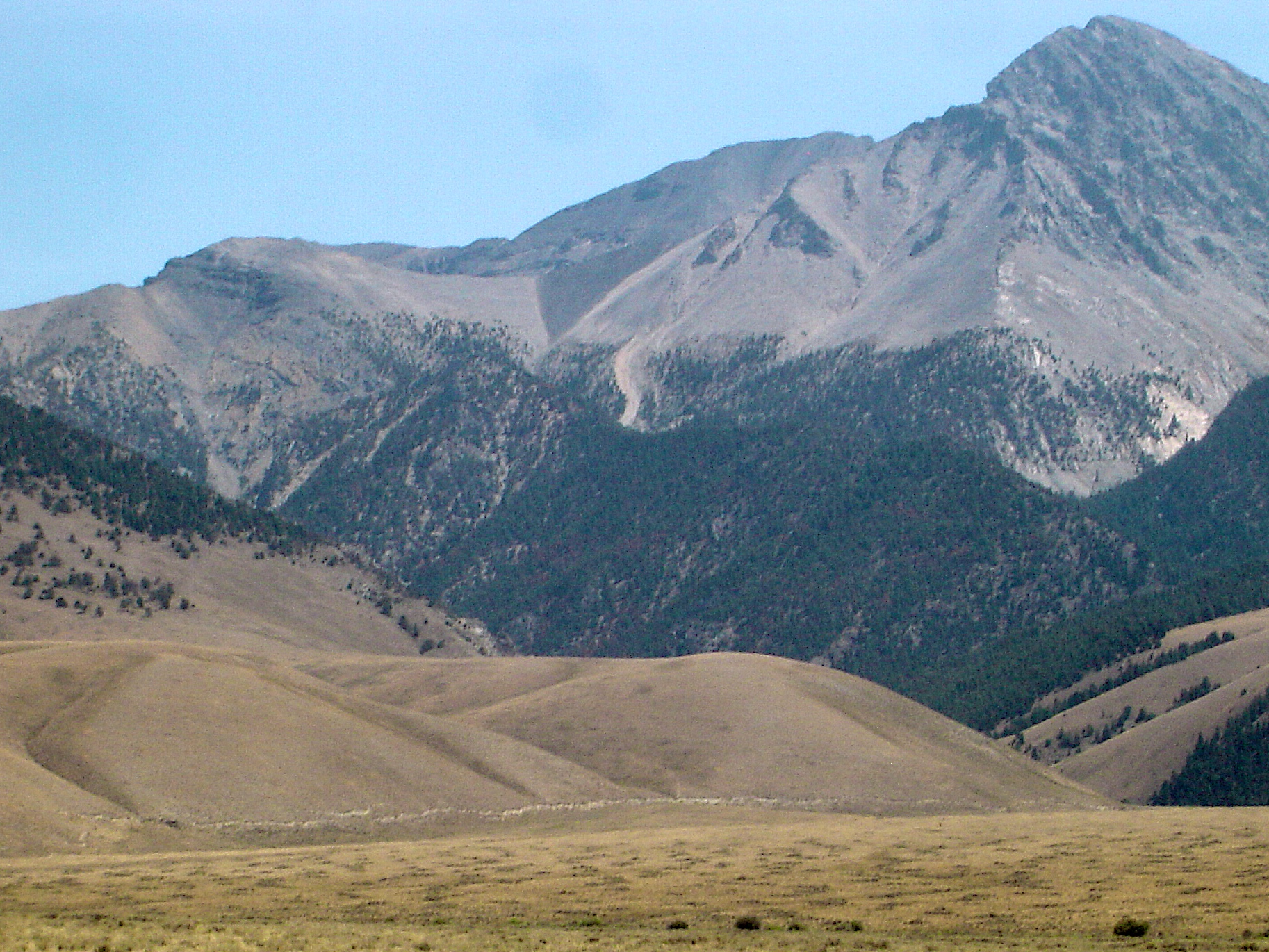
The rupture left its signature visible from the air. A 21-mile zone of fresh fault scarps traced a northwest-trending line along the Lost River Range, some scarps stretching 14 feet wide. Between West Spring and Cedar Creek, the ground had shattered into tilted blocks several meters across, the surface literally broken into pieces like fractured ice on a frozen lake. These scarps remain visible today, a permanent record of the moment the earth's crust gave way. The main shock lasted only seconds, but its violence left the landscape permanently altered. Geologists would later document a graben, a dropped block of earth between parallel faults, near Willow Creek, a textbook feature created in an instant.
Fountains of Sand
Near Chilly Buttes in Thousand Springs Valley, something strange erupted from the ground immediately after the main shock. Artesian fountains burst through the surface, gushing groundwater that carried sand and sediment upward in violent plumes. These sand blows formed small craters surrounded by aprons of light-colored sandy deposits. Observers reported that some fountains ran black with sediment while others flowed clear. The phenomenon occurred along waterways, particularly where small streams joined larger ones. Some blows continued for several minutes after the shaking stopped. The Big Lost River rose several inches as water was expelled from aquifers deep underground. The cause was liquefaction: water-laden sediment layers losing their structure and turning momentarily fluid, the ground itself becoming a temporary spring.
Main Street in Ruins
The towns of Mackay and Challis bore the earthquake's fury. Eleven commercial buildings and 39 homes sustained major damage; another 200 houses suffered lesser harm. Mackay, southeast of Challis along the Lost River, experienced the worst destruction. Most of the large buildings on Main Street were damaged to some extent, and eight were condemned and closed immediately after the quake. These were structures of brick, concrete block, and stone, materials that had seemed permanent until the ground beneath them moved. The two children killed in Challis became the human face of the disaster, their deaths a reminder that earthquakes in the rural West can be as deadly as those in any city.
Old Faithful's New Rhythm
One hundred fifty miles east of the epicenter, in Yellowstone National Park, the earthquake made itself known in an unexpected way. Old Faithful geyser, famous for its predictable eruptions, began keeping different time. The intervals between eruptions lengthened noticeably in the days following the quake and its aftershocks. The connection seems almost mystical: energy released along the Lost River Range somehow reaching through the rock to affect the plumbing of America's most famous geyser. Geologists understood the mechanism, subsurface pressure changes propagating through interconnected aquifer systems, but the effect remained remarkable. The earthquake had touched Yellowstone without ever reaching the surface there.
Aftershocks and Memory
The shaking did not end on October 28. Aftershocks continued for a full year, keeping residents on edge and reminding them that the earth beneath their feet remained unsettled. Nearly ten months after the main event, a magnitude 5.4 aftershock struck, powerful enough to make news on its own. The 1983 Borah Peak earthquake remains Idaho's largest recorded seismic event, a benchmark against which all subsequent tremors are measured. The fault scarps still trace their path along the Lost River Range, a visible reminder of the day the mountains moved. Geologists return regularly to study this outdoor laboratory, where the evidence of crustal failure remains fresh, exposed, and readable in the tilted blocks and dropped grabens of the Idaho highlands.
From the Air
Epicenter located at 44.08N, 113.80W in the Lost River Range of central Idaho. Borah Peak (12,662 ft), Idaho's highest point, rises nearby; maintain minimum 14,000 ft altitude for safe terrain clearance. Fault scarps visible along the western face of the Lost River Range, tracing a 21-mile northwest trend. Nearest airports: Challis (KLLJ) 25nm northwest, Salmon (KSMN) 50nm north. The Thousand Springs Valley east of the range shows evidence of the sand blows. Clear weather provides best viewing of the fault features; morning light emphasizes the relief of the scarps.