2014 Mount Ontake Eruption
It was 11:52 on a Saturday morning, the weather was perfect, and the autumn leaves on Mount Ontake were at their peak. Hundreds of hikers dotted the trails of Japan's second-highest volcano, many of them beginners drawn by the mountain's reputation as an easy and safe climb. Seven minutes earlier, there had been no significant warning. Then the ground opened. Superheated groundwater flashed to steam in a phreatic explosion, hurling rock and ash skyward in a column that would reach 11 kilometers above sea level. Within minutes, pyroclastic flows were cascading down the southwest flank at speeds that left no time to run. September 27, 2014, became the deadliest volcanic event in Japan since Torishima killed an estimated 150 people in 1902.
A Sacred Peak, Deceptively Quiet
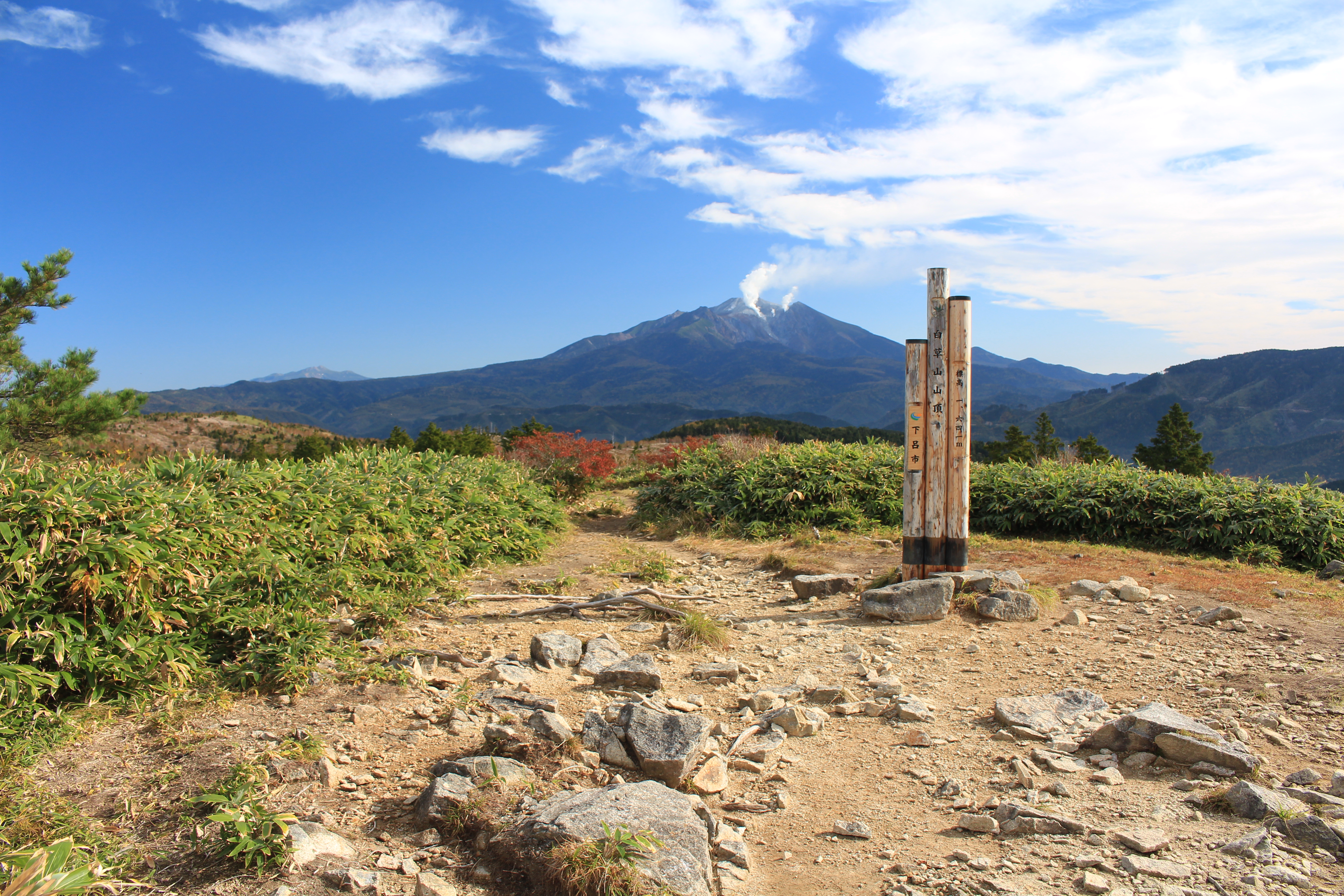
Mount Ontake rises 3,067 meters on the border of Nagano and Gifu prefectures, roughly 100 kilometers northeast of Nagoya and 200 kilometers west of Tokyo. It is the 14th-highest mountain in Japan and the country's second-tallest volcano after Mount Fuji. For centuries, Ontake has held deep spiritual significance as a sacred mountain in the Shugendo tradition, where ascetics, actors, and artists climbed its slopes seeking divine inspiration through meditative trances. Its popularity as a hiking destination grew because of its accessible trails and sweeping views of the Japanese Alps. Before 2014, the last fatal volcanic eruption in Japan had occurred at Mount Unzen in 1991, and Ontake itself had shown only minor activity since a 1979 eruption.
Without Warning
The eruption was phreatic -- driven not by fresh magma reaching the surface, but by groundwater superheating into steam deep within the mountain's hydrothermal system. This type of eruption is notoriously difficult to predict. The Japan Meteorological Agency had noted slightly elevated earthquake activity in the weeks prior, but the data did not meet the threshold for raising the volcanic warning level. No evacuation orders were issued. When the blast came, several hundred people were on the mountain, many near the summit. Ash and ballistic rocks rained down on hikers who had nowhere to shelter. The eruption plume reached a maximum height of 7,000 meters, and pyroclastic flows traveled more than 3 kilometers down the mountainside.
The Search Through Ash
The recovery effort unfolded in agonizing stages. By evening on September 27, six people were confirmed injured and three were believed buried under ash. The next morning, rescue teams found over 30 people in cardiac arrest near the summit -- a Japanese emergency services term for those showing no vital signs but not yet officially pronounced dead by a physician. Over the following two weeks, search teams worked in punishing conditions, probing ash-covered slopes and areas far from established trails. Fears of renewed volcanic activity repeatedly halted operations. Typhoon Phanfone shut down searches entirely on October 5 and 6. By October 11, the confirmed death toll stood at 56, with additional victims discovered in the days that followed. The final count reached 63 dead, with several others still missing.
Grief, Accountability, and the Limits of Prediction
One month after the eruption, authorities and residents gathered to mourn the 57 confirmed dead at that point and the 6 still missing. The disaster exposed a painful truth about phreatic eruptions: they can strike with almost no precursory signals that current monitoring can reliably detect. In January 2017, bereaved families of five victims filed a lawsuit against the national government and Nagano Prefecture, seeking 150 million yen in damages. They argued the warning level should have been raised based on the slightly elevated seismicity. The government countered that the Japan Meteorological Agency's protocols relied on additional data and historical patterns that had not indicated imminent danger. The case underscored a broader scientific challenge -- the gap between what volcanologists can measure and what they can predict.
From the Air
Located at 35.893N, 137.479E on the border of Nagano and Gifu prefectures in central Honshu. Mount Ontake's summit reaches 3,067 meters (10,062 feet), making it a prominent volcanic cone visible from considerable distance. The mountain sits approximately 100 km northeast of Nagoya and 200 km west of Tokyo. Nearest airports include Matsumoto Airport (RJAF) to the northeast and Chubu Centrair International Airport (RJGG) to the south. The volcanic crater and surrounding ash-scarred terrain are visible from altitude. Exercise caution regarding volcanic activity status; check Japan Meteorological Agency alerts before low-altitude approaches.