Abitibi Gold Belt
Val-d'Or means "Valley of Gold" in French, though there is no valley anywhere nearby. The name is pure aspiration -- a declaration stamped onto the Canadian Shield by prospectors who found what they were looking for in the ancient rock beneath their feet. The Abitibi gold belt stretches roughly 800 kilometers from Wawa, Ontario to Val-d'Or, Quebec, a seam of wealth stitched across the boreal wilderness of northern Ontario and western Quebec. Since 1901, more than 100 mines along this corridor have yielded over 170 million ounces of gold. The towns that sprouted along the belt wear their origins openly: Val-d'Or is the valley of gold, Kirkland Lake calls itself "the mile of gold," and Timmins was born in 1912 from the frenzy of the Porcupine Gold Rush. The geological engine driving all of this sits deeper still -- the Abitibi greenstone belt, a formation nearly 2.7 billion years old, forged on ancient seafloors during the Archean eon, when the continents themselves were still taking shape.
The Rush That Built a Region
The Porcupine Gold Rush began in 1909, and by 1912 the mining camps around what would become Timmins had hardened into something permanent. Three mines -- Hollinger, McIntyre, and Dome -- anchored the district and would collectively produce more than 45 million ounces of gold over the decades that followed. That output dwarfs the legendary Klondike Gold Rush, which yielded roughly 12 million ounces. The Porcupine area alone has produced 67 million ounces. Farther east, Kirkland Lake developed its own cluster of mines. The Kerr Addison Mine in Virginiatown became Canada's largest gold-producing mine at its peak. A 12-foot replica of a 1908 gold sovereign stands as one of Canada's oversized roadside attractions, commemorating the country's first gold coin, which was minted from Kerr Addison ore. Gold did not merely pass through these communities; it created them, named them, and defined the rhythm of their existence for over a century.
Forged in Deep Time
The Abitibi greenstone belt is one of the largest Archean greenstone belts on Earth, part of the Superior Province that forms the geological backbone of the Canadian Shield. These rocks formed between 2.8 and 2.6 billion years ago as volcanic eruptions built up layers of basalt, komatiite, and sediment on ancient ocean floors. Tectonic collisions folded and compressed the assemblages, trapping mineral-rich fluids that crystallized into veins of gold, copper, zinc, and silver. The greenstone belt has produced far more than gold alone: over 35 billion pounds of zinc, 15 billion pounds of copper, and 400 million ounces of silver have been extracted, most of it from in and around Timmins. The geology is a time capsule from an era when the planet's crust was still organizing itself, and the metals locked inside represent the remnants of hydrothermal systems that operated billions of years before the first complex life appeared.
Boom, Bust, and Renaissance
Gold mining in the Abitibi belt has never followed a straight line. The original rush towns boomed through the early twentieth century, weathered the Depression, surged during wartime demand, and then settled into steady production as the easiest deposits were exhausted. By the late twentieth century, many mines had closed. Then gold prices climbed. Between 2000 and 2010, two companies -- Osisko Mining and Detour Gold -- invested heavily in Malartic and Detour Lake, breathing new life into the corridor. The Canadian Malartic mine began commercial production in June 2011, projected to contribute approximately $3.25 billion to the regional economy over twenty years. The Detour Lake gold project near Cochrane, Ontario represented North America's fourth-largest undeveloped gold deposit at the time. Another $1.5 billion flowed into Matachewan, Ontario, where the Young-Davidson gold mine held 2.5 million ounces of reserves. The belt's story is cyclical: bust follows boom, but the gold remains in the rock, waiting for the economics to align.
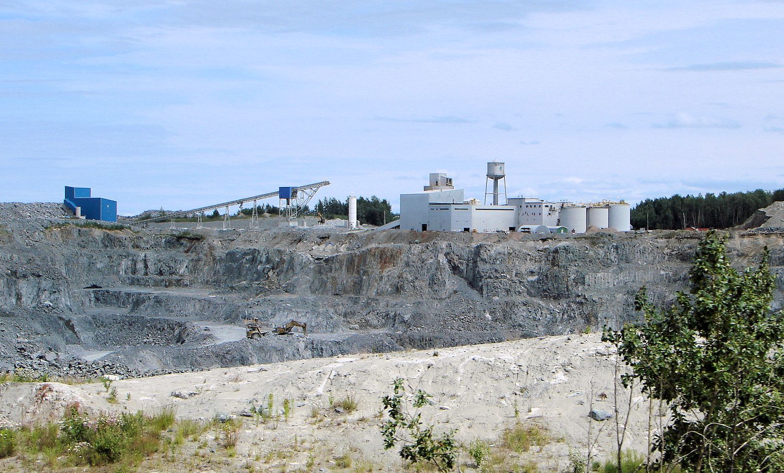
A Landscape Shaped by Extraction
From the air, the Abitibi gold belt reveals itself in scars and settlements. Open pits punctuate the boreal forest. Tailings ponds catch the light like pale mirrors against the dark spruce. The towns themselves -- Timmins, Kirkland Lake, Malartic, Val-d'Or -- sit in clearings carved from the bush, connected by highways that follow the logic of geology rather than geography. Dozens of mining companies, from global giants like Barrick Gold and Agnico Eagle to junior explorers working claims along the Destor-Porcupine Fault Zone, continue to probe the greenstone belt for new deposits. The landscape tells two stories simultaneously: the deep geological history of Archean volcanism that concentrated these metals, and the human history of prospectors, miners, and speculators who transformed a stretch of Canadian wilderness into one of the most productive mineral districts the world has ever known.
From the Air
Located at approximately 48.30°N, 80.80°W, centered in the boreal forest of northeastern Ontario. The belt stretches from Wawa in the west to Val-d'Or, Quebec in the east. From cruising altitude, look for the distinctive pattern of open pit mines, tailings ponds, and mining towns carved into otherwise unbroken spruce forest. Timmins (CYTS) is the primary airport along the belt's Ontario section. Val-d'Or Airport (CYVO) serves the Quebec end. Kirkland Lake Airport (CYKL) sits near many historic mine sites. Best viewed at 5,000-10,000 feet AGL for visibility of mine complexes against the boreal landscape. The terrain is relatively flat Canadian Shield with countless lakes and rivers threading through dense forest.