Aburra Valley
The name means 'the Painters.' When Spanish conquistadors first peered into this Andean valley in 1541, they found the Aburra people decorating textiles with such skill that the craft defined them. The Spaniards renamed the place the Valley of Saint Bartholomew, but the colonial name did not stick. The original one did. Today the Aburra Valley, or Valle de Aburra, holds nearly four million people across ten municipalities, making it one of the most densely populated valleys in South America. At its center sits Medellin, Colombia's second-largest city, and the river that carved this corridor still runs through it all -- from the heights of Caldas in the south to the lowlands of Barbosa in the north.
Ten Thousand Years in a Narrow Corridor
Archaeological evidence places human habitation in the Aburra Valley at least 10,500 years ago. By the fifth century, the valley hosted a web of indigenous communities -- the Aburra, Yamesi, Peque, Ebejico, Norisco, and Mani -- who cultivated maize, beans, and cotton, wove and decorated textiles, traded salt, and practiced goldsmithing. The Aburra were accomplished enough that their textile work gave the valley its enduring name. When Spanish colonizers arrived, they disrupted everything. Under colonial rule, the Aburra lost their lands and were forced into mines and feudal labor systems. Disease brought by Europeans, combined with brutal working conditions, drove the Aburra to extinction within the valley itself. Their descendants survive today in other parts of the Antioquia department, in regions like Uraba and the western and southern highlands.
The Conquistadors' Second Glance
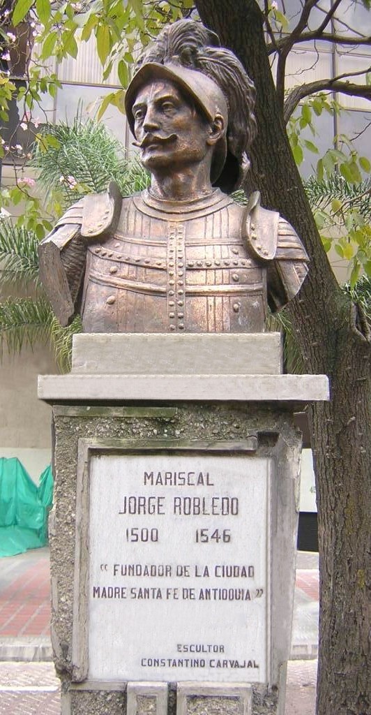
In August 1541, Marshal Jorge Robledo was stationed in what is now Heliconia when he spotted a valley in the distance. He sent Jeronimo Luis Tejelo to investigate, and Tejelo arrived at a flat plain on the night of August 23. The Spaniards were initially unimpressed -- the valley lacked obvious mineral wealth, and its indigenous inhabitants fought back. It took decades before European settlers returned in earnest. In 1574, Gaspar de Rodas petitioned Antioquia's Cabildo for four miles of land to establish herds; the council granted him three. By 1616, colonial administrator Francisco de Herrera y Campuzano had founded a settlement of eighty indigenous people called Poblado de San Lorenzo, in what is now Medellin's El Poblado neighborhood. A 1646 colonial law mandating the separation of indigenous people from mestizos and mulattos led to the construction of a new settlement at Ana, the site of today's Berrio Square and the Minor Basilica of Our Lady of Candelaria.
A Valley Becomes a Metropolis
Medellin became the provincial capital of Antioquia in 1674, and for the next two centuries it remained a modest colonial town clustered along the Santa Elena Creek and the Medellin River. Places that are now dense urban neighborhoods -- El Poblado, La America, Robledo, Manrique -- were rural townships separated by farmland. Towns like Envigado and Bello were tiny villages. That changed dramatically in the early twentieth century, when Medellin launched its industrial revolution. Textile mills, food processing plants, and other factories drew farmers from across Antioquia. By the 1960s, the provincial capital had ballooned past one million inhabitants. The growth swallowed the surrounding villages. Robledo, La America, La Floresta, and El Poblado merged into Medellin's urban fabric, and by the 1970s, the Metropolitan Area of the Aburra Valley had been formally established as Colombia's first metropolitan area.
A Geography That Shapes Everything
The valley runs sixty kilometers from south to north, carved through the Central Range of the Colombian Andes. The Medellin River, which begins in the heights of Caldas at the valley's southern end and flows north to join the Porce River, serves as both geographic spine and urban axis. At its widest, where Medellin spreads across the valley floor, the corridor stretches roughly ten kilometers between the eastern and western mountain walls. At its narrowest, near the municipality of Copacabana, it pinches to just three kilometers. The surrounding peaks reach as high as 3,100 meters at Padre Amaya, while the valley floor drops to 1,300 meters at its lowest point in the north. Ten cities occupy this corridor: Caldas at the highest elevation, Barbosa at the lowest, Medellin the most populous, and Bello a close second.
From the Air
Located at 6.232N, 75.568W in the heart of the Colombian Andes. The valley is unmistakable from the air -- a narrow, heavily urbanized corridor running north-south between mountain walls that rise to 3,100 meters. The Medellin River is visible as a dark line threading through the urban landscape. Approach via SKRG (Jose Maria Cordova International, Rionegro, east of the valley at 2,137m elevation) or SKMD (Olaya Herrera, located within the valley floor in central Medellin). The contrast between the green mountain slopes and the dense urban grid below makes the valley one of the most dramatic metropolitan landscapes visible from a cockpit.