Abyei
Draw a line between two countries, and Abyei falls on both sides. This 10,546-square-kilometer area straddling the Sudan-South Sudan border has been designated a "special administrative status" zone since the 2005 Comprehensive Peace Agreement, making it a legal condominium - part of both nations at once, governed by neither with finality. A referendum that was supposed to settle the question in 2011 has never been held. Ethiopian peacekeepers patrol its boundaries. Meanwhile, as diplomats argue over voter eligibility and cartographers redraw boundaries at The Hague, the Ngok Dinka who farm this land and the Misseriya nomads who graze their cattle through it every dry season continue to share the same rivers and pastures, as they have for at least three centuries.
The 1905 Line That Would Not Hold
Abyei's modern crisis traces back to a British administrative decision. From at least the eighteenth century, the Ngok Dinka - an agro-pastoralist subgroup of the Dinka people - lived permanently in the Abyei region. The Misseriya, nomadic Arab pastoralists based around Muglad in northern South Kordofan, moved their cattle south into the Bahr river basin each dry season. In 1905, after repeated Misseriya raids into Ngok Dinka territory, British colonial administrators transferred nine Ngok Dinka chiefdoms from the southern province of Bahr el Ghazal into the northern province of Kordofan. The logic was pragmatic: bring feuding groups under a single administration to keep the peace. When the British departed in 1956, they left the status of those nine chiefdoms unresolved. That ambiguity festered through two civil wars, decades of displacement, and the discovery of oil beneath the disputed ground.
Oil, Maps, and Arbitration
What makes Abyei intractable is not just identity but geology. Significant oil deposits, including portions of the Heglig oil field, sit beneath and adjacent to the disputed territory. The 2005 Comprehensive Peace Agreement established an Abyei Borders Commission to determine precise boundaries, but when the commission's findings displeased Khartoum, violence erupted. In May 2008, fighting between the Sudan People's Liberation Army and Sudanese government forces destroyed much of Abyei town itself. Publicist Roger Winter said the town had "ceased to exist." An estimated 25,000 civilians fled south. To break the deadlock, both sides agreed to international arbitration at the Permanent Court of Arbitration in The Hague. In July 2009, the tribunal redrew Abyei's boundaries, shrinking the area and placing the richest oil fields on the northern side. Both governments initially accepted the ruling. Implementation, however, proved far more elusive than agreement.
The Referendum That Never Came
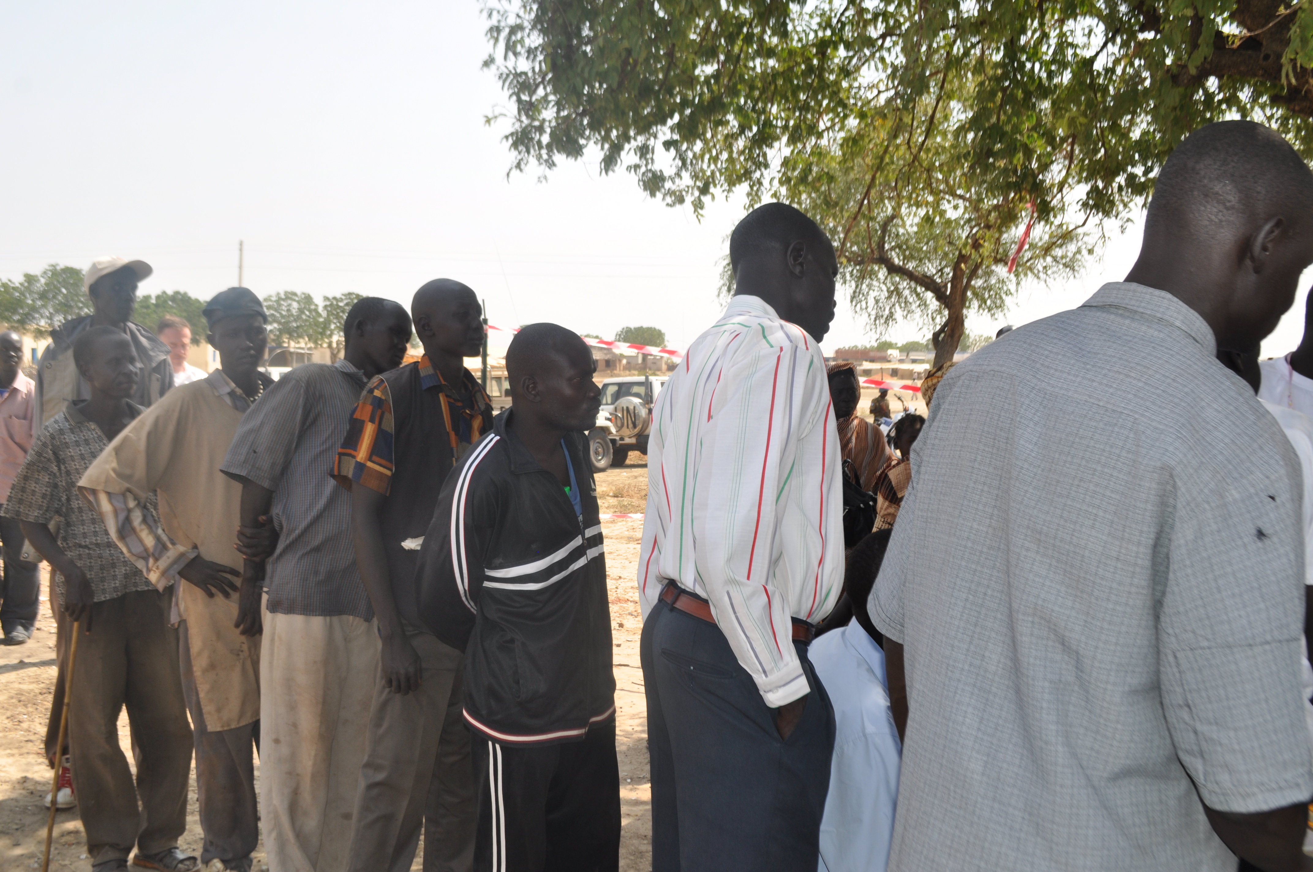
Under the terms of the peace agreement, Abyei's residents were to vote in a referendum alongside South Sudan's 2011 independence vote - choosing to join either Sudan or South Sudan. The question of who qualified as a "resident" proved impossible to resolve. The Ngok Dinka, as permanent inhabitants, would almost certainly vote to join the south. Including the Misseriya, who spend half the year in the area, would likely swing the result northward. The disagreement over voter eligibility has prevented the referendum from being held at all. In May 2011, as South Sudan prepared for independence, Sudanese tanks entered Abyei town. Most residents fled. The southern government called it an act of war. By June, an African Union panel led by former South African President Thabo Mbeki was attempting to de-escalate through talks in Addis Ababa. A demilitarization deal was reached on June 20, 2011, and Ethiopian peacekeepers under the United Nations Interim Security Force for Abyei began arriving in July.
Between Two Flags
Abyei exists today in a state of suspended sovereignty. Ethiopian peacekeepers from UNISFA maintain order under a mandate periodically renewed by the UN Security Council - though in 2024, one peacekeeper was killed when their base in Agok was attacked. Neither Khartoum nor Juba has relinquished its claim. The Ngok Dinka organized their own unofficial referendum in October 2013, voting overwhelmingly to join South Sudan, but the result carried no legal weight. The area remains formally part of both countries and effectively governed as a buffer zone. For the people who live here, the limbo is not abstract. Schools that taught in Arabic before 2005 now teach in English. Families displaced by the 2008 and 2011 fighting have scattered across both nations. The Misseriya still bring their cattle south each dry season, following routes older than any border. What Abyei demonstrates, more than anything, is how colonial boundaries drawn without consulting the people who live within them can generate conflicts that outlast the empires that drew them.
From the Air
Located at 9.07N, 28.43E on the Sudan-South Sudan border in the Abyei Special Administrative Area. The terrain is flat, semi-arid savanna transitioning to grassland, with the Bahr el Arab (Kiir) river system visible as a darker green corridor through the brown landscape. Abyei town sits in a featureless plain - from altitude, scattered settlements and cattle tracks mark the landscape. Nearest airports: Abyei has a small airstrip used by UN flights; Wau Airport (HSWW) in South Sudan is approximately 200 km to the southwest. Ethiopian UNISFA peacekeeping bases are visible as organized compounds. The Heglig oil field infrastructure to the north may be visible as industrial installations in otherwise pastoral terrain. Best viewed at 3,000-5,000 feet where the border region's contested emptiness becomes apparent.