ACE Basin
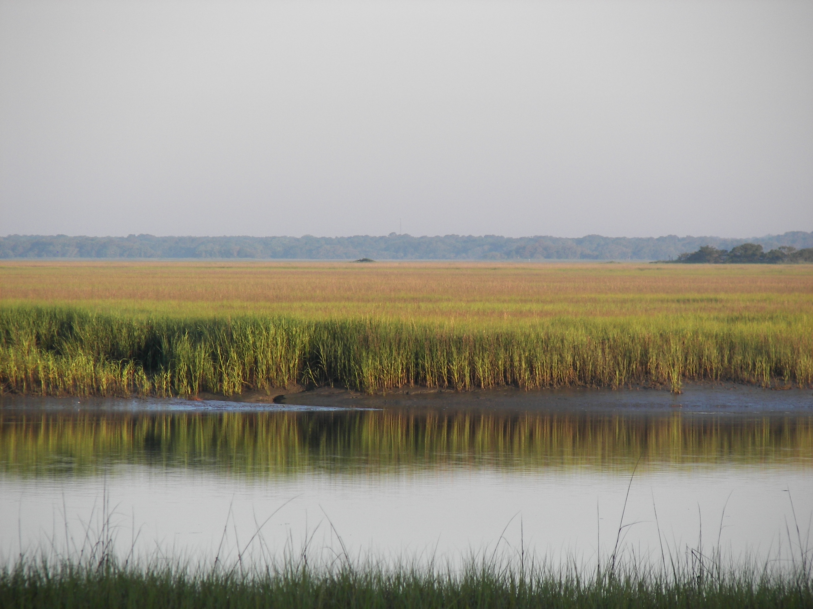
From the air, the ACE Basin looks like the coast forgot to build anything. Three hundred and fifty thousand acres of salt marsh, tidal creek, hardwood forest, and barrier island stretch between Charleston and Beaufort with almost nothing vertical breaking the horizon. No resort towers, no subdivisions, no marinas bristling with white hulls. The Ashepoo, Combahee, and Edisto rivers -- the A, C, and E that give this place its name -- braid through the Lowcountry and empty into St. Helena Sound, carrying the tannin-dark water of the interior out to the Atlantic. It is one of the largest undeveloped estuaries on the eastern seaboard, and it nearly did not survive the twentieth century.
Plantation Country, Emptied
Before the Civil War, rice plantations lined the rivers of the ACE Basin, their impounded fields engineered by enslaved laborers who understood tidal hydrology well enough to flood and drain thousands of acres on schedule. The war destroyed that system. Only three plantation homes survived in the entire basin. The land, no longer profitable for agriculture, reverted to something closer to wildness. Hunters and outdoorsmen moved in where planters had moved out, and for the better part of a century the ACE Basin existed in a kind of productive neglect -- too remote for development, too soggy for farming, and too beautiful for anyone who found it to want to share.
The Developers at the Gate
That isolation could not last. By the 1970s and 1980s, coastal development was eating through the South Carolina shoreline at an alarming pace. Hilton Head had transformed from a quiet sea island into a resort destination, and developers began eyeing the ACE Basin's waterfront acreage. Concerned citizens pushed back. In 1988, they formed the ACE Basin Task Force, a coalition that pulled together the U.S. Fish and Wildlife Service, the South Carolina Department of Natural Resources, The Nature Conservancy, Ducks Unlimited, and dozens of private landowners. The formula was unusual: rather than locking the land behind federal fences, the partnership used conservation easements that allowed property owners to keep their land while permanently restricting development. Senator Fritz Hollings secured $53.8 million in federal funding. Ted Turner and the descendants of the RR Donnelley printing fortune contributed land and endowments. By the time the task force celebrated its thirtieth anniversary in December 2019, more than 250,000 acres had been placed under some form of protection.
A Web of Wild Places
The ACE Basin is not a single park but a patchwork of overlapping preserves. The Ernest F. Hollings ACE Basin National Wildlife Refuge covers 11,815 federally protected acres across two units along the Edisto and Combahee rivers, with its headquarters in the historic Grove Plantation House. The ACE Basin National Estuarine Research Reserve, formed in 1992 as a partnership between NOAA and the state, monitors water quality and wildlife across more than 99,000 acres. Bear Island Wildlife Management Area draws hikers, birders, and anglers from February through October. The Donnelley Wildlife Management Area stays open year-round, its mix of pine forest, bottomland hardwood, and managed wetlands supporting everything from wild turkey to white-tailed deer. Farther out, the islands of the St. Helena Sound Heritage Preserve offer primitive camping and archery hunting on remote stretches of coastline that have barely changed in centuries.
Water Roads and Boat Landings
The principal highway through the ACE Basin is U.S. Route 17, locally known as the ACE Basin Parkway, which skirts the northern edge of the protected lands and connects Charleston, Beaufort, and Savannah. But the real roads here are made of water. Twenty-three boat landings dot the region, maintained by state and county agencies, with four designated for canoes and kayaks only. Small communities -- Bennetts Point, Green Pond, Jacksonboro, Wiggins, Willtown Bluff -- cling to the edges of the basin like barnacles on a piling. The largest nearby town is Walterboro, reachable via state highways 303 and 64. National Geographic featured the basin in a November 2014 spread celebrating twenty-five years of conservation. From above, the ACE Basin reveals what the entire Atlantic coast once looked like: a vast, breathing wetland where rivers meet the sea with nothing in between.
From the Air
Located at 32.654N, 80.545W, the ACE Basin stretches across Colleton, Charleston, and Beaufort counties along the South Carolina coast between Charleston and Beaufort. The basin is enormous -- roughly 350,000 acres -- and is identifiable from the air by its vast expanse of undeveloped salt marsh, meandering tidal creeks, and the three river systems (Ashepoo, Combahee, Edisto) draining into St. Helena Sound. Nearest airports: Beaufort Executive Airport (KARW) to the south, Charleston Executive Airport (KJZI) to the north, and Walterboro-Colleton County Airport (KRBW) to the northwest. Best viewed at 3,000-5,000 ft AGL to appreciate the scale of the undeveloped estuary. The contrast with developed coastal areas to the north and south is striking from altitude.
Sources
- ACE Basin - Wikipedia
- Ernest F. Hollings ACE Basin NWR - U.S. Fish & Wildlife Service
- ACE Basin Task Force Project - SC DNR
- ACE Basin National Estuarine Research Reserve - NOAA
- Low Country Legacy - National Geographic (November 2014)
- Gathering wildlife make SC's ACE Basin more special after 30 years - Post & Courier