Admiralty Inlet
Every ship that enters or leaves Puget Sound, from container vessels bound for Seattle's waterfront to Navy destroyers heading to Bremerton, must pass through a bottleneck only six kilometers wide. Admiralty Inlet is the narrow strait between Whidbey Island and the Olympic Peninsula where the Strait of Juan de Fuca funnels into the vast inland sea of Puget Sound. Tidal currents here can reach six knots, strong enough to challenge even powered vessels, and nearly all the seawater that fills and drains the Sound during each tidal cycle surges through this single passage. It is a geographic chokepoint with strategic, ecological, and navigational significance far beyond its modest width.
Two Names, Two Empires
The Spanish found it first. In 1790, Manuel Quimper led an expedition north from Mexico along the Pacific coast, and his pilot Juan Carrasco sighted the entrance to a body of water they mistook for a bay. Carrasco named it Ensenada de Caamano, honoring the Spanish naval officer Jacinto Caamano. Two years later, the British explorer George Vancouver sailed through and recognized the inlet for what it was: the gateway to an enormous inland waterway. Vancouver named it Admiralty Inlet after his superiors, the Board of Admiralty in London. The Spanish name was not entirely lost; it migrated east and attached itself to Camano Island, the land mass on the opposite side of Whidbey Island. In the Pacific Northwest, the ghosts of competing empires linger in the place names.
The Triangle of Fire
The strategic value of controlling Admiralty Inlet was not lost on the United States military. In the late 1890s, the federal government constructed three fortifications around the inlet's narrowest point: Fort Worden near Port Townsend on the Olympic Peninsula side, Fort Casey on Whidbey Island's western shore, and Fort Flagler on Marrowstone Island at the inlet's eastern edge. Together they formed what military planners called the Triangle of Fire, a defensive ring of coastal artillery designed to prevent any hostile fleet from reaching the naval installations and cities of Puget Sound. The forts were armed with disappearing guns that could be raised above their emplacements to fire, then lowered below the parapet for protection. No enemy fleet ever tested the defenses. All three forts are now state parks.
Port of Entry
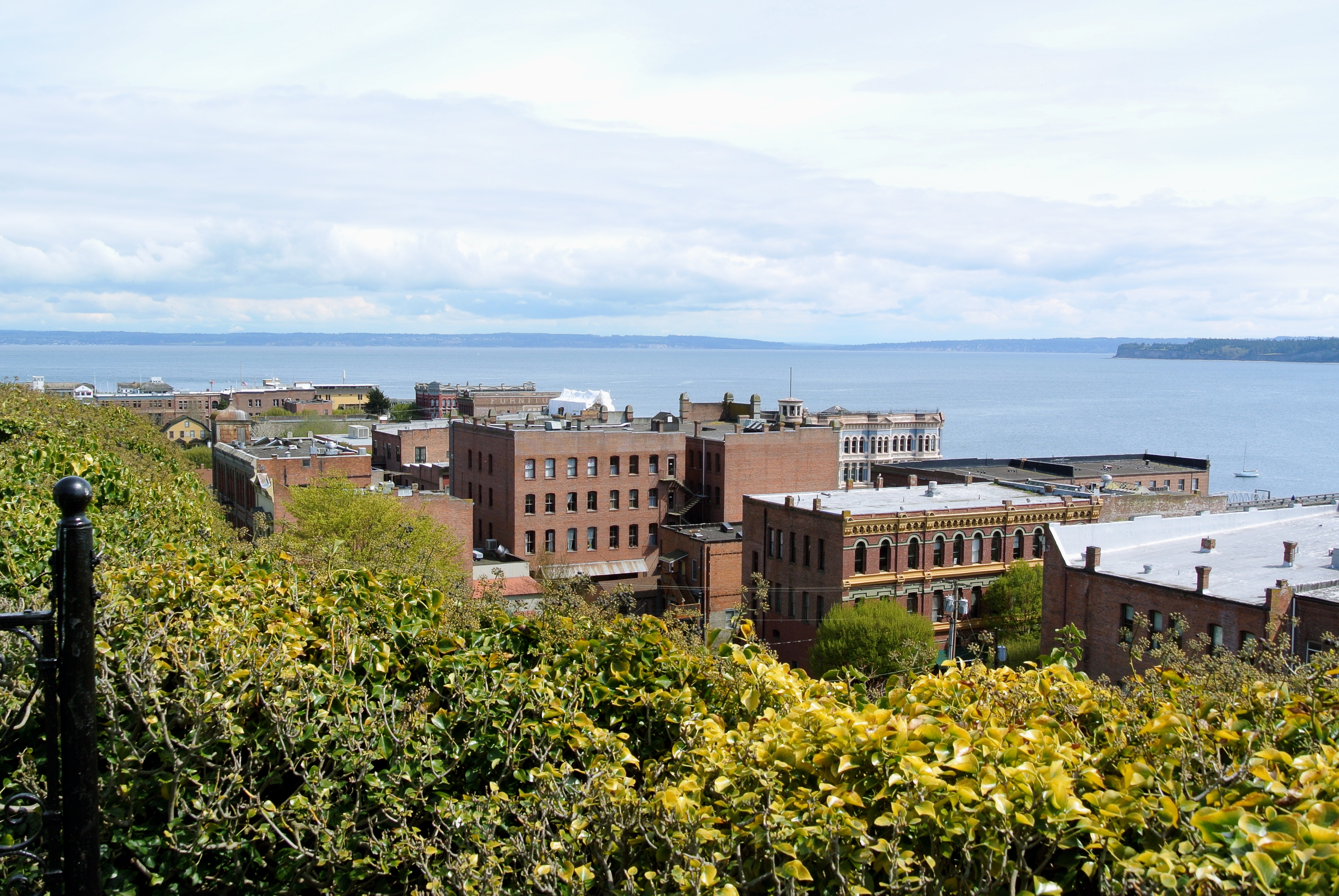
Because Admiralty Inlet is the only deepwater entrance to Puget Sound, the town of Port Townsend on the Quimper Peninsula became the official port of entry for the entire Sound region during the early days of American commerce. Every vessel had to stop there for customs inspection before proceeding south to Seattle, Tacoma, or any other port. The only alternative routes into the Sound, Deception Pass and the Swinomish Channel, are too shallow and narrow for large vessels. This geographic monopoly made Port Townsend briefly one of the most important cities in Washington Territory, its Victorian downtown built on the expectation of a booming future that ultimately migrated south to Seattle. Today the Keystone-Port Townsend ferry run of Washington State Ferries crosses the inlet daily, linking Whidbey Island to the Olympic Peninsula along the State Route 20 corridor.
The Pulse of the Sound
Admiralty Inlet covers 437 square kilometers with a mean depth of 35 meters, but its importance lies in the water that moves through it rather than the water that sits within it. Twice daily, the tide pushes cold, nutrient-rich ocean water from the Strait of Juan de Fuca through the inlet and into Puget Sound, then pulls it back out again. This tidal exchange sustains the Sound's marine ecosystem, delivering oxygen and nutrients to the deep basins where salmon, orcas, and Dungeness crab depend on it. A proposed tidal power project once aimed to harness the inlet's powerful currents for electricity generation, but the costs of monitoring the impact on marine wildlife proved prohibitive, and the project was canceled. The currents continue to flow, ungoverned, as they have for millennia.
From the Air
Admiralty Inlet stretches between Whidbey Island (east) and the Olympic Peninsula (west), centered at approximately 48.07°N, 122.66°W. The narrowest point is between Point Wilson (with its lighthouse on the Port Townsend side) and Admiralty Head Lighthouse on Whidbey Island. Best viewed from 3,000-5,000 ft AGL. The Keystone ferry crossing is visible as a thin wake line. Nearest airports: 0S9 (Jefferson County International, 5 nm W), KNUW (NAS Whidbey Island, 12 nm N), W10 (Whidbey Airpark, 8 nm E).