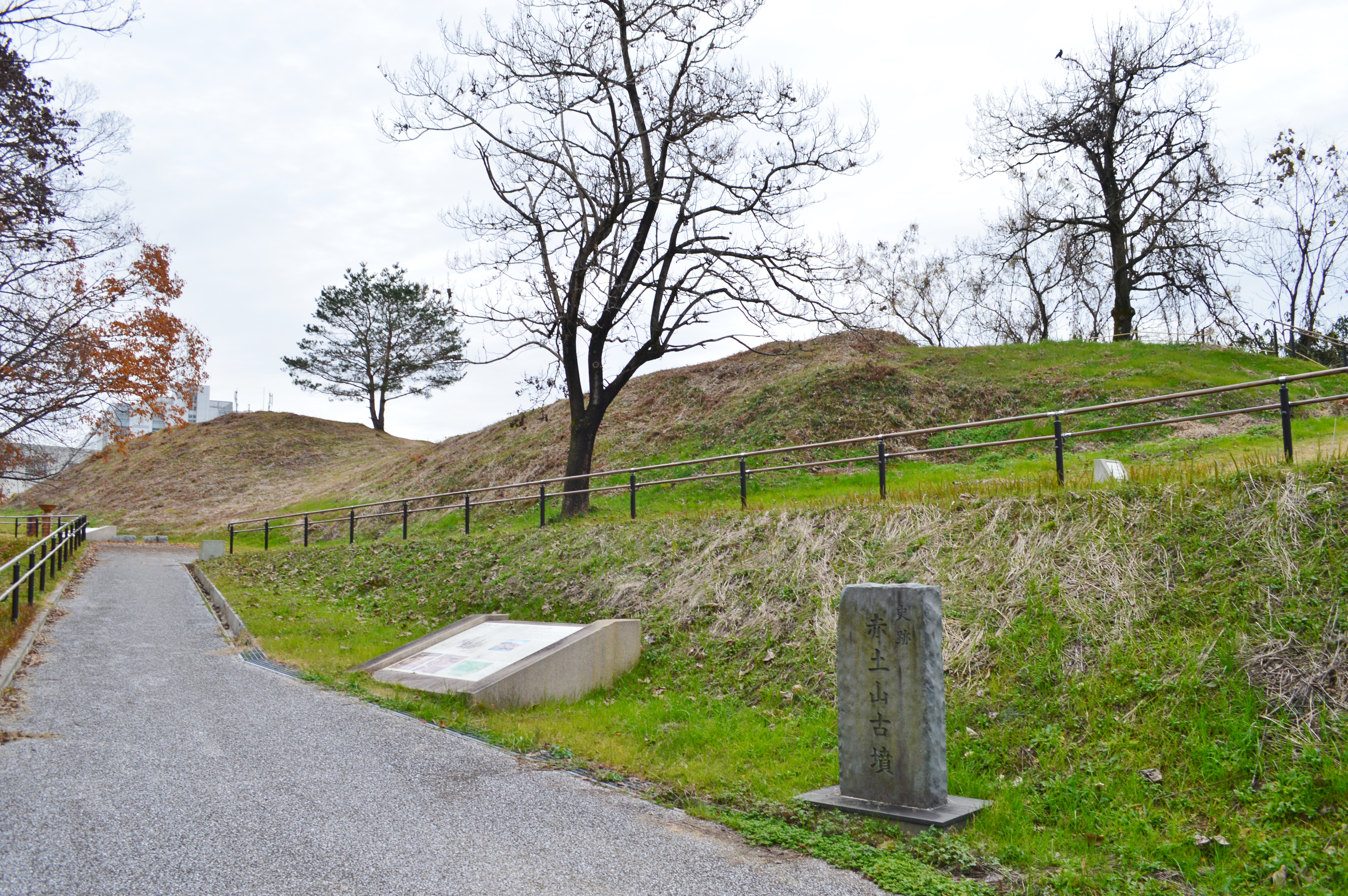
Akatsuchiyama Kofun: The Keyhole in the Hills
Seen from above, the shape is unmistakable -- a keyhole cut into the hills of the Nara Basin. One end is square, the other circular, and the whole form stretches roughly 110 meters across the ridgeline of Tōdaijiyama in the city of Tenri. This is the Akatsuchiyama Kofun, a burial mound from the early Kofun period that was built to honor someone important enough to require a monument visible from the sky. The Japanese have a word for this type of tomb: zenpō-kōen-fun, meaning a keyhole-shaped tumulus, and thousands were built across the archipelago between the third and seventh centuries. Akatsuchiyama stands out among them -- not for its size, though it is substantial, but for what nine archaeological excavations since 1987 have pulled from its earth: clay coffin fragments stained with vermilion, stone bracelets, and rows of cylindrical haniwa clay figures that were found still standing upright, guarding the mound exactly where they were placed some sixteen hundred years ago.
The Shape of Power
The keyhole-shaped tomb is one of ancient Japan's most distinctive architectural forms. The Akatsuchiyama Kofun sits in the southeastern part of the Nara Basin, on an east-west ridge called Tōdaijiyama, surrounded by a cluster of burial mounds known as the Tōdaijiyama Kofun Group -- five keyhole-shaped tombs and forty to fifty smaller circular and square tombs dating from the early to middle Kofun period. Akatsuchiyama's remaining mound length measures 103.5 meters, with an estimated original length of 110 meters. The entire exterior was once covered in fukiishi -- a layer of cobblestones placed deliberately over the surface of the mound, giving it a finished, almost armored appearance. The posterior circular portion measures approximately 44 by 33 meters, with rounded corners and a projection at the tip that gives it a unique shape even among its keyhole-shaped peers.
Sentinels in Clay
The grave goods tell the story. Excavations of the sedimentary soil on the south side of the rear mound -- where a landslide destroyed the original burial chamber -- revealed fragments of a clay coffin, traces of vermilion pigment, stone bracelets, and stone replicas of ritual objects. But the most striking discoveries were the haniwa. These hollow clay figures, placed in rows around the perimeter of the mound, served as guardians and markers of sacred space. At Akatsuchiyama, the haniwa are predominantly cylindrical forms arranged in lines, but the collection also includes figurative pieces shaped like houses, lids, and chickens. During excavation, some rows of cylindrical haniwa were found still standing in place -- an extraordinary survival across more than a millennium and a half. The mound also yielded Haji ware pottery, linking the tomb to the domestic material culture of its era.
The Wani Clan's Legacy
Based on the excavated remains and the tomb's position within the Tōdaijiyama group, archaeologists believe the Akatsuchiyama Kofun was built for a member of the Wani clan, one of the powerful families that dominated the Yamato heartland during the early Kofun period. The Wani were influential figures in the politics and culture of ancient Japan, and their cluster of tombs in the Tenri area speaks to generations of accumulated power and territorial control. The south side of the mound collapsed in a landslide at some point in history, and the front end was leveled, but enough remained to earn designation as a National Historic Site of Japan in 1992. The site was developed into a public park in 2009, accessible by a twenty-minute walk from Ichinomoto Station on the JR West Sakurai Line, transforming an ancient power statement into a quiet green space where visitors can trace the outline of a keyhole that once announced a ruler's immortality.
From the Air
Located at 34.619°N, 135.840°E in the Tōdaijiyama hills, southeastern Nara Basin. The keyhole shape of the tumulus is best appreciated from directly above at 1,500-3,000 feet AGL. The mound sits among the Tōdaijiyama Kofun Group, so multiple burial mound outlines may be visible in the surrounding hillside. Nara is on the eastern edge of the Osaka-Kobe-Kyoto metropolitan corridor. Osaka Itami Airport (RJOO) lies approximately 18 nautical miles to the west. Kansai International Airport (RJBB) is about 30 nautical miles to the southwest. Nara Airfield (RJNN) is the closest small facility.