Alamo Canal
Charles Rockwood made the decision "after mature deliberation," according to his own account — which is a careful way of saying that a man facing bankruptcy chose to cut a hole in the bank of the Colorado River. That choice, made in 1904, eventually sent the entire flow of the Colorado into an inland desert basin for two years. The Salton Sea is still there.
The Canal That Would Irrigate the Desert
For decades before the Alamo Canal was built, people had noticed that the Colorado occasionally flooded southeast into a vast natural sink called the Salton Sink. The Colorado Desert, stretching from the river west into California, sat below sea level, waiting. O. M. Wozencraft was among the first to propose a deliberate diversion — channel the river through the dry bed of the Alamo River and irrigate what would become the Imperial Valley.
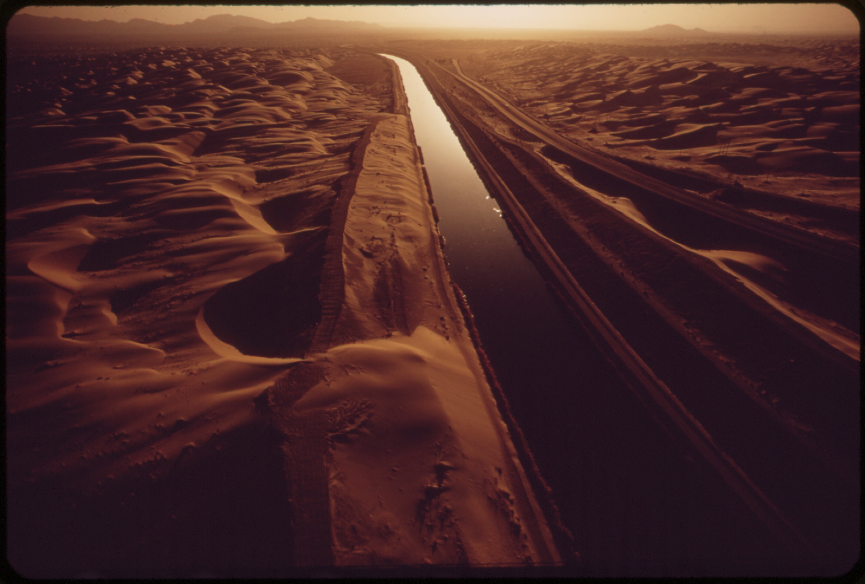
Engineer George Chaffey of the California Development Company turned the vision into construction starting in 1900. The canal's intake — known as the Chaffey Gate — was built at Pilot Knob, just inside the United States, where a rock foundation could support the wooden headgates. The canal then crossed into Mexico and ran parallel to the Colorado for about four miles before cutting west to the head of the Alamo River. The detour through Mexico avoided the Algodones Dunes, which would have required expensive engineering to cross.
The first irrigation water reached the Imperial Valley in 1901. By 1902, larger flows were arriving, and farms were blooming in what had been desert.
The Decision That Made the Salton Sea
By 1904, silt had clogged the canal, dramatically reducing its capacity. Imperial Valley farmers — many of whom had staked everything on the promise of irrigation — were desperate. Rockwood, whose California Development Company was already facing bankruptcy, chose an engineering shortcut: rather than dredging the silted intake, he directed workers to cut a new intake breach in the Colorado's bank about four miles south of the existing headgates.
The problem was that the new breach had no headgates. When the seasonal floods came in 1904, the water poured freely through the opening and into the Salton Sink. The following year, a third breach was cut — this one described as the "Lower Mexican Intake" — with the same fatal flaw. At times during the 1904 to 1906 flood seasons, the entire Colorado River was flowing into the desert rather than to the Gulf of California. The Salton Sink filled and became the Salton Sea.
Ruin, Lawsuits, and Legacy
The consequences were severe and lasting. The New Liverpool Salt Company's works, which had operated in the Salton Sink, were destroyed. The courts awarded the company $458,246.23 against the California Development Company in 1908. Southern Pacific Railroad, which had spent heavily repairing the breaks, held a judgment of $3,772,128.52 against the same company. By 1915, total debts exceeded $5 million. California Development went bankrupt, and all its assets passed to Southern Pacific.
In 1911, Imperial Valley farmers formed the Imperial Irrigation District. By 1916, the district had purchased the canal infrastructure and assumed operations. The district continued running the Alamo Canal system until the All-American Canal was completed in 1940, entirely within United States territory, eliminating the reliance on a route through Mexico. By 1942, the All-American Canal was the sole water supply for the Imperial Valley, and the Alamo Canal fell into disuse.
What Remains
Disused headgates at Hanlon Heading mark where the Alamo Canal system once diverted the Colorado. The Chaffey Gate, the original wooden intake, was located about 100 meters south of those concrete headgates. Old photographs show crews erecting dikes, workers in canvas clothes against the glare, the muddy Colorado flowing into channels cut by hand.
The Salton Sea — the accidental lake created by the canal's failure — remains today, shrinking and increasingly saline, a continuing legacy of that "mature deliberation" in 1904. From the air, you can see its silver expanse catching the desert light, about 60 miles northwest of where the Alamo Canal once drew its water.
From the Air
The Alamo Canal intake area is near 32.64°N, 114.86°W, near Pilot Knob at the California-Arizona border. The canal route ran roughly parallel to the Colorado River south into Mexico before turning west. The Algodones Dunes are visible to the west. Nearest airport: Yuma International Airport (KNYL), about 15 miles to the east.