Alamos
Two tall white rock formations on Mount Alamos look, if you squint the right way, like hooded monks. The conquistador Francisco Vasquez de Coronado camped below them in 1540 and called the place Real de los Frailes, the Mining Camp of the Friars. By the 1680s, silver was pouring out of the surrounding hills, and the settlement that grew up around those monk-shaped rocks would become the northernmost silver city in Mexico, the financial engine behind expeditions that reached San Francisco Bay, and eventually one of the most beautiful ghost towns in the Americas.
Silver and the Navarrese Network
The silver mines at Los Frailes were officially founded in 1683, at a moment when ambitious Spaniards from Navarre were building networks of power across northwestern New Spain. Isidro Atondo de Antillon, who had won the politically contested position of Alcalde Mayor of Sinaloa in 1673, used Alamos as a base for expeditions into Baja California alongside the Jesuit Eusebio Kino. The town sat at a crossroads connecting Sinaloa, Sonora, Chihuahua, Arizona, and the Baja California peninsula, and its wealthy silver merchants operated with remarkable independence from both Madrid and Mexico City. The haciendas that still line the cobblestone streets were built by these financiers, men whose silver funded ships in the Gulf of California and pack trains across the desert.
From Los Frailes to San Francisco
Alamos's most consequential contribution to history may be the settlers it supplied. In 1775, Captain Juan Bautista de Anza II recruited settlers across Sonora and Sinaloa, drawing more colonizers from Alamos than from any other single town -- some 30 citizens joined what became an expedition of nearly 300 people. The trek was financed in part by Alamos's silver mine owners. It opened the land route to Alta California, the path that would eventually connect the Spanish missions all the way to San Francisco Bay. Felipe de Goycoechea, son of Alamos merchants, later commanded the presidio on the Santa Barbara Channel until 1803. The connection between this remote Sonoran town and the founding of California runs deep and direct.
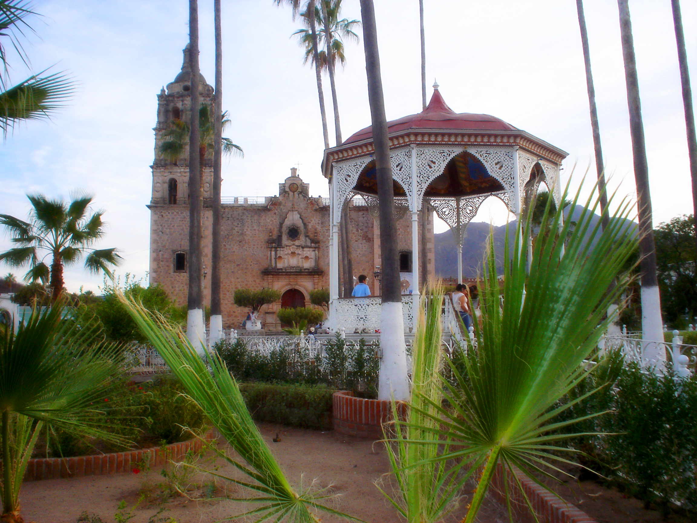
Capital, Then Ghost Town
In the early 1800s, Alamos became the capital of the state of Occidental, a territory encompassing modern Sonora, northern Sinaloa, parts of Baja California, and southern Arizona. But when silver prices collapsed in the early 20th century, the wealth evaporated and the people followed. The Mexican Revolution accelerated the exodus. By the 1930s, the city's grand colonial mansions stood empty and crumbling, their arched portales collecting dust. Only a few hundred residents remained in what had been a thriving center of thousands. The Church of La Purisima Concepcion still anchored the Plaza de Armas, but the congregation had thinned to almost nothing.
The Americans Who Moved In
In the late 1940s, an American farmer named William Levant Alcorn bought one of the decaying mansions, restored it, and opened a hotel. The publicity attracted other foreigners, and a slow restoration movement began. By 1955, the town had electricity from dusk to midnight. By 1960, power ran around the clock, generated at a dam on a nearby river. In the 1980s, students from the University of Sinaloa cataloged 185 structures worthy of historic monument status. In 2005, the Mexican government designated Alamos a Pueblo Magico. Today, the town hosts the nine-day Festival Alfonso Ortiz Tirado each January, honoring the locally born tenor once known as El Tenor de las Americas, and the Alamos Alliance, an annual economics summit that has earned the town the nickname "Little Mexican Davos."
Birds, Canyons, and a Jet-Rated Runway
The Sierra de Alamos-Rio Cuchujaqui Biosphere Reserve, just outside town, holds what researchers consider the most species-rich subtropical habitat in the Northern Hemisphere. Hundreds of bird species make their southern migration terminus here, drawing serious birders from around the world. The reserve's Cuchujaqui Creek has become a subject of international scientific study. Alamos also serves as a gateway to the Copper Canyon, with charter flights available from its jet-rated airport. More than 20 hotels and bed-and-breakfasts accommodate visitors in a town where the streets are still cobblestoned, the portales still arch overhead, and the monk-shaped rocks on the mountainside still keep watch.
From the Air
Located at 27.02N, 108.94W in the foothills of the Sierra Madre Occidental in southeastern Sonora. Alamos has a jet-rated airport (XALA) that accommodates general aviation from Mexico, the US, and Canada. The town sits in a valley surrounded by subtropical forest that transitions to Sierra Madre pine-oak at higher elevations. Best viewed at 3,000-5,000 feet AGL. The colonial town center with its distinctive architecture is visible from altitude. Charter service to Copper Canyon areas is available. The nearby Adolfo Ruiz Cortinez Dam and Reservoir (El Mocuzarit) is a prominent landmark 16 km northwest.