Alishan National Scenic Area
The alarm goes off before 4 am, and nobody complains. Visitors file onto the Chushan Line train in darkness, rattling uphill through cypress forest to a viewing platform where they wait for the show. When it arrives, the sunrise over Yushan -- Taiwan's highest peak at 3,952 meters -- paints the sea of clouds below in bands of gold and rose. This daily spectacle is the signature experience of Alishan, a 415-square-kilometer national scenic area in Chiayi County that has become one of Taiwan's most recognized landmarks, equal in fame to Taroko Gorge and Sun Moon Lake. But the mountains were not always a destination. They were first a resource, then a homeland lost, then a logging ground before finally becoming the scenic area that draws millions.
The Tsou and the Settlers
The Alishan area was originally the homeland of the Tsou, one of Taiwan's indigenous peoples. The name itself derives from the Tsou word Jarissang. Ethnic Han Chinese settlers arrived on the plains near modern-day Chiayi during the late Ming Dynasty, around the mid-17th century, but did not push into the mountains until the late 18th century. They established towns at Ruili, Ruifeng, Xiding, and Fenqihu -- names that still mark the map today. The expansion came at a cost: armed clashes between settlers and the Tsou pushed the indigenous population deeper into the mountains, a displacement that echoed across Taiwan wherever lowland agriculture met highland territory. Today, Tsou communities at Dabang, Shanmei, and Chashan remain within the scenic area's boundaries, and the Tsou Cultural Park preserves traditions that long predate the logging trains and tourist buses.
The Trees That Built an Industry
Following Taiwan's cession to Japan at the end of the First Sino-Japanese War, Japanese expeditions discovered enormous stands of cypress and Taiwania in the Alishan mountains -- timber so valuable that the colonial government built an entire narrow-gauge railway system to haul it out. The Alishan Forest Railway, completed in stages from 1906 to 1913, transformed the mountain economy from subsistence farming to industrial logging. New villages sprouted along the rail lines, and Japanese planners even drafted proposals for a Niitaka Arisan National Park. In 1906, surveyors found a red cypress estimated at over 3,000 years old, standing 52 meters tall with a trunk nearly 5 meters across. The Japanese declared it the Sacred Tree -- a designation that honored the tree while the industry around it felled its neighbors by the thousands.
From Stumps to Scenic Area
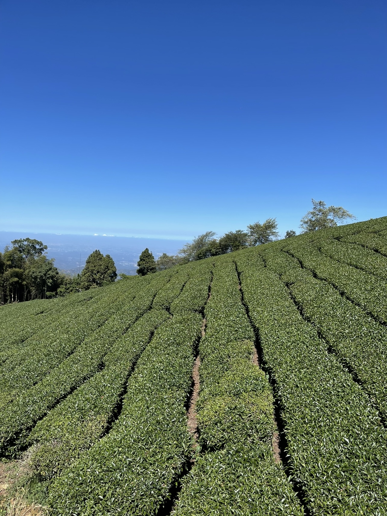
By the 1970s, the cypress forests were exhausted, and logging gave way to tourism as the primary economic activity. The completion of the Alishan Highway in the 1980s accelerated the shift, offering faster access than the railway and opening the mountains to bus-borne day-trippers. High-mountain tea plantations and wasabi farms expanded across the cleared slopes, and visitor numbers climbed toward millions annually. The original Sacred Tree, weakened by lightning and heavy rain, finally fell and was laid down in 1998. In 2006, a public vote selected its replacement: the 45-meter, 2,300-year-old Xianglin Giant Tree. A trail system now winds past more than 38 giant trees, most hundreds of years old -- the survivors of an industry that stripped their forests but inadvertently created the attraction that protects what remains.
Fenqihu and the Mountain Towns
Halfway up the railway at 1,400 meters sits Fenqihu, a small town of low wooden buildings terraced into the mountainside. Famous across Taiwan for its bento box lunches -- sold from stalls at the train station and from the Fenqihu Hotel on the old street -- the town also draws visitors to natural rock formations, mountain streams, and the ruins of a Shinto temple in the surrounding forest. The bento tradition dates to the railway's active logging days, when workers and travelers needed portable meals for the long ascent. Above Fenqihu, the climate shifts from subtropical to temperate to alpine as the train climbs past the 2,000-meter mark. The scenic area encompasses 25 peaks above that elevation, with the highest being Datashan at 2,663 meters. At the summit stations, temperatures average just 10 degrees Celsius year-round, and snow occasionally falls in winter -- a meteorological fact that astonishes visitors who boarded the train in Chiayi's tropical heat just hours earlier.
From the Air
Coordinates: 23.52N, 120.80E. Alishan National Scenic Area occupies the western slopes of Taiwan's central mountain range in Chiayi County. From the air, the area is marked by dense forest cover punctuated by tea plantations at higher elevations. The narrow-gauge Alishan Forest Railway is visible threading through the terrain. Yushan (3,952 m), Taiwan's highest peak, rises to the southeast. The town of Fenqihu is identifiable as a clearing at the railway's midpoint. Nearest airports: Chiayi Airport (RCKU) on the plains below. Recommended viewing altitude: 8,000-15,000 ft to appreciate the elevation gradient from plains to alpine; the sea of clouds phenomenon is often visible in the early morning from above.