Alotenango
The Popol Vuh, the sacred narrative of the K'iche' Maya, mentions it as Vucuc Caquix. The town's Nahuatl name -- Alotenango, "in the wall of the parrots" -- predates the Spanish arrival by centuries, and the community itself originally sat three to four kilometers south of where it stands today. That older settlement, now the Candelaria farm, was already established when the Spanish reached the valley in 1524. What draws the eye here is not the town itself but the landscape that frames it: Volcan de Agua looming to the east, Volcan de Fuego to the west, and between them a valley where coffee, faith, and volcanic soil have shaped a community for five hundred years.
Between Fire and Water
Alotenango sits in a valley defined by giants. Volcan de Agua rises to the immediate east, and the town serves as one of the starting points for climbers heading to its summit. To the west, Volcan de Fuego -- one of the most active volcanoes in the world -- presents a more dangerous proposition. The town lies along National Highway 14, which connects Antigua Guatemala to the north with Escuintla to the south, placing Alotenango at a crossroads between the colonial highlands and the Pacific lowlands. The municipality's population reached 23,358 in the 2018 census, spread across four wards in the Sacatepequez department. The climate is temperate, and the volcanic soil makes nearly anything grow -- a fact that would transform the town's economy in the nineteenth century.
The Volcano Climbers
In 1881, French writer Eugenio Dussaussay arrived in Alotenango with ambitions to climb Volcan de Fuego, then practically unexplored. The bureaucratic chain alone tells the story of a different era: he needed permission from the Sacatepequez governor, who issued a letter to Alotenango's mayor requesting guides. Dussaussay and his companion Tadeo Trabanino wanted to reach the central peak, but no guide would take them there. Only Rudecindo Zul, a local man, agreed to help -- and only as far as the saddle between Fuego and neighboring Volcan Acatenango. The townspeople feared and respected the mountain too much to go beyond that point. Eleven years later, British archaeologist Alfred Percival Maudslay launched his own expedition from Alotenango on January 7, 1892, documenting what he saw in his book A Glimpse at Guatemala and photographing Fuego's summit from the saddle between the two volcanoes.
Coffee, Parrots, and Grand Prizes
Alotenango became a Ladino coffee center during the liberal regime of General Justo Rufino Barrios, which lasted from 1873 to 1885. The Capetillo farm tells the story of that transformation in miniature. Developed in the eighteenth century by Spanish Royal Treasurer Juan Antonio Capetillo, the farm grew only sugar cane for generations. In 1875, Jose Mariano Rodriguez purchased the property and planted coffee. The numbers chart a rapid ascent: revenue of 2,800 pesos in the first year jumped to 12,000 by 1878. By 1880, the farm boasted 200,000 producing coffee trees, its own mill, and 25,000 pesos in annual revenue. Capetillo coffee earned the only Grand Prize for Coffee at the 1915 Panama-Pacific International Exposition -- a recognition that placed this small Guatemalan valley alongside the world's finest growing regions.
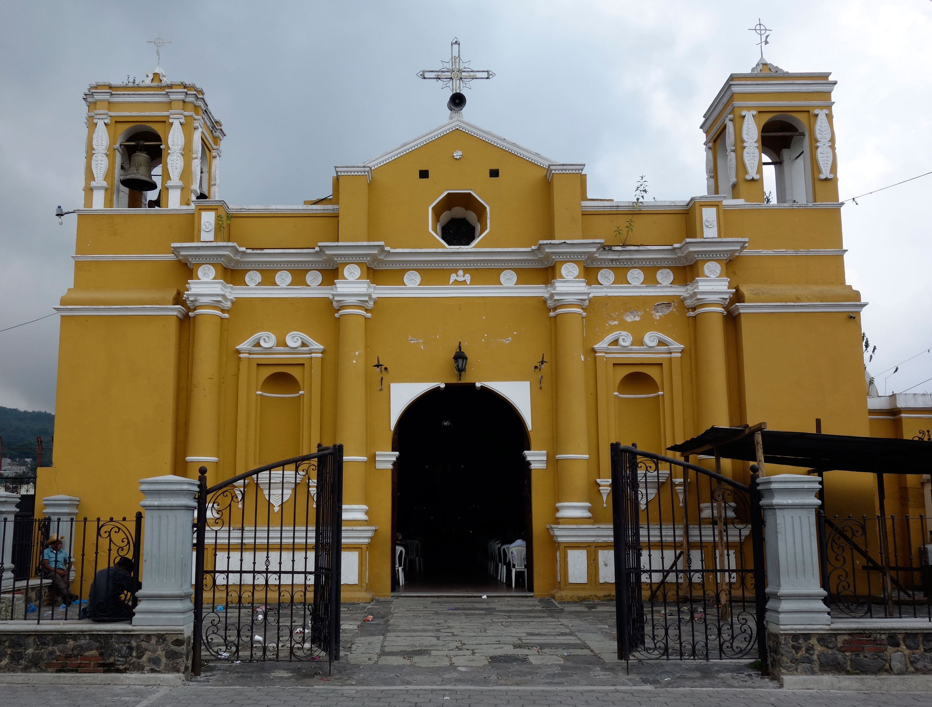
A Franciscan Valley
The cultural threads of Alotenango weave indigenous and colonial traditions into a fabric that has held for centuries. In the 1540s, Bishop Francisco Marroquin divided the Guatemala central valley's religious territories between the Dominican and Franciscan orders, and the Franciscans received Alotenango. The municipality still holds a Franciscan monastery and a large church. The sandy plaza hosts a Sunday market, and a large hut has long served as the town's courthouse. Most residents are descendants of the Kaqchikel people, who once spoke only Kaqchikel but now primarily speak Spanish. Some historians trace the town's roots instead to Nahua-speaking Pipil people from western El Salvador -- a debate that reflects the layered indigenous heritage of the Guatemalan highlands, where languages and peoples mingled long before European contact.
From the Air
Located at 14.49N, 90.81W in the valley between Volcan de Agua (east) and Volcan de Fuego (west). Clearly visible along National Highway 14, which runs north-south through the valley connecting Antigua Guatemala and Escuintla. Nearest major airport is La Aurora International Airport (MGGT) in Guatemala City, approximately 45 km to the northeast. From altitude, the town appears as a small settlement in the green valley floor between the two massive volcanic cones. Best viewed at 3,000-5,000 feet AGL for context of the volcanic landscape.