Altaelva
In the Sami language they call it Alttaeatnu. In Kven it is Alattionjoki. In Norwegian it is simply Altaelva, the Alta River. That it carries three names in three languages tells you something about this waterway before you learn a single geographic fact: it flows through a place where cultures overlap, where borders are recent inventions laid over ancient patterns of life. The Altaelva runs 240 kilometers from the mountains and lakes of Kautokeino Municipality, near the Finnish border, northward through one of Europe's largest canyons before emptying into the Altafjorden at the town of Alta. Along its length, the river has shaped landscapes, sustained communities, and provoked one of Norway's most dramatic political confrontations.
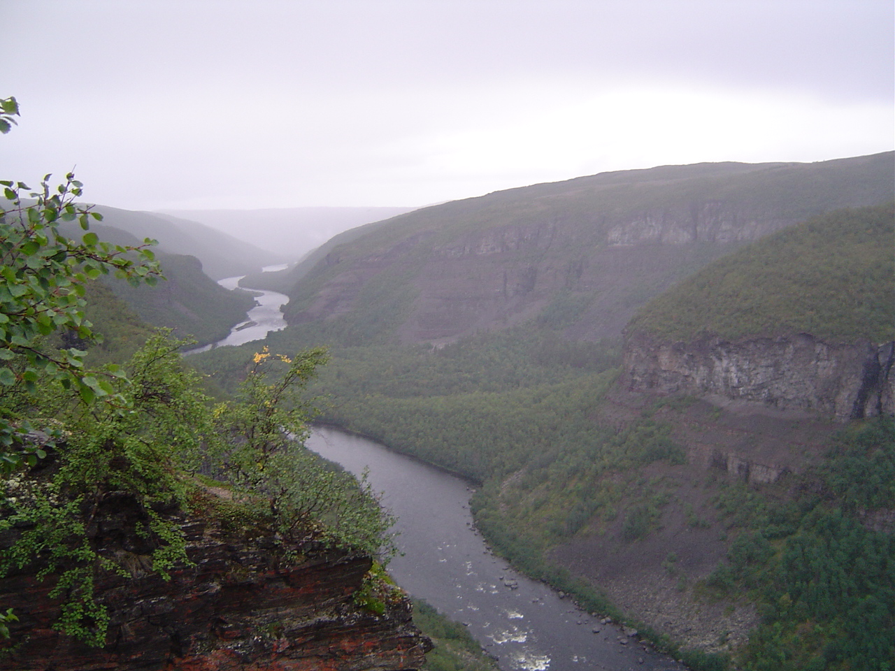
The Canyon Called Sautso
Between the high Finnmarksvidda plateau and the sea, the Altaelva has carved Sautso, one of the largest canyons in Europe. The scale is difficult to grasp from a map. The river drops from the vast, open plateau, where reindeer graze across treeless expanses, into a deep gorge cut through bedrock over thousands of years. The villages of Kautokeino and Masi sit along the upper reaches, small communities where the Sami people have herded reindeer for generations. Below the canyon, the river widens as it approaches the Altafjorden, its pace slowing, its character shifting from wild gorge to broad estuary. From the air, the transition is striking: plateau gives way to canyon gives way to fjord, all connected by a single thread of moving water.
The River of Salmon Kings
The Altaelva is widely regarded as one of the finest Atlantic salmon rivers in the world. The combination of clean, cold water flowing from the Finnmarksvidda plateau and the river's size creates ideal spawning and rearing habitat. Fishing here is not casual; it is a tradition with its own rituals and economy. In 2011, anglers landed 1,082 salmon weighing seven kilograms or heavier, a record that speaks to both the river's productivity and the size of its fish. A 24-kilogram salmon caught by rod that same year made national news. The river below the dam remains productive, though the relationship between hydroelectric infrastructure upstream and salmon habitat downstream is a tension that has never fully resolved.
The Dam That Changed Norway
In the 1970s, the Norwegian Water Resources and Energy Directorate published plans to dam the Altaelva for hydroelectric power. The original plan would have flooded the Sami village of Maze entirely. A revised proposal reduced the displacement but still threatened reindeer migration routes and the salmon fishery. What followed became known as the Alta controversy, a confrontation that reshaped Norwegian politics and indigenous rights across Scandinavia. In 1978, opponents formed an organized movement. By 1979, activists blocked construction equipment at Stilla while Sami protestors camped outside the Norwegian parliament on a hunger strike. Declassified documents later revealed that the government considered deploying military forces against the demonstrators.
A Thousand Chains and a Cruise Ship
Prime Minister Odvar Nordli promised a parliamentary review, but the legislature confirmed its decision to proceed. In January 1981, more than a thousand protesters chained themselves to the construction site. The police response was enormous: at one point, 10 percent of all Norwegian police officers were stationed in Alta, quartered aboard a cruise ship. For the first time since World War II, individuals were charged under laws against rioting. Sami organizations severed all cooperation with the Norwegian government. The Supreme Court ruled in the government's favor in 1982, and the Alta power station opened in 1987, creating the reservoir lake Virdnejavri. The dam stands today as Norway's tallest. But the controversy permanently changed the nation's relationship with its indigenous Sami population, leading directly to the establishment of the Sami Parliament in 1989.
From the Air
Located at 69.90N, 23.28E in Finnmark county, Arctic Norway. The river is a prominent landscape feature running north from the Finnmarksvidda plateau to the Altafjorden. The Sautso canyon is clearly visible from altitude. Nearest airport is Alta Airport (ENAT). The reservoir lake Virdnejavri and the dam are visible landmarks along the river's course. Approach from the south at 5,000 feet for dramatic canyon views.