Altit Fort
The name means 'this side down,' and standing at the edge of Altit Fort, you understand why. The ancient structure clings to a sheer rock promontory above the Hunza River, and the valley drops away beneath it with the casual violence of Karakoram geology. For more than eleven centuries, this fort has watched over the comings and goings of the Hunza Valley -- the caravans on the Silk Road corridor below, the seasonal floods, the slow work of glaciers carving the world's deepest gorges. It is the oldest monument in all of Gilgit-Baltistan, and in 2011 UNESCO honored its restoration with an Asia Pacific Heritage Award for Cultural Heritage Conservation.
Where Four Tribes Converge
The people of Altit belong to the Burusho, who speak Burushaski -- a language isolate with no demonstrated connection to any other tongue on Earth. Their origins are a subject of overlapping legends and competing claims that reveal the crossroads nature of this valley. The Husain Kuts trace their ancestors to Tibet or Ladakh. The Khano Kuts point to Tajikistan, Diamer, and Nagar. The Hukalo Kuts claim descent from Balti royalty. And the Shoshoroting maintain an oral tradition that their forebears migrated from Rome through eastern Iran and across the Hindu Kush before settling here. Whether any of these origin stories can be verified matters less than what they collectively reveal: Altit has been absorbing people from across Central and South Asia for centuries, each group layering its own history onto a single narrow promontory above the river.
A Fortress Built by a Bride's Craftsmen
According to local tradition, the fort's most significant construction phase came in the sixteenth century when a prince of Hunza married a princess from Baltistan. She brought with her master Balti craftsmen, and they built both Altit Fort and its younger sibling, Baltit Fort, a short distance up the valley. The Shikari tower, the fort's oldest surviving element, dates back roughly 1,100 years -- predating the Balti additions by centuries. The structure is a study in high-altitude building: stone walls bonded with mud, timber frames that flex rather than crack during earthquakes, and rooms stacked vertically to maximize the narrow footprint of available rock. The hereditary rulers of Hunza, who carried the title of Mir, governed from Altit for generations before eventually relocating to Baltit Fort, where the grander setting better suited the ambitions of a growing state.
Legends Older Than the Walls
Every corner of Altit carries a story that predates written records. The original name for the village, according to legend, was Hunukushal -- the village of Huns -- and some locals claim descent from White Huns who arrived around 47 AD. Others believe themselves descendants of soldiers in Alexander the Great's army, a claim echoed in communities across the Karakoram and Hindu Kush wherever Greek influence once reached. The Khanu Kuts tribe still holds the status of Saath Guy, the hereditary privilege of initiating any community activity, festival, or event. Meanwhile, the Husain Kuts -- whose name some elders say derives from 'Hun' -- were once so powerful that the Raja of Gilgit organized a mass killing of their members with the help of rival tribes. These are not footnotes from a textbook. They are the living oral history of families who still inhabit the old cluster settlement of Burum Khan, within sight of the fort.
Stone, Wood, and a New Economy
The Aga Khan Trust for Culture led the restoration that earned Altit Fort its UNESCO recognition. What visitors see today is a careful balance between preservation and accessibility: the original stone-and-timber construction remains legible, while modern reinforcement keeps the structure safe. A garden surrounds the fort, and the Kha Basi Cafe offers tea and views of the Hunza Peak's snow-capped ridgeline. The fort employs up to fifteen local people and has become a significant revenue source for Altit's economy. Tourism was always a fragile proposition in a place this remote -- the Karakoram Highway is the only road in, and it closes regularly to landslides -- but the fort has given the community an anchor. Visitors from across Pakistan and abroad pay to walk the same corridors where the Mirs once governed, guided by local residents whose families have lived in the fort's shadow for generations.
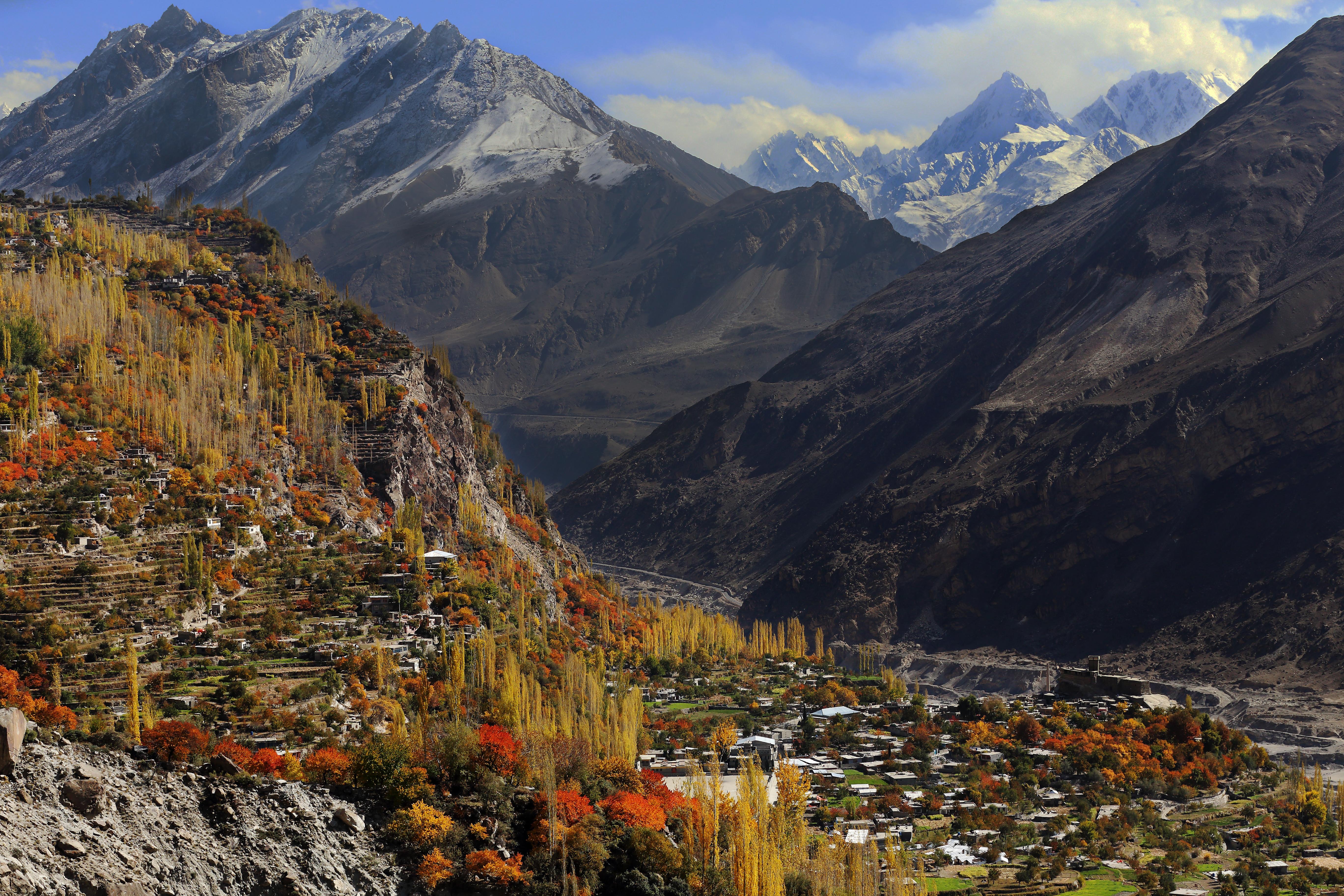
From the Air
Located at 36.317N, 74.682E in the Hunza Valley, Gilgit-Baltistan, Pakistan. The fort sits on a rocky promontory above the Hunza River at approximately 2,400m elevation, flanked by peaks exceeding 7,000m. Gilgit Airport (OPGL) is the nearest airfield, roughly 90 km to the southwest along the Karakoram Highway. The snow-covered Hunza Peak (6,270m) is visible directly behind the fort and serves as an excellent visual reference. Best viewed from 12,000-15,000 ft AGL. The Karakoram Highway threading through the valley below is a useful navigation aid. Clear weather offers views of Rakaposhi (7,788m) to the south.