Ama Site
In 1928, workers digging foundations for a farm attached to Kyoto University's Graduate School of Agriculture struck something unexpected in the earth near Takatsuki -- pottery, stone tools, traces of structures that predated anything they were building by more than two thousand years. They had found the Ama Site, what would eventually be recognized as the earliest known location of Yayoi culture and rice cultivation in the Kinai region, the ancient heartland of Japanese civilization. Over more than fifty excavations since 1966, archaeologists have mapped a settlement stretching 1.5 kilometers east to west and 600 meters north to south: a community of rice farmers, weavers, and toolmakers who organized their world with a precision that still impresses -- dwellings here, paddy fields there, cemeteries over there -- until the floodwaters of the Hino River eventually drove them away.
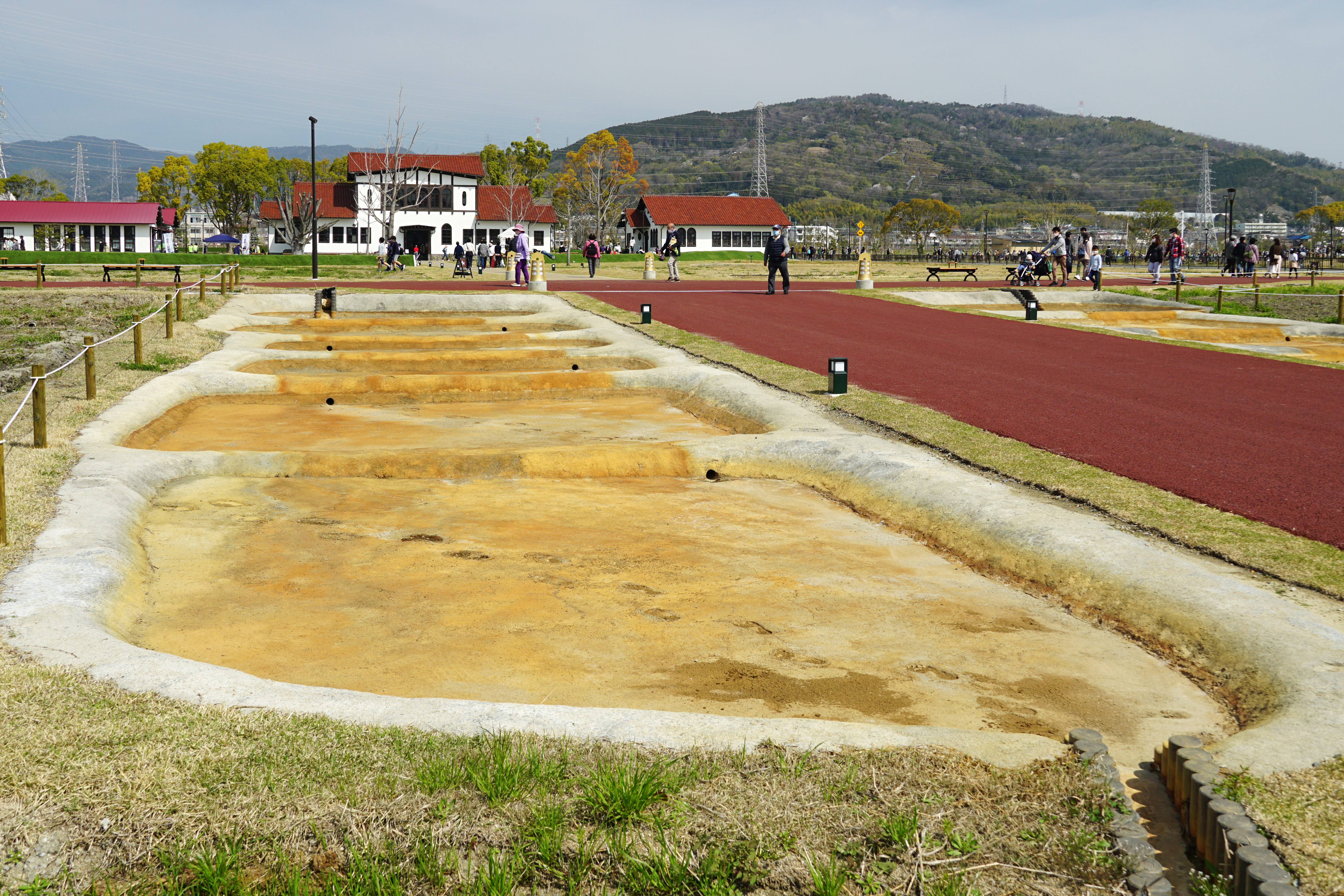
Rice Paddies on the Alluvial Fan
The Ama Site occupies the eastern end of the Mishima Plain, perched on an alluvial fan shaped by the Hino River as it flows through eastern Takatsuki. This was deliberate geography for Yayoi settlers: the fan provided elevated, well-drained ground for homes while the low-lying margins offered the waterlogged soil essential for wet-rice agriculture. The settlement's layout reveals a people who thought carefully about how to use their land. Distinct zones were dedicated to clusters of dwellings, production areas with paddy fields and irrigation canals, and cemeteries centered on rectangular circumferential graves. This was not a random scattering of huts. It was a planned community, organized around the seasonal rhythms of rice cultivation in a landscape shaped by water.
Three Lives of a Village
The Ama Site tells its story in three chapters. In its earliest phase, a moated settlement measuring 150 by 140 meters occupied a hill south of the site's center. Paddy fields with irrigation canals stretched to the south; the dead were buried to the east. The wetland setting brought fertility but also flooding, and the settlement was periodically abandoned. In the middle Yayoi period, the village rebounded and grew dramatically. A second residential zone appeared 200 meters to the north, complete with its own paddy fields, while a new cemetery opened to the west. Then came decline. In the final phase, the northern settlement disappeared entirely, and the original community shifted eastward to the ground that had once been its cemetery -- the living literally moving onto the land of the dead as their world contracted.
What the Earth Gave Back
More than fifty excavations since 1966 have yielded a rich catalogue of Yayoi life. Pottery in abundance -- the distinctive reddish-brown Yayoi ware that marks this culture across western Japan. Stone tools for cutting and grinding. Wooden implements: agricultural tools, parts of looms for weaving cloth, and ritual objects whose purposes can only be guessed at. Among the most telling finds are items brought from other regions, evidence that this settlement on the Mishima Plain was not isolated but connected to wider trade networks stretching across the Japanese archipelago. Daily life tools sit alongside accessories and ceremonial objects, painting a picture of a community that farmed, traded, worshipped, and buried its dead with care across the early to middle Yayoi period.
From University Farm to Ruins Park
For most of the 20th century, the Ama Site lay beneath the fields of Kyoto University's agricultural research farm -- an irony not lost on anyone, given that the ancient settlement was itself devoted to farming. The site was designated a National Historic Site in 1993, but it took the university's decision to relocate the farm to finally open the ground for preservation. Takatsuki City transformed the area into Aman Ruins Park, designed both to protect the archaeological remains and to serve as open space for disaster prevention. The west side opened in March 2019, and the full park followed in March 2021. Today the site sits fifteen minutes on foot from Takatsuki Station on the JR West Tokaido Main Line, a green pause in the dense urban fabric of the Osaka-Kyoto corridor -- ancient rice paddies remembered in a city that long ago paved over its own.
From the Air
Located at 34.86N, 135.63E in Takatsuki, Osaka Prefecture, on the eastern end of the Mishima Plain. The park is visible as a distinctive green rectangle amid dense suburban development along the Osaka-Kyoto corridor. The Hino River, whose alluvial fan created the site's geography, flows nearby. Nearest major airport: Osaka Itami (RJOO) approximately 10nm south-southwest. Kansai International (RJBB) lies approximately 40nm south. The JR Tokaido Main Line and Hankyu Railway corridor provide clear east-west visual references. The flat terrain of the Mishima Plain contrasts with the wooded hills to the north and east.