Ambohimanga
The word manga in Malagasy can mean sacred, or blue, or beautiful. The hill called Ambohimanga is all three. Rising 24 kilometers northeast of Antananarivo, this fortified royal settlement has held spiritual significance for at least four centuries, through the rise and fall of the Merina Kingdom, through French colonization and independence, through the destruction by fire of its sister site in the capital. When the Rova of Antananarivo burned in 1995, Ambohimanga became the last surviving physical link to precolonial Merina civilization. UNESCO inscribed it as a World Heritage Site in 2001 -- the inscription that had been intended for the Rova.
Before the Merina
The hill's human story begins long before the kingdom. Madagascar's central highlands were first settled between 200 BCE and 300 CE by the Vazimba, the island's earliest inhabitants, who arrived by pirogue from southeastern Borneo across thousands of miles of open Indian Ocean. By the 15th century, the Merina had migrated into the highlands from the southeastern coast, establishing villages on hilltops among existing Vazimba settlements. At least four Vazimba tombs survive on or around Ambohimanga -- the tombs of Ingorikelisahiloza, Andriantsidonina, Ramomba, and Kotosarotra -- and remain active pilgrimage sites. The hill's earliest known name was Tsimadilo. Around 1700, a dethroned prince named Andriamborona settled on the hilltop with his family and renamed it Ambohitrakanga, "hill of the guinea fowls." King Andriamasinavalona gave the hill its current name in the early 18th century.
The War That Built a Capital
Ambohimanga became politically powerful in 1710, when King Andriamasinavalona divided the Kingdom of Imerina into four quadrants and assigned his son Andriantsimitoviaminiandriana to govern the northeastern quarter, Avaradrano, from its new capital here. What followed was 77 years of civil war between rival principalities. During those decades, successive rulers of Avaradrano fortified Ambohimanga with increasingly sophisticated defenses while launching military campaigns to expand their territory. The war ended here too. In 1787, a prince from Ambohimanga named Ramboasalama seized the throne under the name Andrianampoinimerina and, through force and negotiation, reunited Imerina by 1793. He then captured Antananarivo and made it his political capital -- but declared Ambohimanga its spiritual equal, conducting royal rituals and maintaining residences on the sacred hill until his death.
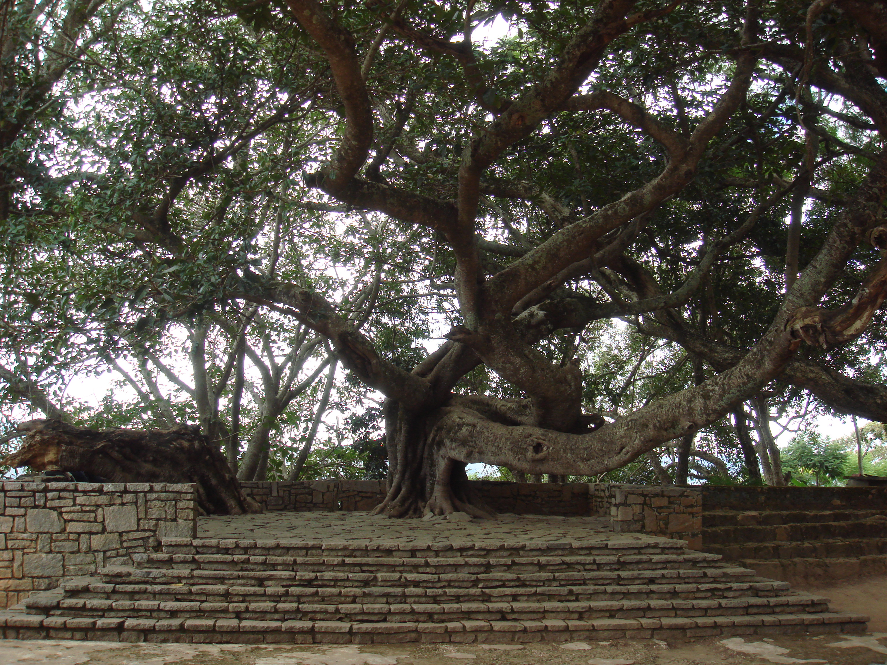
Walls Within Walls
The fortifications at Ambohimanga reflect centuries of military refinement. Protective trenches called hadivory, some plunging 30 meters deep, ring the village alongside stone walls -- a defensive system typical of fortified royal cities in Imerina since the 15th century. Fourteen gateways pierce the walls, many sealed by massive rolling stone discs. Inside, the compound divides into three smaller rova. The largest, Mahandrihono, was established between 1710 and 1730 by King Andriambelomasina. It remains largely intact and contains the royal tombs, the house of King Andrianampoinimerina -- complete with his weapons, drums, talismans, and a fanorona game board -- and the summer palace of Queen Ranavalona II. The layout follows cosmological principles: buildings and gateways are oriented according to cardinal directions, with the northeast held as the most sacred. But elevation matters even more than compass bearing here. Each new compound was built on higher ground than the last, because in Merina spatial thinking, height equals rank.
What Survives
The French colonial administration under General Gallieni attempted to break Ambohimanga's sacred power after 1897 by exhuming royal remains from its tombs and transferring them to the Rova in Antananarivo. The desecration was deliberate -- an effort to sever the Malagasy people's spiritual connection to their royal ancestors. It did not work. Ambohimanga retained its sacred character through colonial rule and independence alike. When fire destroyed the Rova of Antananarivo in 1995, the hill's significance intensified. Among the Tsimahafotsy clan and the andriana nobility, a belief persists that only Ambohimanga possesses the ancestral benediction -- the hasina -- to serve as the true national capital and to grant leaders the legitimacy to govern. Pilgrims continue to come from across Madagascar and beyond. Conservation efforts supported by UNESCO and organizations like C.H.A.M. work to protect the site, though the growing population around the hill and the ever-present risk of fire to its wooden structures and forests make the work urgent.
From the Air
Located at 18.76S, 47.56E approximately 24 km northeast of Antananarivo on Madagascar's central highland plateau. The fortified hilltop is visible from moderate altitude as a prominent wooded hill with stone walls and cleared compound areas at the summit. Ivato International Airport (FMMI) is the nearest major airport, 30 km to the southwest. From the air, the relationship between Ambohimanga and Antananarivo illustrates the Merina dual-capital system: the political capital to the southwest, the spiritual capital on this northeastern hill.