Andros, The Bahamas
The Lucayan people called it Habacoa -- "large upper outer land" -- and the name still fits. Andros is the biggest island in The Bahamas by a wide margin, its land area exceeding all 700 other Bahamian islands combined. Yet fly over it and you will struggle to find a town. Nearly the entire population of roughly 8,000 clusters along a thin strip of the eastern coast, while the interior dissolves into vast pine forests, mangrove swamps, and tidal flats that few outsiders have ever explored. The Bahamian tourism board markets Andros as the least-explored island in the chain, and the claim is not exaggerated. What the island lacks in resort infrastructure it compensates for in sheer biological strangeness: 178 inland blue holes, a barrier reef running approximately 200 kilometers along its eastern edge, and creatures -- both real and legendary -- found nowhere else on Earth.
Water's Architecture
The eastern shore of Andros drops away into the Tongue of the Ocean, a U-shaped submarine trench plunging to depths of 2,000 meters. Between that abyss and the island itself runs the Andros Barrier Reef, the world's third longest, stretching approximately 200 kilometers and averaging just one to three kilometers offshore. On the western side, the island dissolves into the shallow flats of the Great Bahama Bank, an expanse of turquoise water rarely deeper than a few meters. This collision of extreme depth and extreme shallowness creates one of the most distinctive marine environments in the Atlantic. Bonefishers wade the western flats in knee-deep water while, a short boat ride east, divers descend into walls that drop beyond the reach of sunlight. The contrast is visible from the air: pale aquamarine fading to the west, dark indigo plunging to the east.
Into the Blue Holes
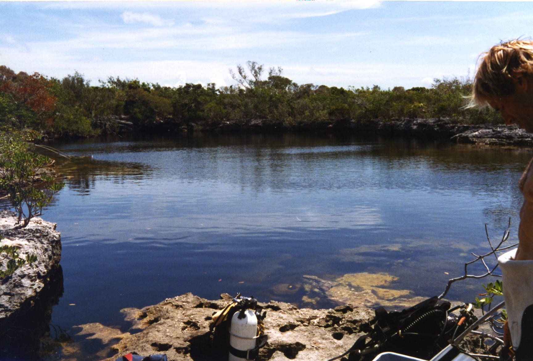
Scattered across Andros are 178 inland blue holes and at least 50 more in the surrounding sea -- dark, circular portals in the shallow limestone that open into vast subterranean cave systems. Some extend laterally for several kilometers; others plunge hundreds of meters straight down. Jacques Cousteau explored several of them in 1970, filming an expedition he called "The Secret of the Sunken Caves." National Geographic has featured the Andros blue holes multiple times over the past three decades. The caves formed during ice ages when sea levels dropped and rainwater dissolved the soft carbonate rock. When the seas rose again, they flooded the passages. Divers who enter these systems pass through layers of fresh and salt water, encountering unique bacterial colonies and fossils sealed in the rock. Local legend populates the blue holes with the Lusca, a many-armed creature said to drag swimmers beneath the surface -- a myth that likely reflects the genuine danger of the powerful tidal currents that pulse through these underwater tunnels.
Creatures Real and Imagined
Andros exhibits greater botanical diversity than any other Bahamian island, and its fauna is equally remarkable. The Andros Island iguana, a large endangered subspecies of the Northern Bahamian rock iguana, survives here with a wild population of roughly 3,500 individuals. The Bahama oriole, critically endangered with perhaps only a few hundred remaining, is found exclusively on Andros. Kirtland's warbler, one of North America's rarest songbirds, was first recorded on the island in 1879 and still winters here. The species recovered from near-extinction to around 2,300 breeding pairs by 2019, when it was delisted from the Endangered Species List, though populations have since declined again. More than 50 species of wild orchids thrive in the subtropical forests and swamps, including three native species of the climbing orchid Vanilla found nowhere else. Beyond the documented species, Bahamian folklore assigns Andros two mythical inhabitants: the Lusca of the blue holes and the Chickcharnie, a bird-like creature said to inhabit the pine forests. Believers warn that anyone who treats a Chickcharnie disrespectfully will be cursed with bad luck.
A Thin Strip of Settlement
Despite its size -- 167 kilometers long and 64 kilometers wide at its broadest -- Andros remains strikingly empty. Almost everyone lives along the Queen Elizabeth Highway on the eastern coast, a ribbon of small settlements strung between Nicholls Town in the north and Little Creek in the south. Three main landmasses -- North Andros, Mangrove Cay, and South Andros -- are separated by bights, wide estuaries that cut the island from east to west. Between the settlements lie pine forests that were heavily logged by the Owens Lumber company in the 1960s and 1970s; today the regrowth is dense with young trees. The western interior remains largely inaccessible wetland. Andros has the only freshwater river in all of The Bahamas, contributing to the island's unusual biodiversity. Four airports with paved runways connect the communities to Nassau, just 30 miles east across the Tongue of the Ocean, but the island's pace remains unhurried. Roughly 35 to 40 small lodges cater primarily to divers and bonefishers, and the total room count across the entire island hovers around 400.
The Deep Water Next Door
The Tongue of the Ocean is not only a geological curiosity but a strategic asset. The U.S. Navy operates the Atlantic Undersea Test and Evaluation Center on Andros's eastern coast, using the deep trench to test submarines, weapons systems, and sonar in conditions sheltered from open-ocean interference. The facility has been active since 1966, and under a joint agreement signed in 1963, the Royal Navy has equal access. For civilian visitors arriving by air, the approach to Andros reveals the island's dual personality: the turquoise shallows of the Great Bahama Bank to the west shimmer in pale green, while the Tongue of the Ocean appears as a sudden dark stripe running along the eastern shore. Between them lies Andros itself -- green, flat, and wild, its interior still keeping secrets that neither divers nor scientists have fully mapped.
From the Air
Located at 24.67N, 77.92W in the central Bahamas, about 30 miles west of Nassau. Four airports serve the island: San Andros Airport (MYAM) at Nicholls Town, Andros Town International Airport (MYAF) at Fresh Creek, Clarence A. Bain Airport (MYAB) at Mangrove Cay, and Congo Town Airport (MYAK) in South Andros. Nassau's Lynden Pindling International Airport (MYNN) is the main gateway. From the air, the contrast between the pale turquoise Great Bahama Bank to the west and the dark indigo Tongue of the Ocean to the east is dramatic. The barrier reef is visible as a thin white line of breaking waves along the eastern shore. Blue holes appear as dark circles in the shallow limestone. Best viewed at 3,000-5,000 feet for reef and blue hole detail.