Androy
The Tandroy name their famines. Marotaola means 'many human bones.' Malalak'akanjo means 'one is wide in his clothes,' because the body wastes away while the garments stay the same size. Tsy mitolike means 'eating without return,' because there is nothing to replenish what is consumed. These are not distant historical events; they recur every eight to ten years in Androy, the deep south of Madagascar, a semi-arid region of 19,540 square kilometers wedged between the Mandrare and Menarandra rivers below the Tropic of Capricorn. The Tandroy, whose name translates as 'people of the thorny bush,' have lived with drought, famine, and the relentless drying wind called the Tiokatimo for centuries. Understanding Androy requires understanding that survival here is not a backdrop to life. It is the subject of it.
The Spiny Land
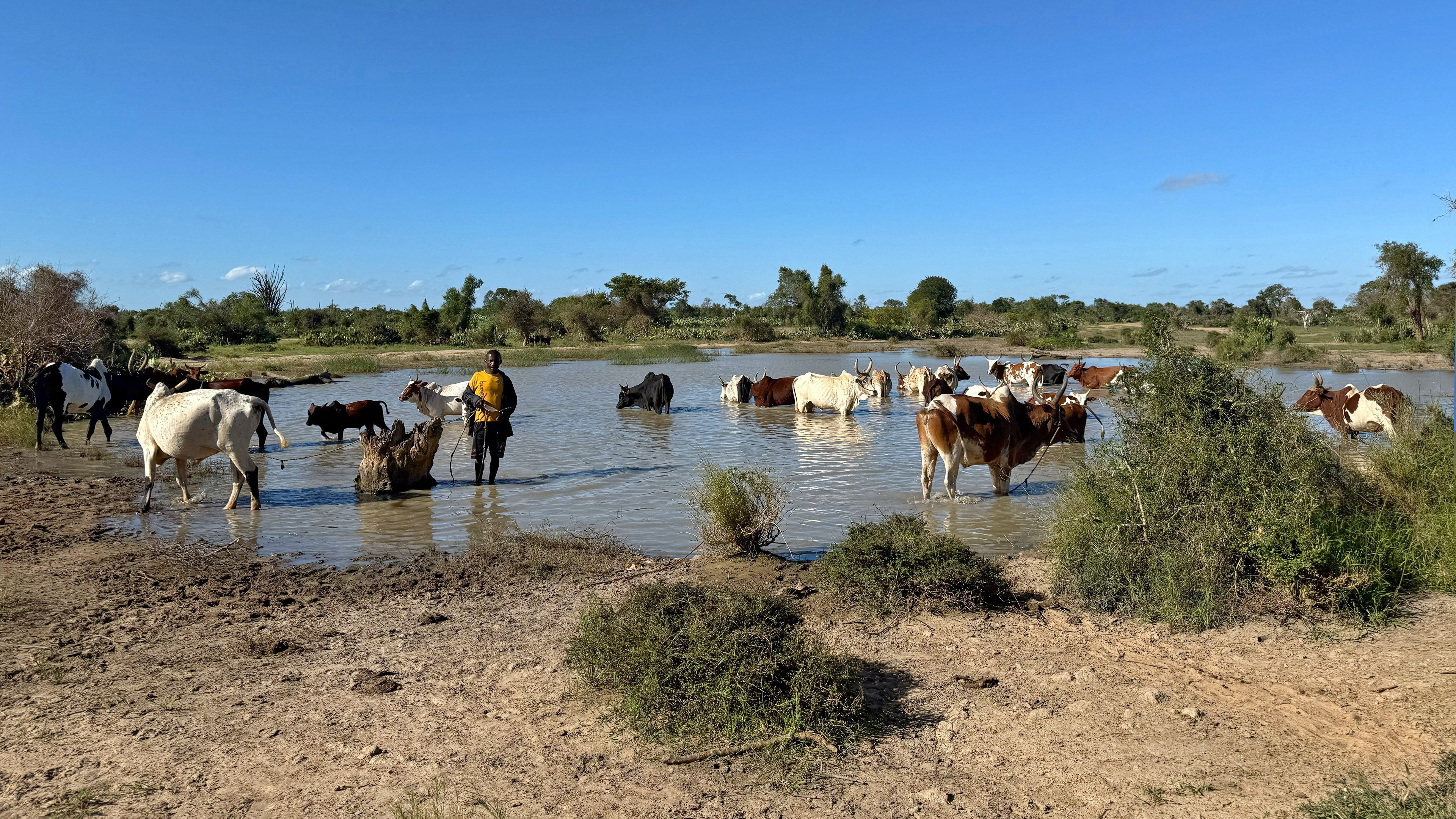
Androy translates literally as 'the land of roy,' referring to Mimosa delicatula, but the common translation is 'spiny land,' and the name is earned. The landscape is dominated by thorny scrub, with only 344 square kilometers of forest remaining from a region nearly twenty thousand square kilometers in size. Average rainfall is just 400 millimeters per year, dropping to 350 along the southwestern coast and rising slightly toward the north. Most riverbeds are dry for much of the year; only the Mandrare flows reliably. Water is so scarce that it is delivered by truck or sold from oxcarts. The climate is classified as semi- to sub-arid, and the almost constant wind along the coast accelerates evaporation. In this environment, the Tandroy have developed a subsistence agriculture centered on cassava, maize, sweet potatoes, millet, sorghum, and groundnuts. Rice cannot grow here. Zebu cattle are central to Tandroy religious and social life, serving as markers of wealth and status as much as sources of milk, meat, and leather.
The Cactus That Saved and Starved
In 1769, the spiny prickly pear cactus Opuntia dillenii was introduced to Madagascar near Fort Dauphin and spread across the Androy region. Over the following century, the cactus became woven into daily life, providing fruit and water for both people and cattle, and forming natural barriers that protected herds. Then, in 1924, French botanist H. Perrier de la Bathie introduced the cochineal insect to control the invasive cactus, which was overtaking farmland. The insect spread from Toliary at roughly 100 kilometers per year, and by 1928 it had devastated the Opuntia across Androy. The countryside turned gray. Between 10,000 and 100,000 cattle died. Deforestation accelerated as people stripped trees for fuel and food. By 1930, the Tsihombe district had lost half its population to death and emigration. A deadly famine followed in 1930-31, compounded by a cricket invasion. What had been intended as biological control became ecological catastrophe. The French colonial authorities eventually planted Opuntia stricta, a spineless variety, on 4,000 hectares in 1955, but the damage to Androy's ecology and people had already reshaped a generation.
Resistance and Resilience
The Tandroy have never been passive recipients of their circumstances. When the French conquered Androy between 1901 and 1903, the Antandroy resisted so fiercely that the region remained under a state of emergency until 1917. In 1958, Monja Jaona, a political leader from the south, founded the MO.NI.MA. party, which represented both radical intellectuals and impoverished peasants from Androy and became a significant force in Malagasy politics. In April 1971, more than a thousand armed MO.NI.MA. members attacked five military posts in the Tulear province, driven to insurrection by the corruption of government tax collectors, a cattle plague, and the government's failure to provide drought relief. The uprising was swiftly and harshly suppressed, with 45 killed and hundreds imprisoned on the island of Nosy Lava. But Monja Jaona and his movement eventually helped bring down President Tsiranana in 1972, aided by Tananarive's university students who took up the southern cause. The Tandroy pattern, across centuries, has been to endure the land's punishments and resist the impositions of outside power.
Ancient Crossroads
Androy's history stretches far deeper than colonialism. Archaeological evidence points to human habitation as far back as the 11th century, with the Manda Civilization building walled towns near Bekily and Bekitro that traded by sea with Zimbabwe, Mozambique, and the Swahili Coast. The Tandroy themselves may be a composite ethnicity, assembled from clans of Sakalava, Bara, Mahafaly, and Antanosy origin who arrived in migration waves over several centuries. By the 16th century, the Andriamanare royal dynasty dominated the region from their capital at Ampotake, and their megalithic tombs, massive stone constructions that archaeologist Mike Parker Pearson documented extensively, remain some of the most striking built structures in southern Madagascar. Even Androy's encounters with Europeans carry the texture of deep time: in 1703, the English ship Degrave was wrecked near Ambovombe, and sailor Robert Drury was enslaved by the Antandroy for approximately fourteen years, eventually recording his experience in a memoir that remains one of the earliest European accounts of life in southern Madagascar.
What Water Means
Between 15 and 30 percent of the Tandroy have left Androy entirely, driven west to Toliary or north to other parts of Madagascar by the recurring cycle of drought and famine. Those who remain, numbering over 900,000 in the 2018 census, inhabit a region that is one of the poorest in Madagascar and among the poorest on Earth. Chronic food insecurity is the baseline, not the crisis. Less than five percent of the land is farmed. Stores are small, concentrated in urban centers, and often owned by Indo-Pakistani, Chinese, or highland Malagasy merchants. Weekly markets are where most Tandroy buy and sell. In 2023, a 97-kilometer pipeline was built from the Efaho River in neighboring Anosy to southern Androy, a piece of infrastructure that represents something beyond plumbing. In a region where the names of famines form a calendar of suffering, the arrival of reliable water is not an improvement. It is a transformation so fundamental that the Tandroy, the people of the thorny bush, may finally have a tool to break the cycle that has defined their homeland for as long as memory reaches.
From the Air
Androy is located at approximately 24.80S, 45.30E at the southern tip of Madagascar. From the air, it appears as a vast semi-arid expanse of thorny scrub and dry riverbeds, strikingly different from the lush forests of eastern Madagascar. The coastline along the south is visible, and Cape Sainte Marie, the southernmost point of Madagascar, lies at 25 35S. Best viewed at 5,000-10,000 feet AGL for the full scope of the region. Bekily Airport is the nearest airstrip. The nearest major airport is Tolagnaro Airport (FMSD) in Fort Dauphin, approximately 110 km to the east. Route nationale 10 and Route nationale 13 are visible as thin lines crossing the scrubland.