Angkor Thom
An early European visitor, arriving sometime before 1609, found the city uninhabited and described it as "as fantastic as the Atlantis of Plato." By then, Angkor Thom had already been abandoned for generations -- its wooden buildings rotted, its canals silted, its population relocated southeast to Phnom Penh after the Ayutthaya Kingdom sacked the capital. But the stone endured. The gateways still stood, each crowned with enormous carved faces gazing outward in four directions. The walls still enclosed their nine square kilometers. The Bayon still rose at the center, its towers dense with serene, smiling stone visages. What Plato imagined, the Khmer had actually built.
A Groom and His Bride
King Jayavarman VII established Angkor Thom in the late twelfth century as the capital of an empire that stretched across much of mainland Southeast Asia. An inscription found within the city calls Jayavarman the groom and the city his bride -- a metaphor that captures the scale of personal ambition the project required. The name itself, properly Nokor Thom, combines the Sanskrit word nagara (city) with the Khmer word thom (great). Jayavarman filled his Great City with temples, hospitals, and infrastructure, centering everything on the Bayon, his state temple. The Bayon has no wall or moat of its own; instead, the walls and moat of the entire city serve that function, representing the mountains and oceans that Hindu and Buddhist cosmology placed around the sacred Mount Meru at the center of the universe.
Stone Faces at the Gates
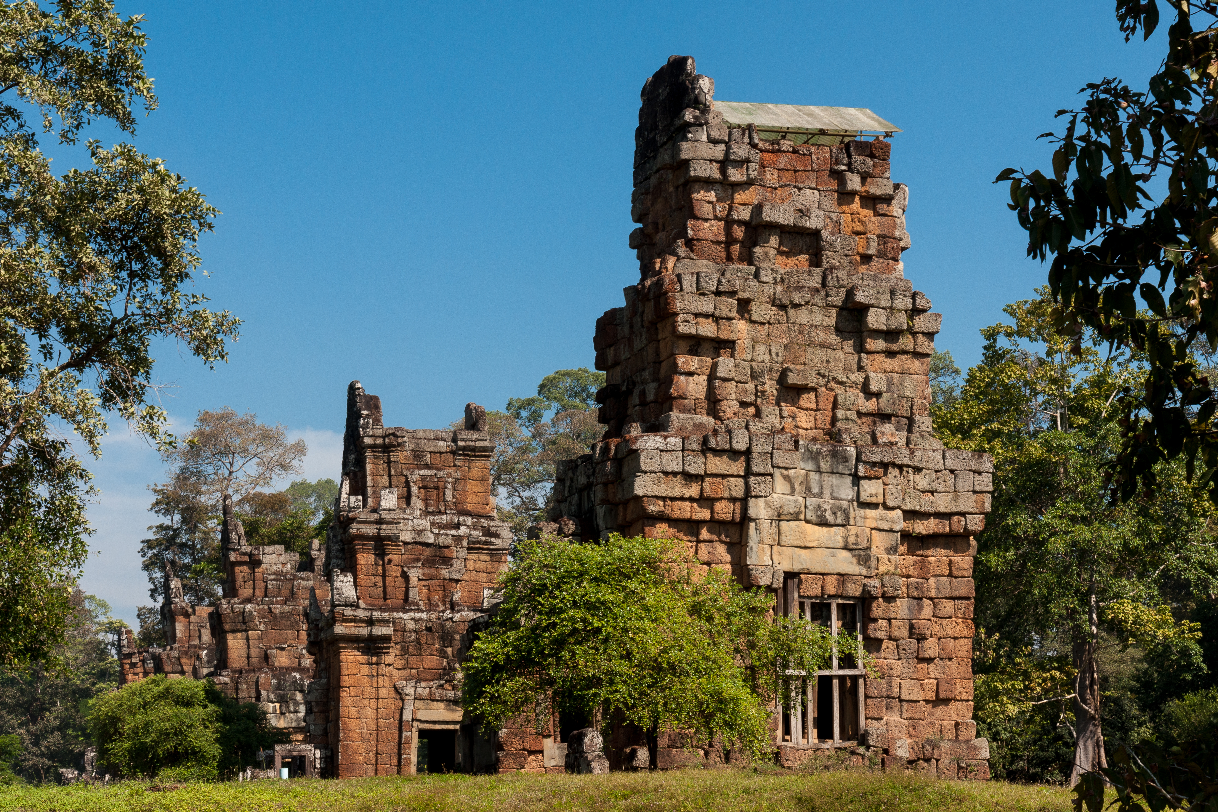
The approach to Angkor Thom remains one of the most striking arrivals in Southeast Asian architecture. Each of the city's five gateways -- one at each cardinal point plus the Victory Gate to the east -- is crowned with towers bearing four enormous carved faces, serene and watchful. Lining the causeways that cross the moat are rows of giant stone figures: 54 devas on one side, 54 asuras on the other, each row holding the body of a naga, the mythological serpent. The effect is theatrical and intentional. You do not simply enter Angkor Thom; you are received by it. The walls themselves stand 8 meters high, built of laterite buttressed with earth, running 3 kilometers on each side to enclose the full 9 square kilometers of the city. At each corner, a Prasat Chrung -- a sandstone corner shrine dedicated to Avalokiteshvara -- marks the boundary.
A City Carved and Grown
Within the walls, Angkor Thom was both monument and functioning metropolis. A system of canals carried water from northeast to southwest through the city. The secular buildings -- homes, markets, administrative halls -- were built of wood and have long since vanished; the land they occupied is now forest. What survives is stone: the vast bas-reliefs that cover the Bayon and other temples, depicting gods, goddesses, and scenes from Hindu epics alongside depictions of everyday Khmer life. Elephants, snakes, monkeys, and fish appear among mythological creatures. At the nearby ruins of Ta Prohm, roundels on pilasters depict only real animals -- pigs, water buffaloes, roosters -- with no mythological figures among them. These carvings offer a window into what the twelfth-century Khmer actually saw around them, preserved in sandstone while the living world they documented has changed beyond recognition.
The Fall and the Forest
The last temple known to have been constructed within Angkor Thom was Mangalartha, dedicated in 1295. After that, modifications continued, but new construction used perishable materials that have not survived. The city's decline came in stages. The Ayutthaya Kingdom, under King Borommarachathirat II, sacked Angkor Thom and forced the Khmer court under Ponhea Yat to abandon it for Phnom Penh to the southeast. By the time European travelers arrived in the seventeenth century, the forest had already begun its long reclamation. Trees grew through courtyards. Roots threaded between stone blocks. The faces on the towers continued smiling into the canopy, undisturbed by the absence of the people who had carved them.
The Faces Persist
Today, the south gate is the main tourist entrance, and the causeway lined with devas and asuras remains the iconic introduction to the site. Angkor Thom sits 7.2 kilometers north of Siem Reap and just 1.7 kilometers north of Angkor Wat, its more famous neighbor. But where Angkor Wat is a single temple complex, Angkor Thom was an entire walled city -- a place where people lived, worked, worshipped, and governed for centuries before the forest took it back. The faces on the Bayon's towers, now identified by most scholars as representations of Avalokiteshvara, gaze out in every direction with an expression that visitors have tried to read for generations. It is not quite a smile. It is not quite serenity. It is the look of something that has been watching for 800 years and intends to continue.
From the Air
Angkor Thom is located at 13.44N, 103.86E, approximately 7.2 km north of Siem Reap. The walled city's square layout (3 km per side) with its moat is clearly visible from altitude. The Bayon temple sits at the exact center. Angkor Wat is visible 1.7 km to the south. Nearest airport is Siem Reap-Angkor International Airport (VDSR), just minutes away. The entire Angkor archaeological complex spreads across the forested plain west of the Siem Reap River, a tributary of Tonle Sap. Best viewed in clear conditions at moderate altitude to appreciate the geometric city plan.