Anne Beadell Highway
Len Beadell named the road after his wife, which might be the most romantic gesture in the history of civil engineering -- or the cruelest, depending on how you feel about 1,350 kilometers of corrugated dirt, soft sand, and absolute emptiness. The Anne Beadell Highway is not a highway in any conventional sense. It is a track, scraped through the Great Victoria Desert in the 1950s and 1960s by Beadell and his Gunbarrel Construction Party, connecting the underground opal town of Coober Pedy in South Australia to Laverton in Western Australia. There are no towns between them. There is one roadhouse. The recommended travel season is April to October, because in summer the temperatures will kill you, and in winter the nights drop below freezing.
A Road Born from the Bomb
The Anne Beadell Highway belongs to a family of tracks known as the Bomb Roads. In the 1950s, Len Beadell -- surveyor, bushman, and self-described 'last explorer' of inland Australia -- was tasked with opening routes through the western deserts to support British nuclear weapons testing at the Woomera Range. His Gunbarrel Construction Party bulldozed straight lines across spinifex and sand dunes, creating a network of rough roads that served atomic ambitions during the Cold War. The weapons are long gone. The roads remain, deteriorating slowly under desert sun and the occasional passage of an adventurous 4WD. What was once military infrastructure has become one of Australia's ultimate outback challenges, a route that demands complete self-sufficiency and rewards it with profound solitude.
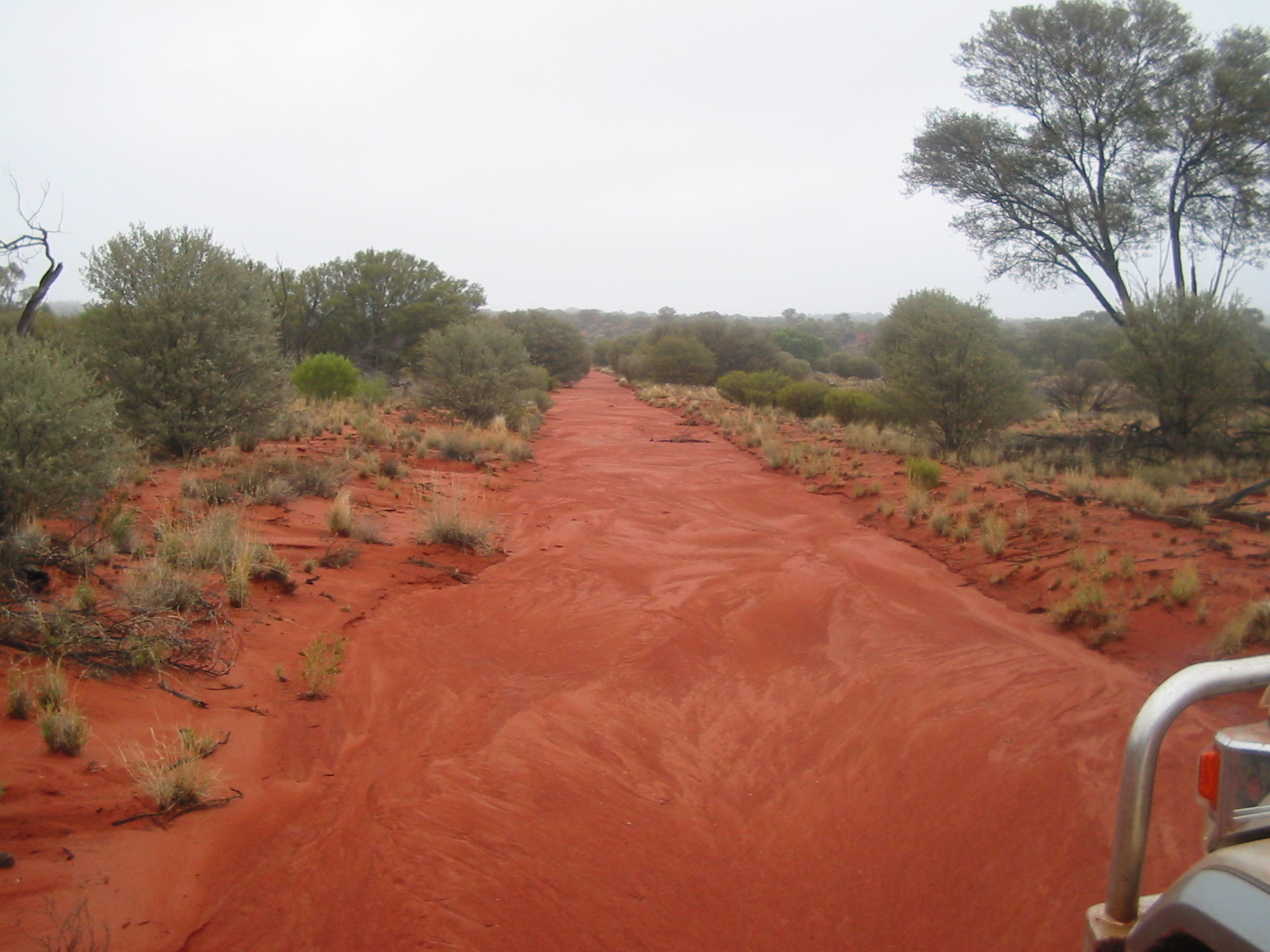
Into the Emptiness
Leaving Coober Pedy, the track passes through the scree hills of abandoned opal diggings before flattening into a vast, sparsely vegetated plain. The first stretch to Mabel Creek Station follows a well-graded gravel road -- the last easy driving you will do for days. Beyond the dingo fence, the surface deteriorates dramatically. Corrugations between Mabel Creek and the South Australian border are among the worst in Australia, rhythmic washboard ridges that rattle every bolt in your vehicle. The track crosses the Tallaringa Conservation Park and enters the Mamungari Conservation Park, where low dunes covered in desert kurrajong and acacia roll away in every direction. Five separate permits are required for the full crossing, covering the Woomera Prohibited Area, two conservation parks, Maralinga-Tjarutja Aboriginal lands, and Western Australian Indigenous territories.
The Single Lifeline
Roughly halfway along the route sits the Ilkurlka Roadhouse, the only settlement between Coober Pedy and Laverton. It operates a service station and offers basic supplies, but travelers cannot rely on it for anything more than small purchases. The highway demands that you carry everything: at least six liters of water per person per day, food with a three- to four-day reserve, two spare wheels, tools, a first-aid kit, and ideally a satellite phone or emergency radio beacon. Mobile phones are useless out here. The landscape offers no landmarks a GPS failure wouldn't make critical, so map-and-compass skills remain essential. West of the Western Australian border, the track crosses low dune crests; elsewhere it follows the valleys between dunes that run east to west, a geological rhythm visible only from the air.
Companions on the Track
Even in peak season, the Anne Beadell Highway sees perhaps eight vehicles a day. The wildlife, by contrast, is constant. Kangaroos and emus pace alongside vehicles before swerving suicidally across the track. Camels -- descendants of animals imported for 19th-century exploration -- use the road as a footpath and refuse to yield, requiring patience rather than horn. Snakes and lizards bask on the warm surface and flee unpredictably when disturbed. At the western end, the track eventually meets sealed road near Laverton, and the sensation of asphalt after days of corrugation has been compared to gliding on calm water. Laverton itself is a small outback town with the basics -- fuel, a hotel, a supermarket -- and connections onward to Kalgoorlie or, via the Great Central Road, to Uluru and Alice Springs.
The Desert's Quiet Reward
Nobody drives the Anne Beadell Highway for convenience. The route exists in a category of travel where difficulty is the point, where the emptiness of the Great Victoria Desert becomes a kind of presence rather than an absence. At night, with no light pollution for hundreds of kilometers, the southern sky is overwhelming. By day, the desert's palette shifts between ochre, pale green, and the bleached white of clay pans. This is Anangu country -- land that has been known and traveled by Aboriginal peoples for tens of thousands of years, long before Beadell's bulldozer arrived. The track is a recent scratch on an ancient surface, and driving it offers a humbling sense of scale: how vast this continent is, how thin the veneer of European infrastructure, and how generous the desert can be to those who come prepared.
From the Air
The Anne Beadell Highway runs roughly east-west at approximately 28.5S, 131.7E through the Great Victoria Desert. From cruising altitude, the track is visible as a faint line through red-brown desert terrain. The nearest airports are Coober Pedy Airport (YCBP) at the eastern end and Laverton Airport at the western end. Overflying at 5,000-10,000 ft AGL reveals the characteristic parallel sand dunes running east-west. The Woomera Prohibited Area lies to the east, so check NOTAMs before overflying.