Antananarivo
The name means "City of a Thousand" -- a tribute to the garrison of soldiers King Andriamasinavalona stationed here centuries ago -- but today Antananarivo holds over 2.6 million. Locals call it simply Tana, and from above it reveals itself as something unexpected: a tropical capital that feels temperate, where terraced rice paddies thread between neighborhoods of terracotta-colored houses built in a style that blends French countryside with Southeast Asian tradition. At 1,280 meters on Madagascar's central plateau, Tana sits higher than Denver, and the thin highland air carries the scent of vanilla from market stalls and woodsmoke from cooking fires in equal measure.
A Kingdom's Footprint
Antananarivo's origins trace to around 1610, when Merina King Andrianjaka drove out the Vazimba people from the hill called Analamanga to establish his capital. The city grew outward from that high ground, layering centuries of history onto the ridgelines of the central highlands. First came the Merina Kingdom, which ruled from the royal compound at the summit. Then came French colonial administration beginning in 1897, which reshaped the lower city with broad avenues and European architecture. A failed armed rebellion in 1947-1948 left deep scars but stiffened resolve, and independence arrived in 1960. Today the city's population includes Merina and other Malagasy peoples alongside Chinese, Indian, and European communities -- a cosmopolitan mix that belies Madagascar's geographic isolation.
Ridgelines and Rice
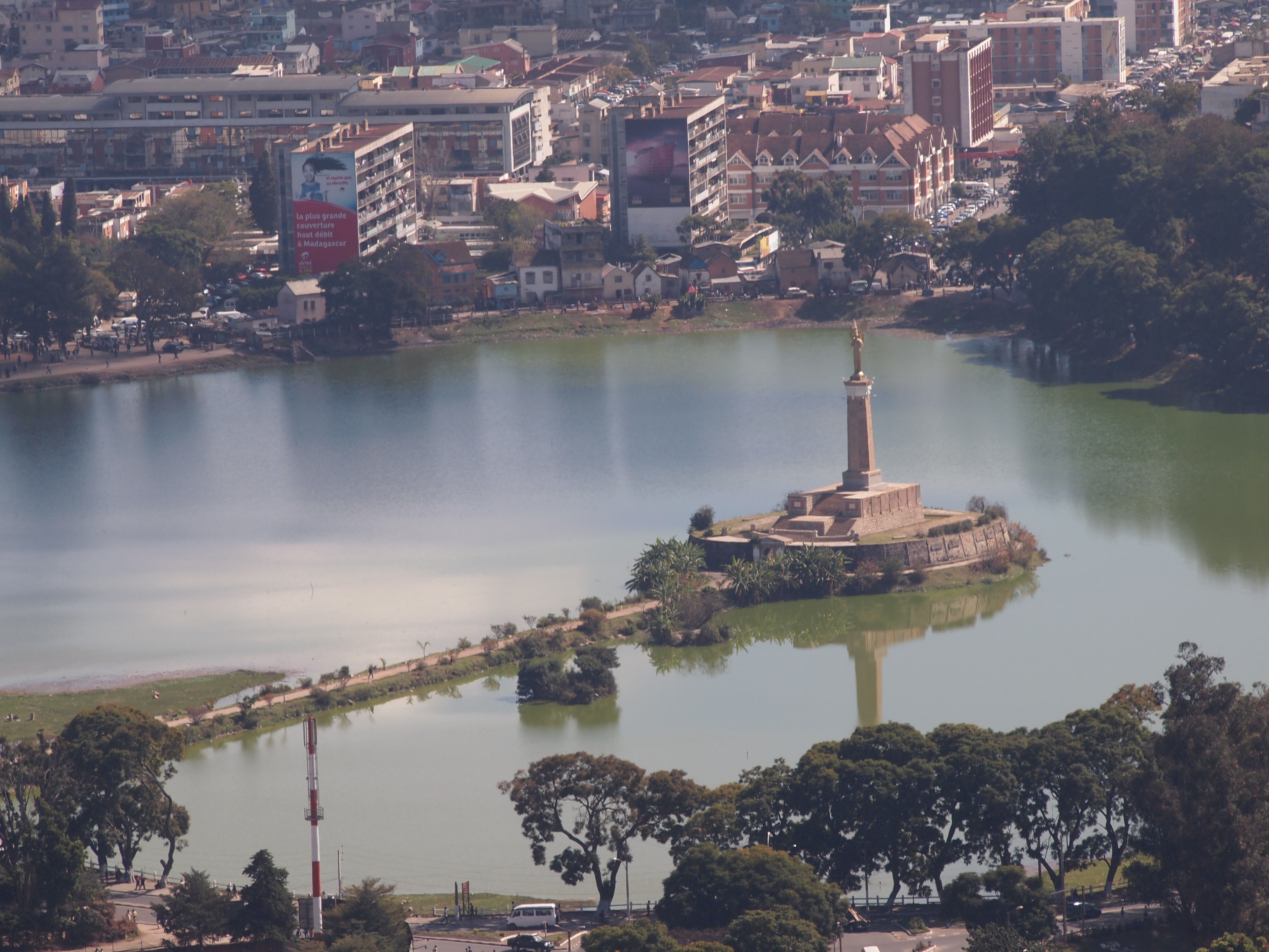
Antananarivo is not flat. The city cascades across a series of ridges and valleys, and the geography dictates everything. The highest point holds the ruins of the Rova, the royal palace complex that once anchored Merina sovereignty. Below it, neighborhoods descend in terraces toward the valley floors where rice paddies occupy every available lowland. The effect from the air is striking -- brilliant green rectangles interspersed among blocks of pastel buildings, as though the city never quite decided whether it wanted to be urban or agricultural. Lake Anosy anchors the city center, and the broad Avenue de l'Independence serves as the commercial spine, lined with shops, restaurants, and the old colonial-era central rail station, now converted into a small shopping arcade since passenger rail service has largely ceased.
Market Days and Vanilla Pods
The Analakely Market captures Tana's energy in concentrated form. Under covered sections, vendors sell bags, jewelry, and clothing at prices that demand haggling. Outside, fruit and vegetable stalls spill onto sidewalks, and you can buy large bundles of vanilla pods -- Madagascar produces the majority of the world's vanilla crop, and nowhere is it cheaper than here. The architecture along the surrounding streets mixes French colonial facades with Indonesian-influenced wooden houses, a visual reminder that Madagascar's settlers arrived from both Africa and Southeast Asia. For those willing to navigate the old smoky Mercedes-Benz minivans that locals call taxi-be, neighborhoods like Isoraka and the Haute-Ville reveal quieter streets, 19th-century churches, and views across the city that stretch to the surrounding highlands.
Highland Rhythms
Despite sitting in the tropics, Antananarivo's climate feels Mediterranean. Nearly all of its 1,400 millimeters of annual rain falls between November and April, leaving the dry season -- May through October -- pleasant, sunny, and cool enough that mornings can bite. Temperatures hover in a narrow band between 15 and 22 degrees Celsius year-round. This comfortable plateau climate drew the Merina here centuries ago and continues to shape daily life. Three Horses Beer, the local THB, wins awards and fuels evening gatherings. Betsa-betsa, an alcohol made from coconut water, offers something stronger. And litchel -- lychee wine -- ranges from pleasantly off-dry to tooth-achingly sweet, depending on the brand. In a city where the tap water is unsafe but the street food is irresistible, Tana teaches visitors to relax into its particular rhythms.
Gateway to an Island Continent
Antananarivo is where nearly every journey through Madagascar begins and ends. Ivato International Airport receives the island's international flights, and the city serves as the hub for Madagascar Airlines' domestic network. From here, roads fan out to the cardinal points -- north to Antsiranana, east toward Andasibe's lemur-filled rainforests, south to Antsirabe, and west to Morondava and the iconic Avenue of the Baobabs. Travel by taxi-brousse, the shared minibuses that link every corner of the island, is an exercise in patience: vehicles depart only when full, and the roads test both vehicle and passenger. But there is, as travelers note, no better way to meet the Malagasy people and understand the country they inhabit.
From the Air
Located at 18.91S, 47.52E at 1,280 meters elevation on Madagascar's central plateau. Ivato International Airport (FMMI) lies 16 km northwest of the city center. The city is visible from cruising altitude as a sprawling settlement across ridgelines with distinctive green rice paddies in valley floors. Approaching from the east, look for Lake Anosy as a landmark near the city center and the prominent hilltop where the Rova palace complex sits.