Antarctic Peninsula
The Lemaire Channel narrows to barely a kilometer, sheer black cliffs rising on either side, glaciers tumbling from unseen heights to meet water so still it mirrors everything perfectly. Your ship slides through in near-silence, the only sounds the creak of ice and the occasional rifle-crack of a calving glacier. A minke whale surfaces alongside, close enough to hear its breath. Ahead, icebergs glow blue in the flat Antarctic light. This is the Antarctic Peninsula - the most accessible part of the frozen continent, and the most dramatic. It reaches 1,600 kilometers toward South America like a frozen arm, and for those willing to cross the Drake Passage, it offers landscapes that make the rest of the world seem small.
The Submerged Andes
Look at a map and you can see it: the Peninsula is the Andes continuing south. The mountains submerge at Tierra del Fuego, loop underwater through the Scotia Arc, touch land briefly at South Georgia, then rise again as this final frozen extension of the American cordillera. The peaks reach nearly 3,000 meters, mantled in ice so thick it flows continuously seaward as glaciers.
Graham Land, the northern portion, lies mostly outside the Antarctic Circle, its climate almost balmy by continental standards - winter temperatures rarely dropping below -15°C, summer days occasionally climbing above freezing. The west coast faces the relatively warm waters of the Bellingshausen Sea; the east coast fronts the Weddell Sea, perpetually choked with pack ice. This difference in accessibility determined which side humans would explore, exploit, and eventually protect.
The Penguin Cities
Penguins need open water for food, so they crowd the Peninsula's intricate coastline in numbers that stagger the imagination. Paulet Island hosts 100,000 pairs of Adélies. Esperanza Base is surrounded by 125,000 more. Gentoos waddle between the rusting machinery of abandoned whaling stations. Chinstraps stand in patient rows on volcanic beaches, their distinctive black face-straps giving them an air of perpetual skepticism.
The colonies are sensory overload - the constant braying of territorial calls, the ammoniac reek of guano, the blur of motion as birds shuffle between nest and sea. Skuas patrol overhead, looking for unguarded eggs. Leopard seals lurk at the water's edge, picking off penguins as they porpoise through the shallows. The violence is matter-of-fact, part of a cycle that has played out for millions of years on these frozen shores.
Ice in All Its Forms
The Peninsula is a gallery of frozen water. Tabular bergs the size of shopping malls drift past, their edges geometrically perfect. Bergy bits - house-sized chunks calved from glaciers - bob in sheltered bays. Brash ice, the shattered remnants of larger pieces, chokes narrow channels with a grinding that reverberates through the hull of any ship passing through.
The glaciers themselves are the main event. They pour from the spine of the Peninsula in frozen rivers, their faces calving continuously into the sea. The blue of glacial ice is otherworldly - light penetrating deep into compressed snow, the red wavelengths absorbed, only the blues escaping to dazzle the eye. In Paradise Bay, you can stand on shore and watch ice collapse from glacier faces half a kilometer wide, the resulting waves rolling toward you in slow motion before breaking on the rocky beach.
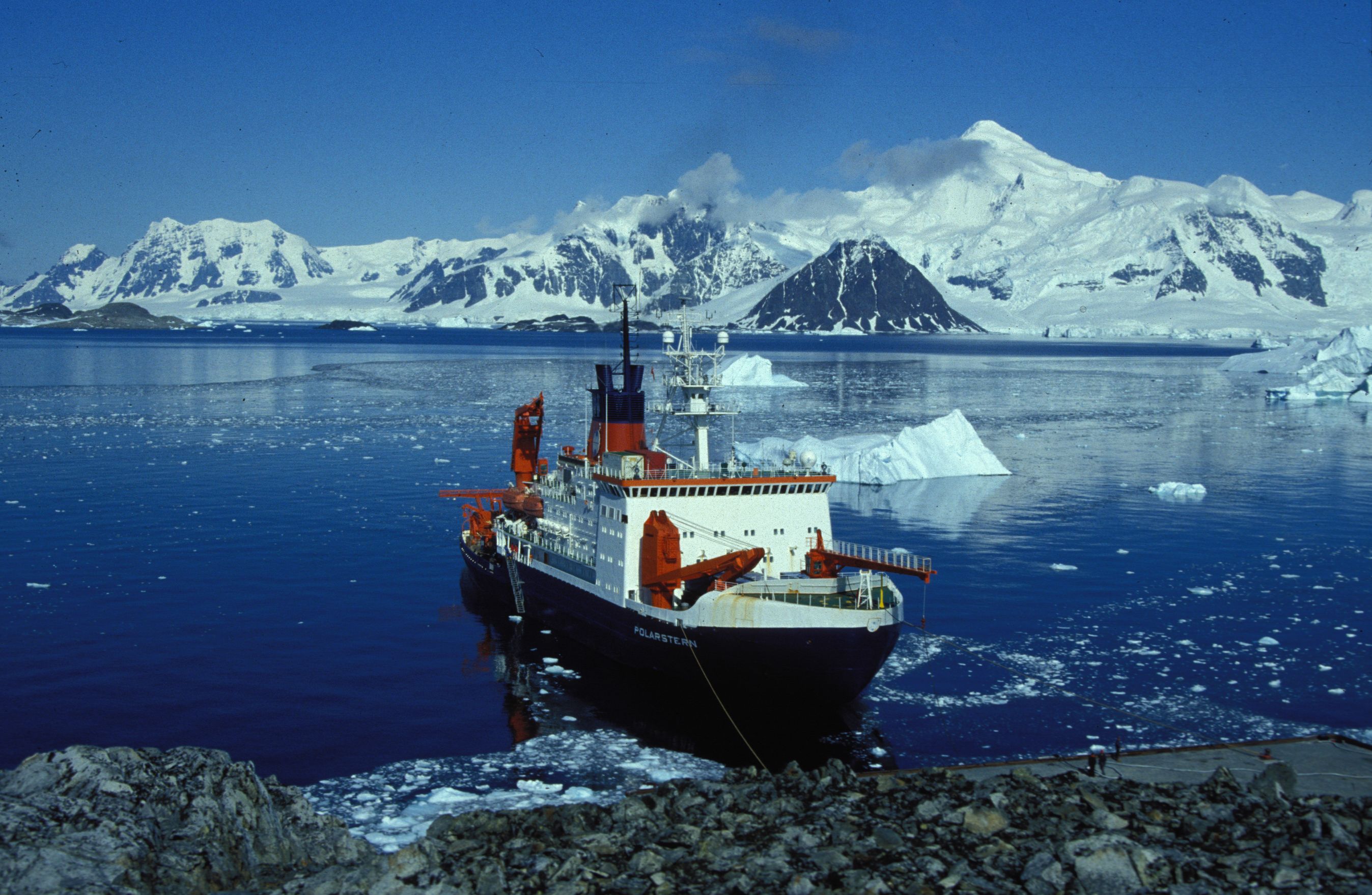
The Human Footprint
A dozen nations maintain research stations on the Peninsula and its islands, from the utilitarian modules of Argentina's Esperanza to the striking red buildings of Port Lockroy, now a museum and post office where you can mail postcards franked with Antarctic stamps. The stations study everything from climate change to penguin behavior, staffed by scientists who spend months in isolation, watching the long Antarctic night give way to endless summer days.
Tourism arrived in the 1960s and has grown steadily since. Expedition ships carrying 100 to 500 passengers now make the crossing regularly in summer, their Zodiacs landing at carefully regulated sites. Port Lockroy alone receives 10,000 visitors a year - and has become a study in itself, with researchers tracking whether tourism harms the resident gentoo colony. So far, the penguins seem unfazed. The humans invariably leave transformed.
The Crossing
No one arrives at the Peninsula easily. The Drake Passage - the 1,000-kilometer gap between Cape Horn and the South Shetland Islands - funnels the entire Southern Ocean through a narrow strait, creating some of the most violent seas on Earth. Ships roll and pitch for two days each way, passengers green with seasickness, crew members walking the corridors as casually as if on land.
But then the sea calms, the first icebergs appear, and the mountains rise from the horizon. The air tastes different - crisp, clean, smelling faintly of penguin and absolutely nothing else. The silence, when the ship's engines stop, is profound. And in that silence, watching a leopard seal eye you from an ice floe or a humpback whale breach against a backdrop of glaciers, you understand why people cross the Drake. This is the last wilderness, the final frontier, a place that remains essentially itself despite everything humans have done to the planet.
From the Air
Located approximately 65-75°S, 60-70°W, extending north toward South America. The Peninsula is 1,600km long, visible as a mountain spine covered in ice fields and glaciers. Key landmarks from altitude: the South Shetland Islands (120km north of the tip), King George Island with Villa las Estrellas airstrip, the narrow Lemaire Channel (65°S), and the dramatic peaks of Graham Land. The west coast shows exposed rock and ice cliffs; the east coast (Weddell Sea side) is typically ice-bound. Research stations appear as small colored dots against the white - look for Argentina's Marambio (has airstrip), UK's Rothera on Adelaide Island, and the bright red buildings of Port Lockroy. No commercial airports; access is via Marambio or King George Island (Chilean/Russian operations). Extreme weather - high winds, sudden whiteouts, temperatures -10 to +5°C in summer. Antarctic Treaty territory - all operations require permits.