Antietam: The Day America Lost 23,000 Men
The numbers are incomprehensible. On September 17, 1862, in the fields and woods around Sharpsburg, Maryland, 23,000 American soldiers were killed, wounded, or went missing - more casualties in one day than in all previous American wars combined. The Battle of Antietam (Sharpsburg to Southerners) was the bloodiest day in American military history. It ended Robert E. Lee's first invasion of the North, gave Abraham Lincoln the victory he needed to issue the Emancipation Proclamation, and transformed the Civil War from constitutional dispute into moral crusade. The battlefield survives almost unchanged, its monuments and walls marking where regiments were annihilated in hours, where the cornfields were literally cut down by fire.
The Invasion
Robert E. Lee invaded Maryland in September 1862, hoping to win Confederate recognition from Britain and France, rally Maryland's slaveholders to the Southern cause, and take the war to the North. His army of 45,000 faced George McClellan's Army of the Potomac, 87,000 strong but cautiously commanded. A copy of Lee's campaign orders, wrapped around cigars, was found by Union soldiers and delivered to McClellan, revealing Lee's dispersed forces. McClellan had the chance to destroy the Confederate army in detail. He moved slowly enough that Lee concentrated at Sharpsburg, back to the Potomac, outnumbered but defiant.
The Battle
The fighting began at dawn in a cornfield on the northern end of the line. For hours, waves of soldiers charged and countercharged through the corn; by mid-morning, the field had changed hands fifteen times and lay carpeted with dead. The center saw fighting along a sunken road - 'Bloody Lane' - where Confederate defenders were eventually overwhelmed after hours of slaughter. The southern end featured Burnside's Bridge, where Union forces tried to cross Antietam Creek against determined resistance. By afternoon, the Union had won the crossing; by evening, the armies held essentially their morning positions. The tactical result was stalemate; the strategic result was Confederate retreat.
The Proclamation
Lincoln had been waiting for a Union victory to issue the Emancipation Proclamation. The preliminary version, announced September 22, five days after Antietam, declared that enslaved people in rebel states would be free as of January 1, 1863. The Proclamation transformed the war's purpose: no longer simply to restore the Union but to end slavery. Britain and France, both with strong anti-slavery sentiments, could no longer consider recognizing the Confederacy without appearing to support slavery. The battle that produced no clear tactical winner produced the strategic victory that changed everything. Antietam's real casualty was the Confederacy's hope of international legitimacy.
The Photography
Alexander Gardner and James Gibson photographed the Antietam battlefield before burial crews finished their work. The images - bloated corpses along Bloody Lane, dead artillery horses, the shattered landscape - shocked Americans who had never seen war's reality. Exhibited in New York, the photographs drew crowds; newspapers reported that viewers searched the faces for recognizable relatives. 'The dead of the battlefield come up to us very rarely,' a New York Times reviewer wrote. Antietam was the first American battle extensively photographed with casualties visible. The images established documentary photography as war's witness.
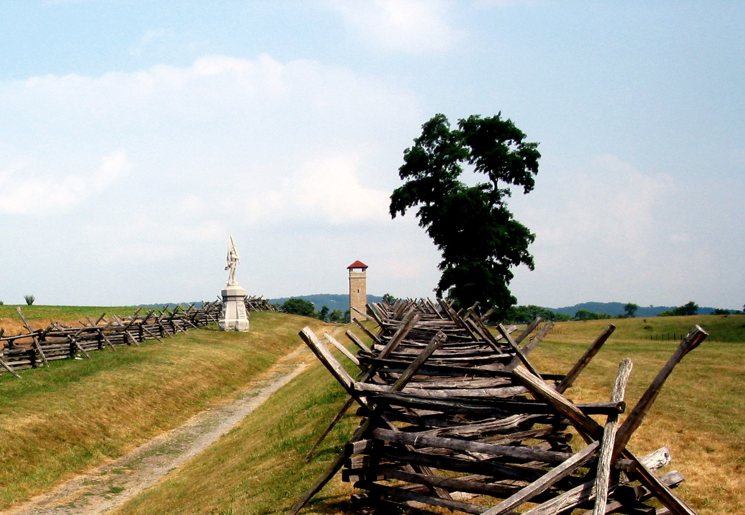
Visiting Antietam
Antietam National Battlefield is located near Sharpsburg, Maryland, approximately 70 miles northwest of Washington, D.C. via Interstate 70. The visitor center offers orientation film and museum. An 8.5-mile driving tour covers the major sites: Dunker Church, the Cornfield, Bloody Lane, Burnside's Bridge. Walking tours provide more detailed understanding; rangers offer programs seasonally. The battlefield is well-preserved, its appearance close to 1862 conditions. The National Cemetery holds 4,776 Union dead; Confederate dead were eventually removed to Southern cemeteries. Allow half a day for the driving tour; serious students need more. The scale of casualties becomes real when standing at Bloody Lane imagining the sunken road filled with dead.
From the Air
Located at 39.47°N, 77.74°W in the rolling countryside of western Maryland. From altitude, the Antietam battlefield appears as agricultural land punctuated by monuments and preserved farm structures. The Antietam Creek meanders through the terrain; Burnside's Bridge is visible as a small stone arch. The town of Sharpsburg is visible adjacent to the battlefield. The terrain is gently rolling - not dramatic, which makes the slaughter harder to imagine. Hagerstown lies to the north; the Potomac River, which Lee's army crossed in retreat, flows to the south. The landscape looks peaceful, productive, ordinary. Twenty-three thousand casualties in one day happened here; the ground absorbed them and kept growing crops.