Antigua Guatemala
Antigua Guatemala was never meant to survive. A catastrophic earthquake in 1773 destroyed the colonial capital of Spanish Central America so thoroughly that authorities ordered it abandoned, moving the government to what became modern Guatemala City. But people refused to leave entirely, and the ruins of their former grandeur became something perhaps more valuable than an intact city could offer: a time capsule of Spanish colonial architecture, frozen at the moment of its destruction and preserved by poverty's inability to replace what had fallen. Today Antigua's cobblestone streets thread between partially restored churches, rubble-strewn monasteries, and colonial mansions converted to boutique hotels. Three volcanoes frame every view - including the actively erupting Fuego, which punctuates nights with glowing explosions visible from rooftop bars. UNESCO recognized this unlikely survivor in 1979, and the Spanish-language schools that cluster here now draw students from around the world to learn among the ruins.
Colonial Glory
For over two centuries, Santiago de los Caballeros de Guatemala - as Antigua was then known - served as Spain's administrative center for all of Central America. The city accumulated the wealth and architecture expected of such importance: baroque churches with elaborate facades, monasteries housing religious orders from across Europe, a university, a printing press, and merchants' mansions surrounding the central plaza. Earthquakes struck repeatedly - this is one of the most seismically active regions on Earth - and repeatedly the city rebuilt. But the Santa Marta earthquakes of 1773 proved too much. The damage was so extensive, the cost of reconstruction so prohibitive, that abandonment seemed the only option. What remained became a quarry for the new capital, yet enough survived to make modern Antigua one of the best-preserved colonial cities in the Americas.
Ruins and Restoration
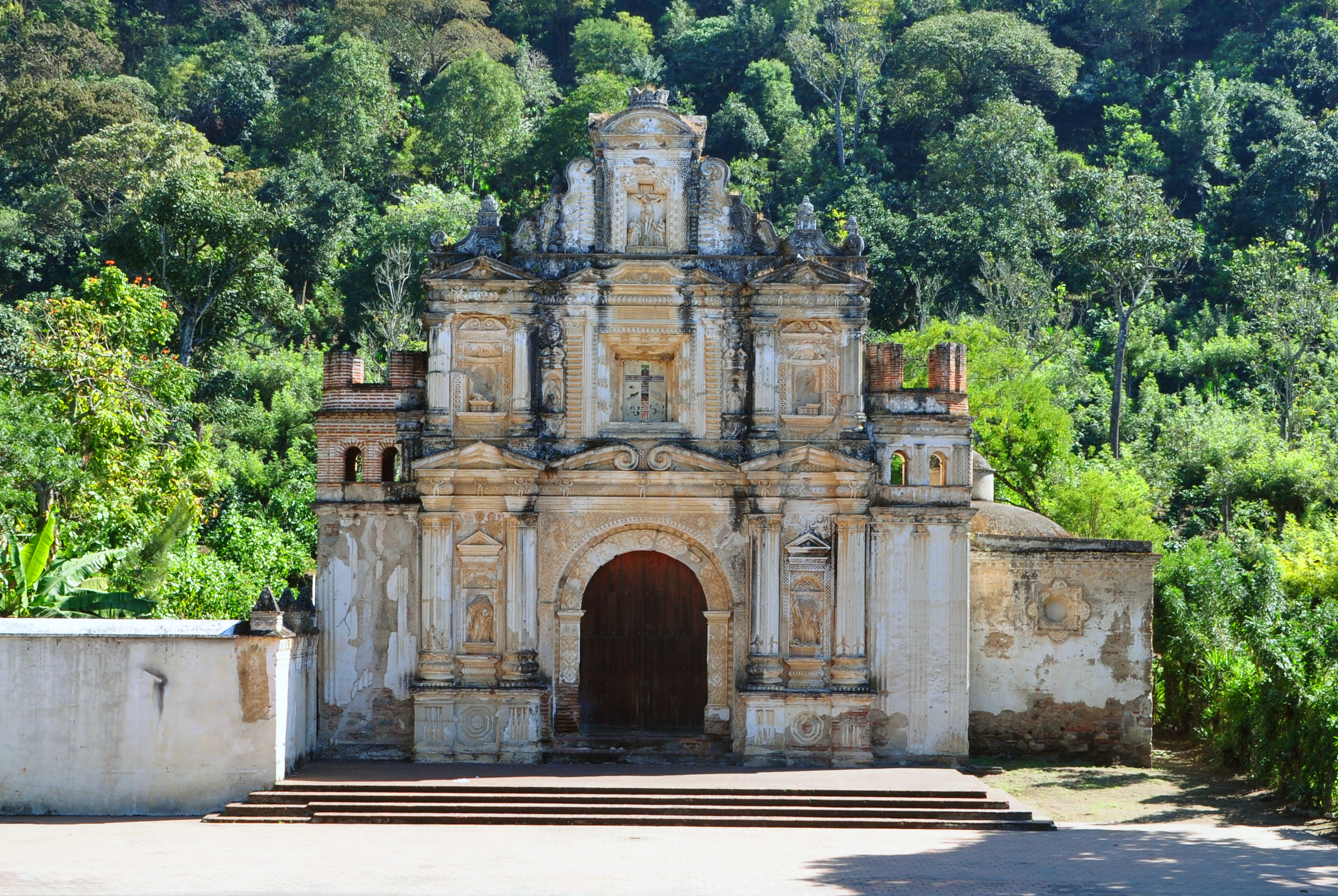
The colonial ruins that now draw tourists range from roofless shells to careful restorations. La Recolección's massive arched walls stand open to the sky, trees growing from rubble-filled naves. San Francisco el Grande has been partially restored and functions as an active church, its cloisters now housing a museum. The Cathedral - once the grandest in Central America - presents a haunting combination of restored facade and ruined interior. Each site charges admission, with fees supporting ongoing preservation. The most photogenic views frame crumbling baroque architecture against volcanic peaks, a juxtaposition that has made Antigua Instagram-famous. Yet the ruins are more than scenery; they're evidence of ambition, disaster, and the stubborn human refusal to abandon beautiful places.
Semana Santa
Holy Week transforms Antigua into one of the world's most spectacular religious celebrations. For seven days, massive processions carry life-sized statues of Christ and the Virgin through streets carpeted with elaborate alfombras - intricate designs created from colored sawdust, flowers, and pine needles that take hours to construct and moments to destroy as the processions pass over them. The tradition dates to 1543, making Antigua's Semana Santa one of the oldest continuous Easter celebrations in the Americas. Purple-robed penitents carry floats so heavy they require dozens of bearers, moving at processional pace through crowds that pack the colonial streets. Hotels book months in advance; prices triple; the experience justifies both inconveniences for those who witness it.
Volcanic Setting
Three volcanoes dominate Antigua's skyline: Agua's perfect cone to the south, Acatenango's forested slopes to the southwest, and Fuego's active crater glowing at night beside it. Climbing Acatenango has become one of Guatemala's premier adventures - an overnight trek to campsites where hikers watch Fuego erupt in the darkness, sometimes multiple times per hour. The climb is strenuous, reaching nearly 4,000 meters, but requires no technical skills and reward-to-effort ratios attract thousands annually. Fuego itself is too dangerous to climb; a 2018 eruption killed hundreds when pyroclastic flows swept down its slopes faster than people could flee. Agua offers easier hiking with stunning views. All three volcanoes remind visitors that Antigua's earthquake-prone history continues into the present.
Living City
Modern Antigua balances preservation with practicality. Spanish-language schools have operated here since the 1970s, drawing students who combine intensive immersion with cultural experiences unavailable in larger cities. Many stay with local families, practicing conversation over home-cooked meals. The tourism economy supports excellent restaurants, from budget comedores to upscale dining in colonial courtyards. Coffee from surrounding highlands earns international recognition. Markets offer textiles and handicrafts from indigenous communities throughout Guatemala. The compact center - barely a kilometer across - makes everything walkable, though tuk-tuks provide affordable transport to outlying attractions. Security remains better than Guatemala's reputation suggests, with tourist police patrolling central areas. Antigua offers perhaps the gentlest introduction to Central America: beautiful, accessible, and just earthquake-damaged enough to remind visitors that nothing here should be taken for granted.
From the Air
Located at 14.57°N, 90.73°W in the Guatemalan Highlands at 1,530m elevation. The colonial city grid is visible surrounded by three prominent volcanic peaks: Volcán de Agua (3,760m) to the south, and the paired Volcán de Fuego (3,763m, often with visible eruption plume) and Volcán Acatenango (3,976m) to the southwest. La Aurora International Airport (GUA) in Guatemala City lies 45km to the east. The city appears as a compact colonial grid distinct from surrounding agricultural areas.