Apache Trail
The Southern Pacific Railway invented the name to sell tickets, but the Apache Trail earned its reputation the hard way. Carved into the flanks of the Superstition Mountains beginning in 1903, this narrow ribbon of road served a purely practical purpose: getting construction materials to the remote site of Theodore Roosevelt Dam. Two years and $551,000 later, workers had transformed an ancient footpath into America's most treacherous supply route. What they could not have predicted was that this utilitarian road would become one of the Southwest's most celebrated scenic drives.
The trail follows paths worn smooth over millennia. Anasazi traders walked these routes to exchange goods with the Hohokam. Apache families used them seasonally, moving between summer and winter camps through the mountains that would eventually bear their name. When federal engineers surveyed the route in 1903, they found the ancient path already pointed the way through terrain that seemed impossible to traverse.
Water Politics and Western Dreams
The Apache Trail exists because of drought. In the late 1890s, the Salt River Valley suffered its worst dry spell since the Civil War, and farmers who had staked their futures on irrigation watched their crops wither. The temperamental Salt River mocked them with alternating floods and droughts, making agricultural planning a gamble. Something had to change.
The National Reclamation Act of 1902, signed by President Theodore Roosevelt, promised federal funding for western water projects. Arizona seized the opportunity. The proposed dam site sat in remote wilderness, accessible only by pack mule, but the prize was worth the difficulty: reliable water storage that would transform Phoenix from a struggling settlement into a viable city. The only obstacle was getting thousands of tons of construction materials to a site that had no roads.
Building the Impossible Road
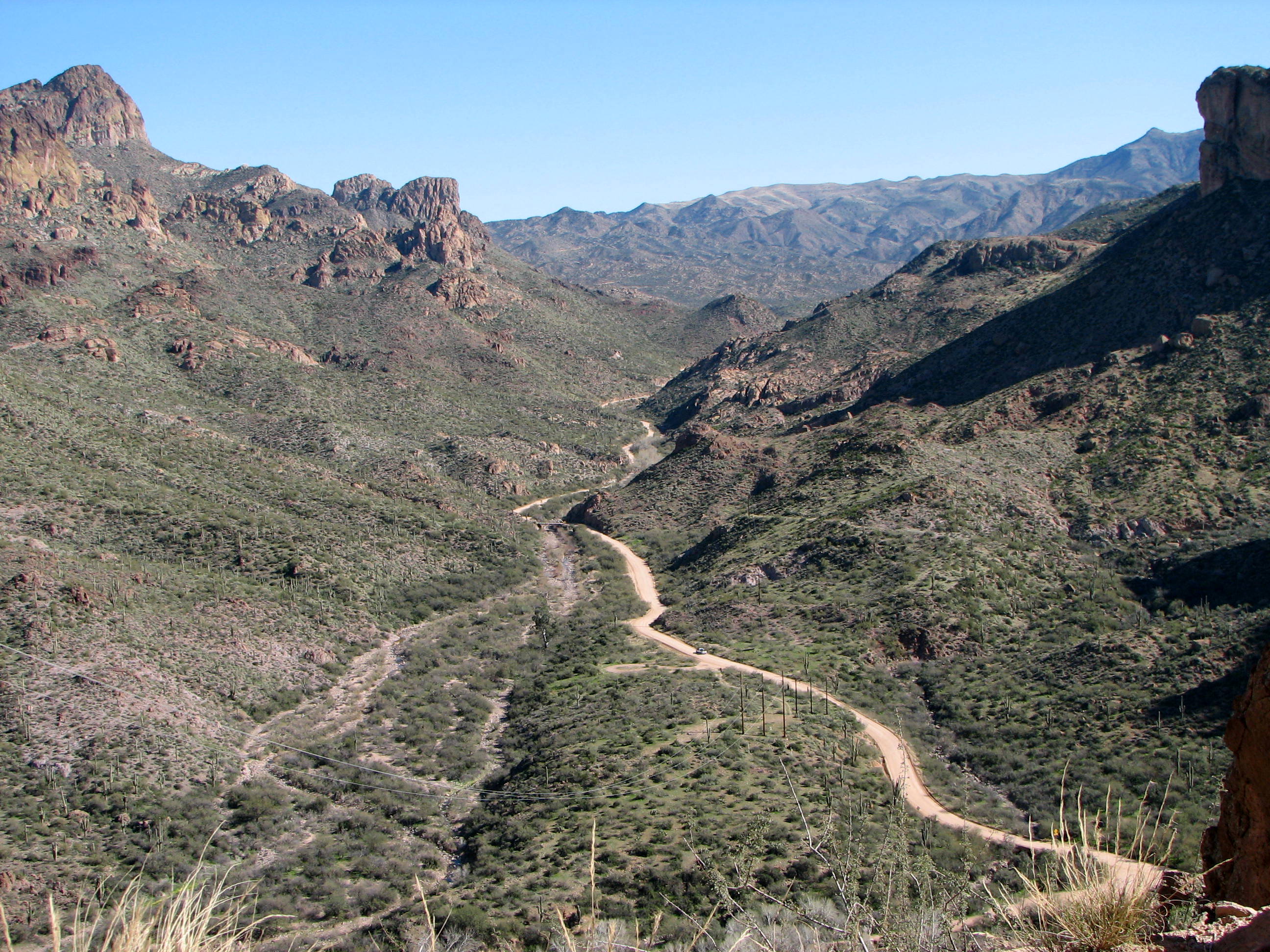
Construction began on August 29, 1903, with a workforce that bridged cultures. Apache laborers provided most of the muscle, living in separate camps with their families while maintaining their traditional ways. They carved switchbacks into volcanic cliffs, blasted tunnels through solid rock, and laid a roadbed along sheer drops where a single misstep meant death.
The road they built wound steeply through rugged desert mountains, passing deep reservoir lakes that would later be named Canyon Lake and Apache Lake. The narrow, winding route remained unpaved for much of its length, with steep cliff drops and few safety barriers. Modern RV rental companies still prohibit their vehicles on this route, honoring the road's original character.
From Supply Route to Sunset Route
The Apache Trail officially opened on September 3, 1905, but its transformation had already begun. Even as construction crews hauled cement and equipment to the dam site, entrepreneurs recognized gold of a different kind. The unspoiled landscape demanded attention, and tourists were willing to pay for the privilege of experiencing it.
Southern Pacific Railroad saw the opportunity first. Their famous "Sunset Route" train service from New Orleans to San Francisco offered passengers a motorcar side trip over the Apache Trail for an additional fee. It was Southern Pacific's advertising department that coined the evocative name, trading on romantic images of the American West to sell tickets. The name stuck, replacing the prosaic "Tonto Wagon Road" in the public imagination.
A Road That Refuses to Die
The Apache Trail has survived fires, floods, and the relentless pressure of modern traffic planning. The Superstition Freeway completed in 1992 rerouted US Highway 60 away from the historic route, but the trail itself remained, now designated State Route 88. Fires and floods in 2019 triggered a massive landslide between Fish Creek Hill Overlook and Apache Lake Marina, closing the road for repairs that lasted until September 2024.
Today the trail still connects Apache Junction to Theodore Roosevelt Lake, passing through the Superstition Mountains and Tonto National Forest. The section east of Tortilla Flat remains unpaved, honoring the character of the original supply road. Drivers who brave the narrow switchbacks experience the same vertiginous views that captivated tourists over a century ago, a reminder that some roads are worth preserving precisely because they refuse to be tamed.
From the Air
The Apache Trail (State Route 88) winds through terrain at approximately 33.42°N, 111.58°W, connecting Apache Junction to Theodore Roosevelt Lake. From the air, look for the narrow road threading through the Superstition Mountains, with Canyon Lake and Apache Lake visible as blue ribbons in the brown desert. The terrain rises dramatically with steep cliff faces. Nearest airports include Phoenix-Mesa Gateway (KIWA) to the southwest and Falcon Field (KFFZ) in Mesa. The road is most visible in morning light when shadows define the switchbacks.