Springer Mountain: Where 2,000 Miles of Footsteps Begin
The bronze plaque at Springer Mountain's summit marks mile zero of the Appalachian Trail. From here, the footpath winds 2,190 miles through 14 states to Mount Katahdin in Maine - the longest hiking-only trail in the world. Each spring, roughly 3,000 'thru-hikers' touch the plaque and start walking north, carrying everything they need on their backs. Only about 25% will reach Katahdin five to seven months later. The rest will quit, injured or exhausted or simply done. But on the first day, standing at Springer, everyone believes they'll be among the finishers. The mountain has witnessed countless beginnings, countless dreams, countless first steps on a journey most will never complete.
The Trail
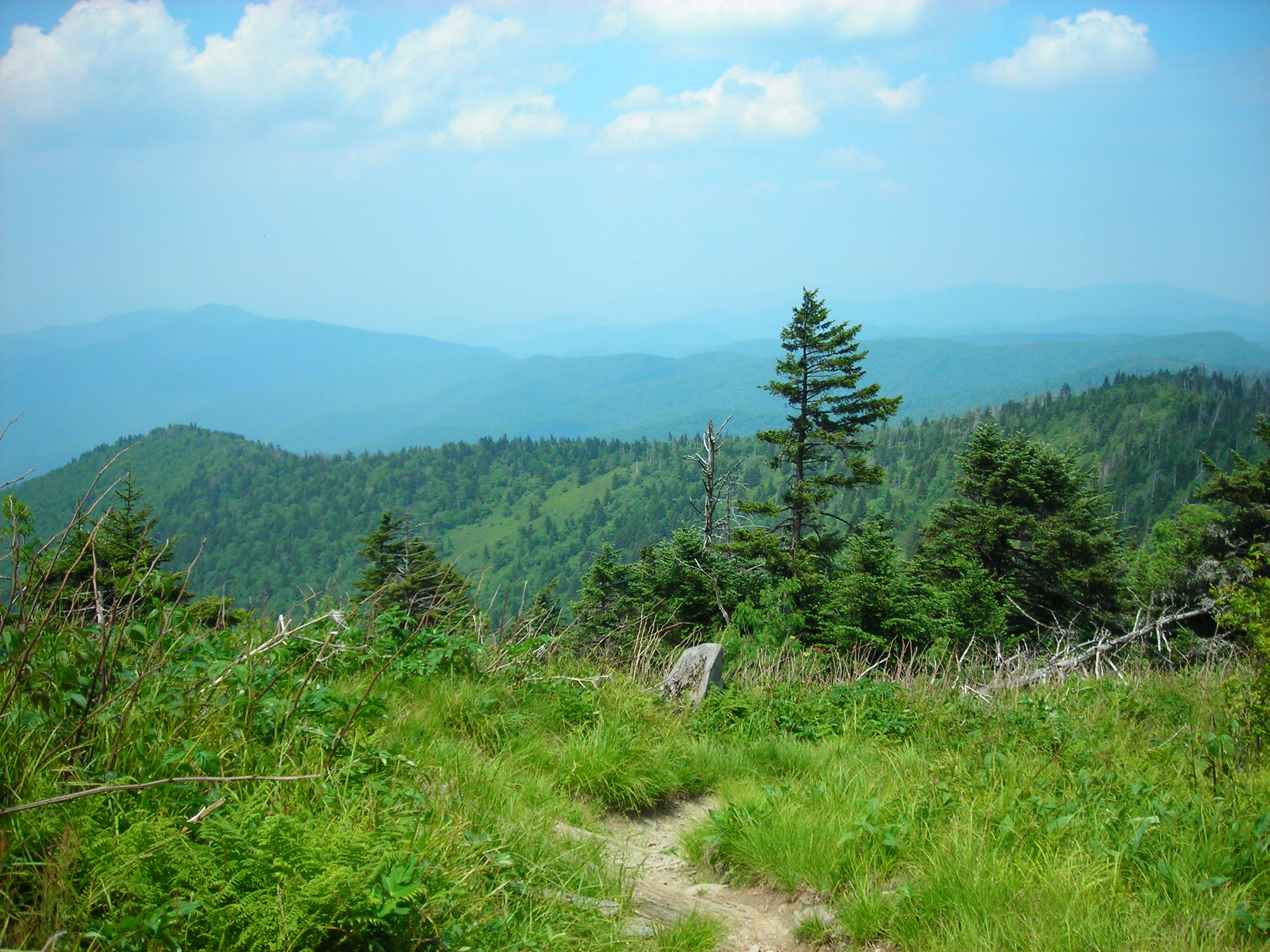
The Appalachian Trail traverses the ancient mountain chain from Georgia to Maine, crossing some of the oldest geological formations on Earth. The route follows ridge lines where possible, rising and falling over countless peaks: Clingmans Dome in Tennessee (the trail's highest point at 6,643 feet), Franconia Ridge in New Hampshire, Katahdin's Knife Edge in Maine. The trail passes through national parks, national forests, and private land; 250,000 volunteers maintain it each year. Shelters spaced every 8-15 miles provide basic cover. The experience is deliberately primitive: no vehicles allowed, minimal infrastructure, the hiker responsible for carrying everything needed for survival.
The Thru-Hike
Completing the entire trail in a single continuous journey - a 'thru-hike' - takes five to seven months. Most hikers start at Springer in March or April, walking northward with the spring, reaching Katahdin before Baxter State Park closes in October. The attrition is brutal: blisters, injuries, exhaustion, the sheer psychological weight of walking all day, every day, for months. Those who finish speak of transformation - the trail as pilgrimage, the walking as meditation, the simplicity of eat-walk-sleep as liberation from complexity. Those who quit speak of lessons learned, of knowing when to stop, of plans for future attempts. The trail accepts both.
The Community
Thru-hikers form a moving community. Hikers who start around the same time leapfrog each other northward, forming trail families who hike, camp, and resupply together. Trail names replace legal names: 'Blaze,' 'Stumble,' 'Phoenix.' Trail angels - local volunteers - provide unexpected gifts: coolers of drinks at road crossings, rides to town, home-cooked meals. Trail magic is the kindness of strangers made tangible. The towns along the trail have adapted to the annual migration: hostels catering to hikers, restaurants offering hiker portions, outfitters replacing worn gear. The Appalachian Trail creates a temporary society, reconstituted each spring, dispersed each fall.
The Origins
Benton MacKaye proposed the Appalachian Trail in 1921, envisioning a continuous path through Appalachian wilderness that would provide escape from industrial urban life. Volunteers began building; the trail was completed in 1937. The route has shifted constantly as sections are relocated away from roads and development or rerouted to higher ground. The footpath today is longer than MacKaye imagined, passing through more wilderness than existed when he proposed it. The trail succeeded beyond any reasonable expectation, becoming a national institution that exists because of unpaid labor - volunteers who maintain 2,190 miles of footpath simply because they believe it should exist.
Visiting Springer Mountain
Springer Mountain is located in the Chattahoochee National Forest in northern Georgia, about 80 miles north of Atlanta. The summit is accessible by an 8.5-mile approach trail from Amicalola Falls State Park or by shorter routes from Forest Service roads. The summit plaque marks the official southern terminus; a register allows hikers to record their intentions. The Appalachian Trail Association in Harpers Ferry, West Virginia, maintains records and provides planning resources. For non-thru-hikers, day hikes and section hikes offer tastes of the trail experience. Peak thru-hiker departure season runs March through April; the summit sees dozens of hopeful beginners on spring days. The experience marks a beginning - whether for 20 miles or 2,190.
From the Air
Located at 34.63°N, 84.19°W in the Blue Ridge Mountains of northern Georgia, within Chattahoochee National Forest. From altitude, Springer Mountain appears as one forested summit among many in the southern Appalachians. The approach trail from Amicalola Falls is invisible beneath tree canopy. The mountain marks the southern terminus of a footpath that extends 2,190 miles to Katahdin in Maine - invisible from altitude except where it crosses balds and ridges. The trail corridor traces northeast, following the Appalachian chain through 14 states. What appears from altitude as unremarkable Georgia highlands is where America's most ambitious footpath begins - the starting point for thousands of journeys, most of them unfinished.