The Appian Way: Queen of Roads
The historian Procopius, writing in the 6th century AD, marveled that the paving stones of the Appian Way fit together so precisely that they appeared to have grown naturally rather than been set by hand. He was describing a road already 800 years old. The Via Appia, begun in 312 BC by the censor Appius Claudius Caecus during Rome's wars against the Samnites, was the first road the Republic built specifically to move troops beyond greater Rome. The Roman poet Statius called it "Appia longarum regina viarum" - the Appian Way, queen of the long roads. That title was not mere flattery. This single ribbon of interlocking volcanic stone, stretching 560 kilometers from Rome to Brindisi on the Adriatic coast, became the template for every Roman road that followed, and the engineering principles behind it still underpin modern highway construction.
Built for War
Rome's affinity for the people of Campania, and the threat of the Samnite mountain tribes who opposed that alliance, created the need for the Appian Way. Around 343 BC, Rome and the city of Capua attempted to form a partnership. The Samnites responded with force, beginning a series of conflicts that would last decades. Between Rome and Capua lay the Pontine Marshes, a vast and treacherous wetland that had stalled armies before. Appius Claudius Caecus solved the problem with engineering: he drove the road straight through the marshes, raising it on an embankment and draining the surrounding land. The main section was started and completed in a single year - 312 BC - an astonishing pace that reflected the military urgency behind it. This was not a trade route that gradually hardened into a road. It was infrastructure built with a specific tactical purpose: get legions south, fast.
Stones That Last Millennia
The construction method was as revolutionary as the road's purpose. Workers leveled a dirt path, laid a foundation of small stones and mortar, covered it with gravel, and topped everything with tightly fitting, interlocking stones to create a surface that was both flat and remarkably durable. The road was cambered - higher in the center than at the edges - to shed rainwater into drainage ditches on either side, which were protected by retaining walls. The Via Appia is believed to have been the first Roman road to use lime cement, with volcanic rock providing the primary building material. Between Rome and Lake Albano, the road passed through the Servian Wall at the Porta Capena, climbed through a cutting in the Clivus Martis, and headed south along the ancient track to the Alban Hills. Dirt pathways flanking the paved surface served as sidewalks. The engineering was so sound that sections of the original pavement survive today, their stones worn smooth by twenty-three centuries of feet, hooves, and wheels.
The Road of Crosses
The Appian Way's most harrowing chapter unfolded in 71 BC. Two years earlier, the gladiator Spartacus had launched a slave revolt from Capua that grew into the Third Servile War, shaking the Republic to its foundations. In an Italy where roughly one in three people was enslaved, Spartacus defeated multiple Roman armies before his forces were finally cornered in Calabria. Marcus Licinius Crassus crushed the rebel army at the Siler River, and Pompey's legions captured thousands more who tried to escape. Rome's judgment was absolute and public: 6,000 captured enslaved people were crucified along the 200 kilometers of the Via Appia between Rome and Capua. The crosses lined both sides of the road, visible to every traveler for months. It was a message written in human suffering, using Rome's proudest engineering achievement as its medium - the road that connected the Republic became the road that displayed its capacity for cruelty.
From Ancient Stones to Modern Footsteps
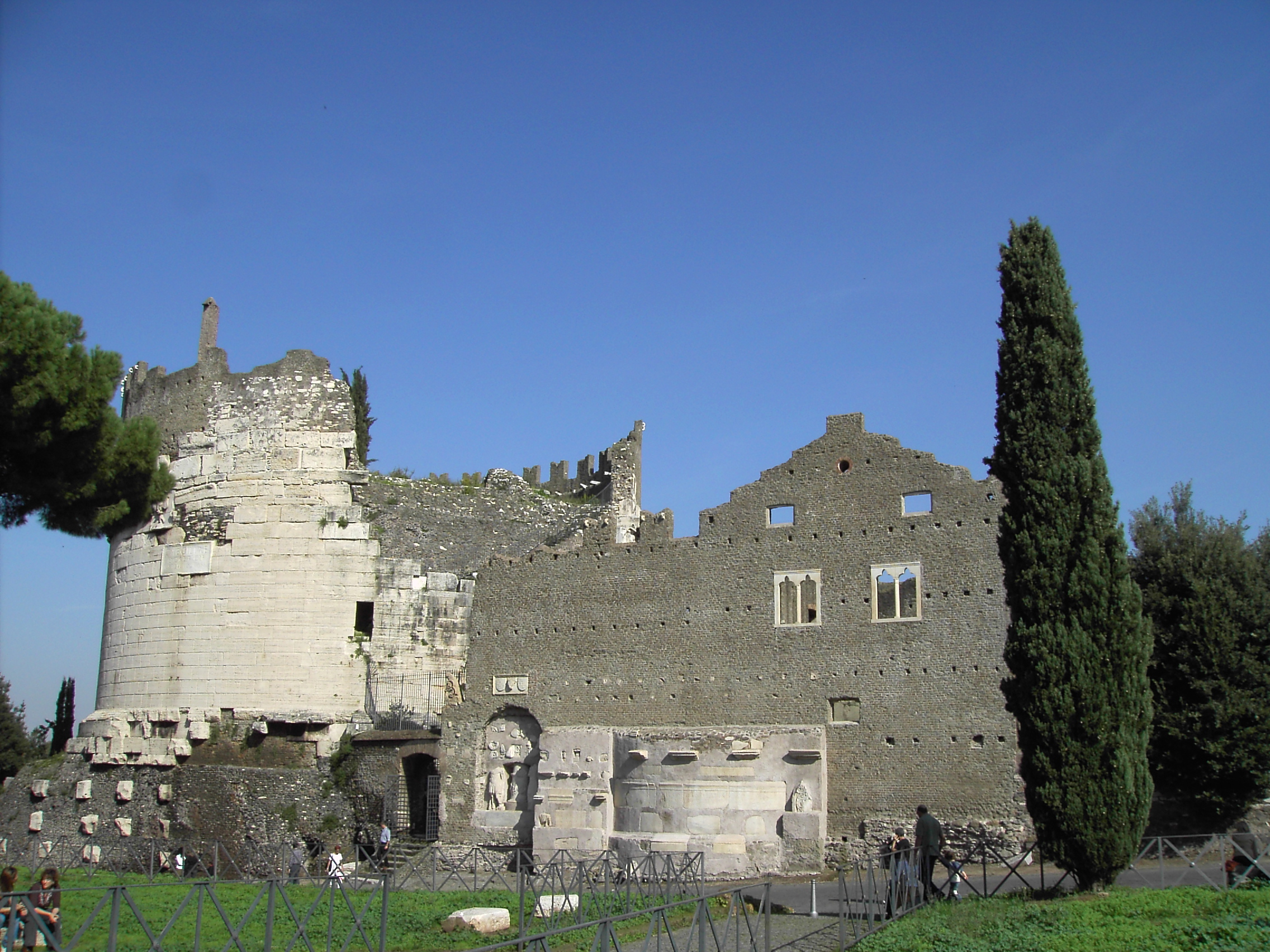
After the fall of the Western Roman Empire, the Appian Way slowly deteriorated. Pope Pius VI ordered its restoration in the 18th century, and in 1784 a parallel road - the Via Appia Nuova - was built alongside the ancient one as far as the Alban Hills. The old road became the Via Appia Antica, its character shifting from highway to monument. Today it is protected within the Appian Way Regional Park, a green corridor stretching south from Rome's Aurelian Walls through a landscape studded with tombs, catacombs, and ruins. The Tomb of Caecilia Metella, the Catacombs of San Sebastiano, and the Circus of Maxentius line its first few miles. In 1960, the marathon event of the Rome Olympics followed the Appian Way, with Ethiopian runner Abebe Bikila famously winning barefoot on the ancient stones. In July 2024, the Via Appia was inscribed on the UNESCO World Heritage List, formal recognition of what Statius knew two millennia ago: this is not merely a road. It is the queen of roads.
From the Air
Located at 41.841N, 12.533E, the Appian Way stretches southeast from central Rome toward Brindisi. From the air, the Via Appia Antica appears as a remarkably straight line of ancient paving cutting through the green parkland of the Appian Way Regional Park, flanked by cypress trees, tombs, and ruins. The road begins at the Porta San Sebastiano in the Aurelian Walls and extends into the Campagna. Look for the round Tomb of Caecilia Metella and the elongated Circus of Maxentius along the first few miles. Best viewed at 1,500-3,000 feet to trace the road's path through the landscape. Nearest major airport: Leonardo da Vinci-Fiumicino Airport (LIRF), approximately 25 km southwest. Ciampino Airport (LIRA) is closer at about 5 km south.