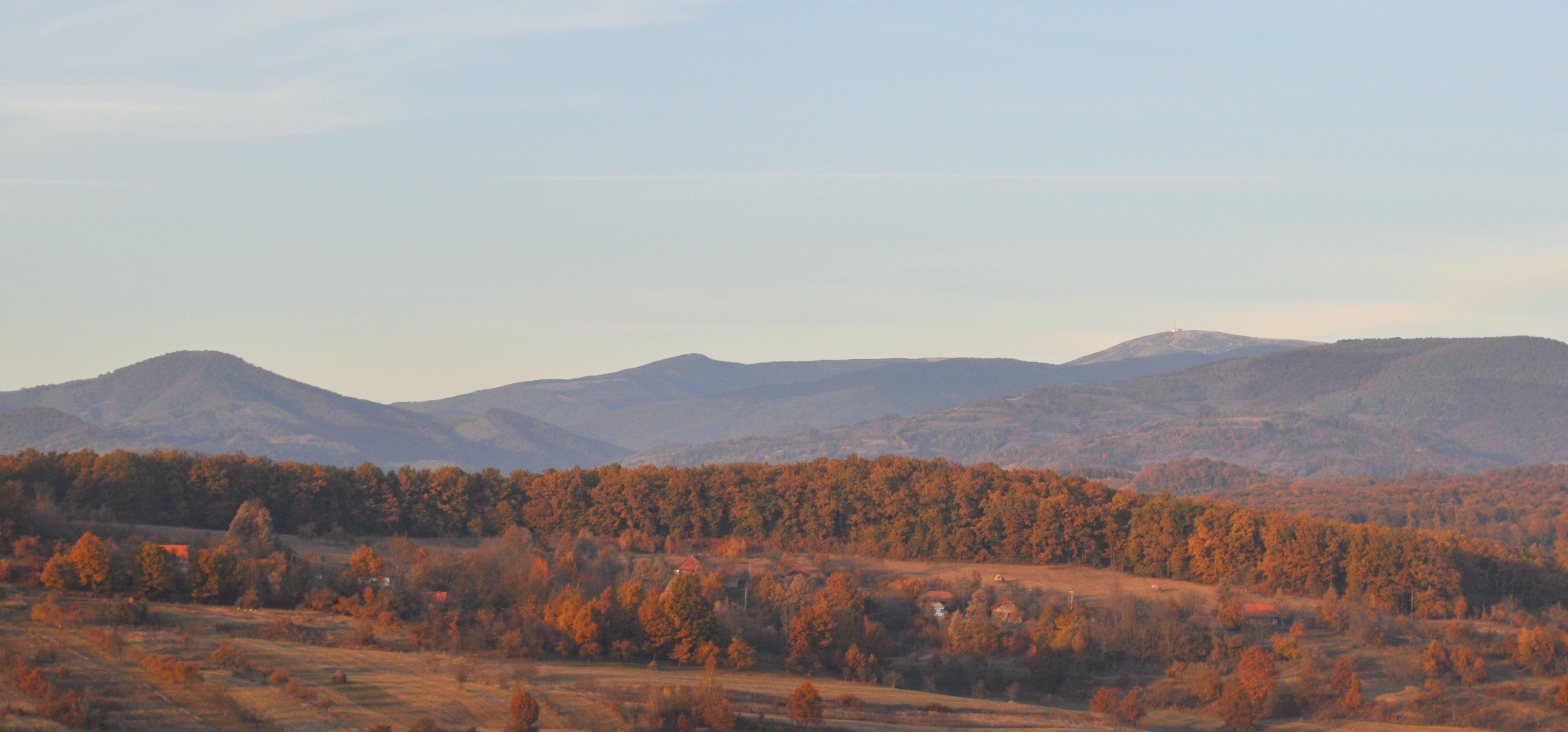
Apuseni Mountains
Four hundred caves hide inside these mountains. That number alone would make the Apuseni remarkable, but the caves are only the beginning. Rising in western Transylvania as part of the Western Romanian Carpathians, the Apuseni Mountains are a landscape where geological time is compressed into visible layers: Precambrian crystalline schists at the base, Carboniferous formations from the Hercynian mountain-building episodes, Cretaceous uplifts that raised the Carpathian chain, and the volcanic eruptions of the Neogene period that built the Metaliferi -- the Ore Mountains -- from fire. The highest point, Bihor Peak, reaches 1,849 meters, modest by Alpine standards but enough to divide climate zones, separate river systems, and harbor one of Romania's richest concentrations of wildlife.
A Billion Years of Construction
The Apuseni Mountains are not one range but a collection of massifs, chains, and depressions that never formed a continuous barrier. Low passes thread through them toward the Crișana plains and the Pannonian Plain to the west, making the range as much a corridor as a wall. From south to north, the principal groups include the Munții Metaliferi with their basaltic masses near Abrud, the Bihor Mountains riddled with caverns, Muntele Mare reaching 1,820 meters southwest of Cluj-Napoca, and the Seș-Meseș chain at the northern edge. The geological record begins in the Precambrian, when crystalline schists first separated. Caledonian mountain-building in the Silurian period and Hercynian movements in the Carboniferous further defined the structures. Alpine orogenesis during the Cretaceous period lifted the entire area, while subsidence created lake-filled depressions at Gurahonț and Brad where rivers deposited sediments over millions of years.
The Ore Mountains' Volcanic Origins
The Metaliferi -- literally "metal-bearing" -- mountains in the southern Apuseni owe their existence and their name to volcanic activity during the second half of the Neogene period, roughly 5 to 23 million years ago. Magma pushed through existing rock, bringing with it the mineral deposits that would later attract Roman gold miners, medieval prospectors, and modern extraction operations. Near the town of Abrud, the Detunata formation rises to 1,148 meters, its distinctive columnar basalt looking like stacked organ pipes. The Apuseni reached their final elevation at the start of the Quaternary period, when receding waters carved the hydrographic network of rivers and streams that now drain toward the Mureș to the south and the Barcău to the north. The Transylvanian Plateau bounds the range to the east, completing the geographic frame.
Forests, Wolves, and Weather
Altitude divides the vegetation sharply. Below 1,300 meters, deciduous forests of beech and oak clothe the slopes. Above that line, conifers take over, giving the higher elevations a darker, denser character. The fauna is among the most diverse in Europe. Wolves, bears, and martens inhabit the forests alongside deer, roe deer, foxes, and squirrels -- a population density of large predators that most of western Europe lost centuries ago. The climate is temperate-continental with oceanic influences, producing average annual temperatures between 6 and 10 degrees Celsius and precipitation of 700 to 1,000 millimeters per year. Winters bring heavy snow to the higher elevations, while the depressions collect fog and cold air. In 2009, the European Union recognized the Apuseni as a European Destination of Excellence, an award for non-traditional tourist destinations that have maintained their natural character.
The Underground Kingdom
The roughly 400 caves that perforate the Apuseni limestone are the range's most distinctive feature. They vary from modest overhangs to complex multi-level systems with underground rivers, stalagmite forests, and chambers large enough to hold cathedrals. Coliboaia Cave, in the Bihor Mountains, contains what may be the oldest cave paintings in Central Europe -- charcoal drawings of bison, bears, and rhinoceros dated to between 35,000 and 23,000 BCE. The Apuseni Natural Park, centered on the Bihor Massif, protects much of this karst landscape. The park encompasses not only the caves but also the gorges, waterfalls, and alpine meadows that make the range one of Romania's most scenically varied regions. For the Moți people who have lived in these mountains for centuries, the caves and forests are not tourist attractions but home -- the landscape that shaped their traditions, their architecture, and their fierce reputation for independence.
From the Air
The Apuseni Mountains are centered at approximately 46.5°N, 23.0°E in western Transylvania, Romania. From cruising altitude, the range is visible as a broad area of forested mountain terrain between the Transylvanian Plateau to the east and the plains of Crișana to the west. Bihor Peak (1,849 m / 6,066 ft MSL) is the highest point. The terrain is moderately rugged with no peaks above 6,100 feet MSL. Cluj-Napoca International Airport (LRCL) lies approximately 30 nm to the northeast, and Oradea International Airport (LROD) approximately 50 nm to the northwest. Mountain weather can produce orographic clouds, turbulence, and reduced visibility, particularly in autumn and winter. The numerous karst features -- gorges, sinkholes, and cave entrances -- are visible at lower altitudes.