Arch of the Philaeni
Two brothers agree to be buried alive so that Carthage can claim more territory. Or so the story goes. The legend of the Philaeni brothers, first recorded by the Roman historian Sallust, describes a border dispute between Carthage and Greek Cyrene sometime in the fifth or fourth century BCE. The solution was a footrace: two teams of runners departed simultaneously from their respective cities, and the border would be set wherever they met. The Carthaginians ran farther and faster. The Cyrenaeans accused them of cheating and demanded a price: the Philaeni brothers must be buried alive at the meeting point. They accepted, and Carthage built altars on the spot. Twenty-four centuries later, Fascist Italy built a triumphal arch there instead.
Empire in Travertine
The Arch of the Philaeni was completed in February 1937 after six months of construction by 200 workers. Designed by the prominent colonial architect Florestano Di Fausto, it stood 31 meters tall with an opening 15.75 meters high and 6.5 meters wide, straddling the Litoranea -- the Libyan Coastal Highway, the first road to connect the eastern and western halves of the country. The arch was clad in 350 tonnes of travertine imported from Tivoli, the same stone used in ancient Roman construction. Egyptian, Hellenistic, and Phoenician motifs mingled with Roman elements in the design, asserting Fascism's claim to the entire legacy of Mediterranean civilization. Two bronze sculptures depicted the Philaeni brothers at the moment of their burial, transforming an ancient Carthaginian legend into Fascist propaganda about self-sacrifice for the state. Bas-reliefs on the interior showed Mussolini saluting King Victor Emmanuel III alongside images of highway construction, agriculture, and the hills of Rome.
A Seven-Course Dinner in the Desert
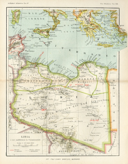
Mussolini inaugurated the arch on 15 March 1937, arriving by convoy as Libyan troops lined the road. The ceremony took place at dusk, the arch surrounded by flaming tripods and lit by spotlights while aircraft flew overhead. At the seven-course banquet that followed -- described by an attending journalist as "like finding a bunch of roses at the North Pole" -- guests marveled at fresh raw vegetables grown by Italian settlers in the desert. The entire spectacle was designed to evoke the wealth of Roman Libya and to project the Fascist mission of transforming the colony. During the same trip, Mussolini received the so-called Sword of Islam, a gesture meant to signal fraternity with the Arab world and to reassure the great powers that Italy's ambitions were peaceful, just months after the brutal invasion of Ethiopia. The arch was located near Ras Lanuf on the Gulf of Sidra, about 30 kilometers west of the purported site of the ancient Carthaginian altars. Though it became one of colonial Libya's most prominent tourist attractions, appearing on postcards and in guidebooks, few visitors actually made the journey to see it.
The Marble Arch at War
During World War II, the Litoranea became the main artery for moving troops and equipment through Libya, and the arch sat squarely on it. The British Long Range Desert Group found a route through the Great Sand Sea -- thought by the Axis to be impassable -- and established an observation post 8 kilometers east of the arch, from which they watched and reported on Axis traffic from March until July 1942. British soldiers nicknamed the monument the "Marble Arch," a wry nod to London's own landmark. The post was briefly reactivated during the Axis retreat following the Second Battle of El Alamein in late 1942. On 17 December of that year, the 2nd New Zealand Division captured the arch and its adjacent airfield as the Allies pushed westward through Libya.
Demolition and the Debris of Ideology
After Libyan independence in 1951, the arch's Latin inscriptions were replaced with Arabic verse written by the poet Ahmed Rafiq al-Mahdawi. But the structure itself remained standing, its Fascist bas-reliefs and bronze statues intact. That changed when Muammar Gaddafi, who seized power in 1969 and viewed the arch as an unwelcome relic of Italian colonialism, ordered its demolition in the early 1970s. By 2009, almost nothing visible remained of its foundations. The bronze sculptures and carved panels had been removed before destruction and transported to a museum at Madina Sultan near Sirte, where they remain in poor condition. The site on the Gulf of Sidra, once a carefully stage-managed symbol of empire, reverted to empty desert -- a stretch of coastal highway where the only trace of the Philaeni brothers is the name on older maps.
From the Air
The former site of the arch is located at approximately 30.33N, 18.78E, on the Libyan coast near Ras Lanuf along the Gulf of Sidra. The area is flat coastal desert with the highway visible from altitude. Nearest airports include Ras Lanuf Airport and Benina International Airport (HLLB) near Benghazi, roughly 400 km to the east. From the air, the Gulf of Sidra's deep southward curve is the primary landmark; the arch site sits near the gulf's westernmost extent.