Arctic Ocean Highway
Finland once touched the Arctic Ocean. It sounds improbable now, but until 1944 a slender corridor of Finnish territory reached north through Lapland to the ice-free port of Liinakhamari on Pechenga Bay, an inlet of the Barents Sea. And connecting that port to the rest of the country was a single road: the Arctic Ocean Highway, 531 kilometers of gravel and ambition running from Rovaniemi through the wilderness to the edge of the world. Opened in 1931, it was the first highway on Earth to reach the Arctic Ocean. Within a decade, it would become one of the most strategically vital roads in Europe. Within two decades, the country it served would no longer own the stretch of coastline it was built to reach.
Built on Ancient Tracks
The highway followed a route that was already old when Finland was young. Its path traced the Finnmark Path, a 16th-century trail connecting Finnish Lapland to the Finnmark region of Norway. In the early 1900s, Finland's northernmost road ended at the village of Tankavaara, 225 kilometers north of Rovaniemi. The road to Ivalo was completed in 1913, and in 1916, Tsar Nicholas II ordered the construction of a new road to Petsamo, the Finnish name for the territory that included the Arctic coastline. Finland's independence in 1917 transferred the project from imperial to national hands. Workers widened the old narrow tracks to five meters and pushed the road north through bog and birch forest. In 1931, the completed highway was renamed the Arctic Ocean Highway, and Finland had its corridor to the sea.
Nickel, Ice, and Ambition
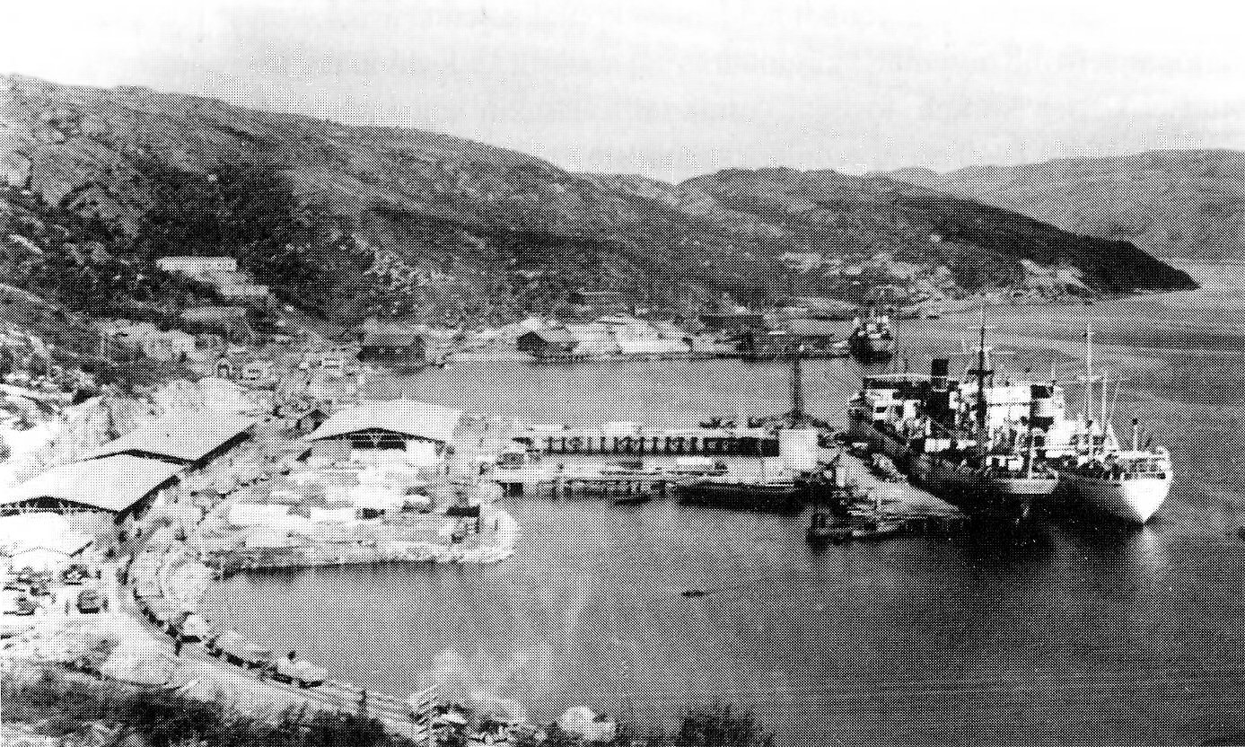
During the 1930s, the highway transformed from a symbolic achievement into an economic artery. The Petsamo nickel mines opened, and Liinakhamari grew into one of Finland's major ports -- notably, its only year-round ice-free harbor. While the Baltic ports froze solid in winter, Liinakhamari stayed open, kept navigable by the warm currents of the North Atlantic Drift that reach even these latitudes. A 1939 Chicago Tribune article described it as Finland's "vital harbor," and the highway that served it as "unique" -- a road that started in the Arctic Circle's capital and ended where the land ran out. The traffic grew rapidly as nickel exports boomed and the strategic value of an ice-free Arctic port became impossible to ignore.
The Lifeline That Changed Hands
When World War II engulfed northern Europe, the Arctic Ocean Highway became a lifeline of a different kind. In 1940 and 1941, it served as the only export route for Finland and Sweden that was not controlled by either Nazi Germany or the Soviet Union -- a narrow corridor of neutrality in a world of belligerents. That neutrality was fragile. In early June 1941, German forces began moving troops into Finland in preparation for Operation Barbarossa. On 14 June, the British Navy blockaded Liinakhamari, but the Germans used the highway to transport 40,000 soldiers into Lapland by road. During the autumn of 1944, as Finland switched sides and the Germans retreated, those same troops used the highway heading south, burning everything in their path in the scorched-earth withdrawal that devastated Finnmark and northern Finland.
The Road to Nowhere
After the war, Finland ceded the Petsamo area to the Soviet Union under the terms of the 1947 Paris Peace Treaty. The country's access to the Arctic Ocean vanished overnight. Liinakhamari became a Soviet naval base. The Arctic Ocean Highway, stripped of its destination, was rerouted. Instead of heading north to Petsamo and the sea, it turned northwest toward Utsjoki and the Norwegian border, following the western shore of Lake Inari. It became part of Finnish national road 4, a prosaic designation for a road with an extraordinary history. Today the highway is part of the E75 European route, carrying tourists to Saariselka and Ivalo and onward to Norway. The Arctic Ocean still exists at the end of a Finnish road -- but it is Norway's coastline now, not Finland's.
A Country's Lost Coastline
Maps of Finland before 1944 show the peculiar finger of territory reaching north to Pechenga Bay -- a geographic curiosity that shaped a nation's sense of possibility. Having an Arctic port meant Finland was not merely a Baltic country but a northern one, with direct access to the oceanic trade routes of the Atlantic. Losing it meant accepting a diminished geography. The highway remains, repurposed and renumbered, carrying travelers who may not realize they are driving on a road that was once the world's first connection between civilization and the Arctic Ocean. Near Tankavaara, a gold-panning village that has become a modest tourist attraction, the old route passes through the kind of landscape that explains why it took so long to build: endless birch and pine, open bog, and a silence that seems to thicken the farther north you drive.
From the Air
Coordinates: 69.02°N, 29.08°E (approximate midpoint of the original route in the former Petsamo corridor). The highway's route from Rovaniemi northward through Sodankyla, Tankavaara, Ivalo, and onward is visible from altitude as the E75/national road 4 corridor threading through the forested Lapland interior. Nearest airports: Ivalo Airport (EFIV), Rovaniemi Airport (EFRO). The original Arctic terminus at Liinakhamari (now in Russia's Murmansk Oblast) lies on Pechenga Bay, visible as a small inlet on the Barents Sea coast. Lake Inari, one of Finland's largest lakes, is a prominent landmark along the rerouted highway.