Tsiigehtchic: Where Rivers Meet at the Arctic Circle
At the confluence of the Arctic Red and Mackenzie Rivers, where the Dempster Highway crosses into the Northwest Territories, sits Tsiigehtchic - a Gwich'in village of about 200 people living where their ancestors have fished and hunted for centuries. The name means 'mouth of the iron river' in Gwich'in, referring to the rust-colored Arctic Red. Getting here requires crossing the Mackenzie by ferry in summer or ice bridge in winter; during freeze-up and break-up, you can't get there at all. The village exists at the mercy of rivers and seasons, exactly as it has for millennia, now with a highway passing through when the rivers allow.
The Rivers
The Mackenzie River drains 1.8 million square kilometers - the largest river system in Canada, second in North America only to the Mississippi. The Arctic Red River joins it from the east at Tsiigehtchic, adding its iron-stained waters to the Mackenzie's gray flow. The confluence has been a gathering place for Indigenous peoples for thousands of years: the rivers provided fish, the surrounding land provided caribou, and the junction itself provided a natural meeting point. The Gwich'in made this their home; the landscape made this inevitable.
The People
The Gwich'in are the northernmost Indigenous peoples in North America, living across the border region of Yukon, Northwest Territories, and Alaska. Tsiigehtchic (formerly Arctic Red River) is one of their traditional communities, its population sustained by subsistence hunting, fishing, and trapping alongside wage employment. The community maintains Gwich'in language and culture while adapting to modern realities - snowmobiles supplement dog teams; power comes from diesel generators; satellite dishes bring the internet. The balance between tradition and modernity is negotiated constantly.
The Crossing
The Dempster Highway reaches Tsiigehtchic from the south, but the Mackenzie River bars the way. From June to October, the MV Louis Cardinal ferries vehicles across (free, operated by GNWT). From December to April, an ice bridge freezes solid enough for trucks. During freeze-up (late October to December) and break-up (May to June), the river is impassable - ice is too weak for driving, too thick for ferries. Travelers wait on either shore until conditions change. The highway doesn't control the schedule; the river does.
The Visitor
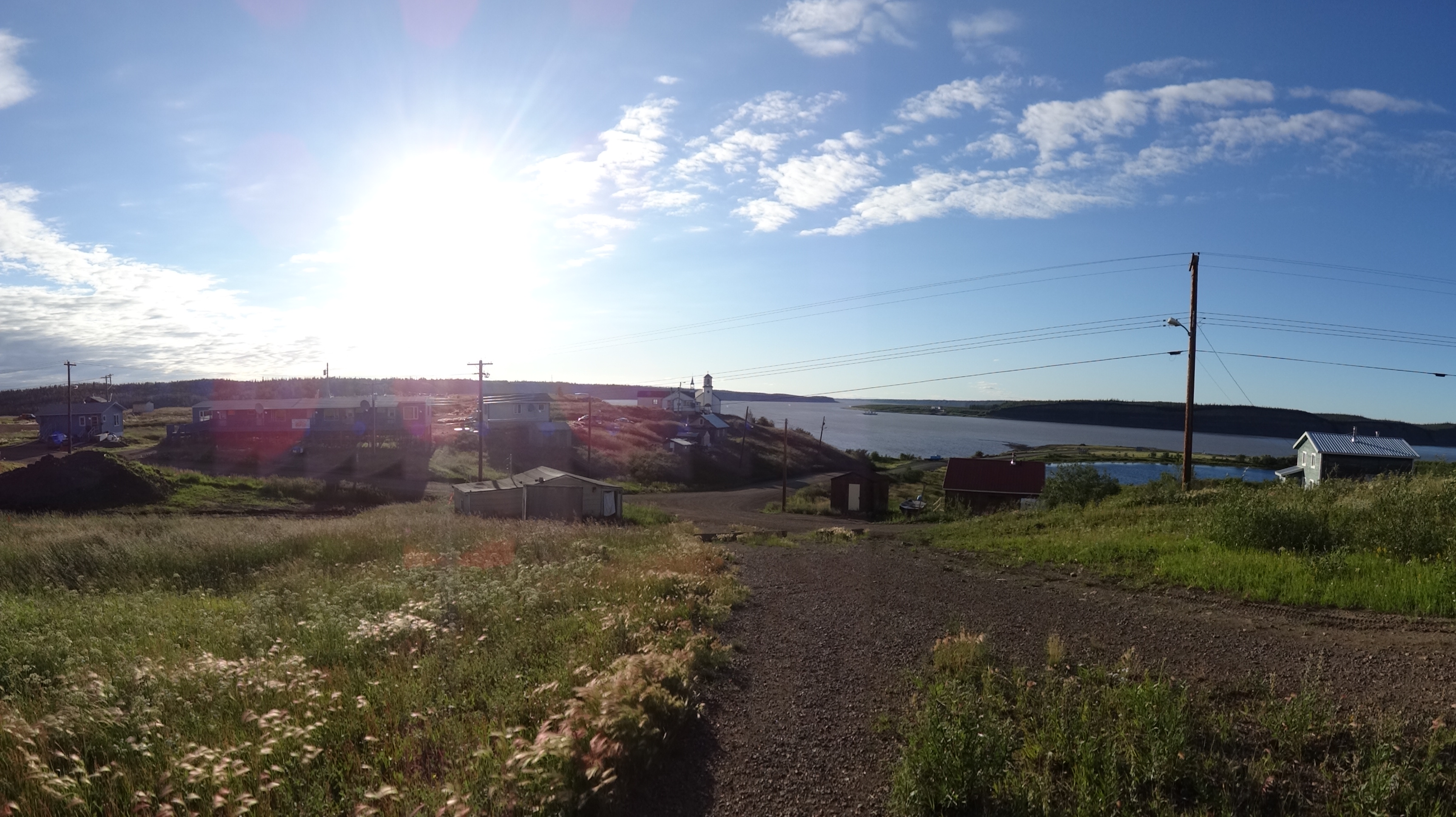
Most Dempster Highway travelers pass through Tsiigehtchic on their way to Inuvik and Tuktoyaktuk, stopping only for the ferry crossing. Those who pause find a small community with basic services: a store, a motel, fuel. The church on the hill dates from 1931. The confluence viewpoint shows where two great rivers merge. The village isn't a tourist destination - it's a community that happens to sit where travelers must cross. The experience is authentic rather than curated: this is how people live when the nearest city is 500 kilometers away.
Visiting Tsiigehtchic
Tsiigehtchic is located on the Dempster Highway at the Mackenzie River crossing, 300 km north of Dawson City and 200 km south of Inuvik. The ferry operates 24 hours during open water season; wait times vary with demand. The ice bridge operates when river ice is sufficiently thick; check GNWT road conditions. During shoulder seasons (freeze-up and break-up), the crossing is impossible - plan accordingly. The village has a small motel, convenience store, and fuel. Food options are very limited. Respect for community members and property is expected. The Arctic Circle lies about 40 km south; a sign marks the crossing. Continue north for Inuvik and the Arctic Ocean at Tuktoyaktuk.
From the Air
Located at 67.44°N, 133.75°W at the confluence of the Arctic Red and Mackenzie Rivers, Northwest Territories. From altitude, Tsiigehtchic appears as a small cluster of buildings on the point where two major rivers meet. The Arctic Red enters from the east, visibly different in color from the Mackenzie. The ferry route (or ice bridge location) crosses the Mackenzie just south of the confluence. The Dempster Highway is visible approaching from the south and continuing north toward Inuvik. The landscape is boreal forest giving way to tundra - the Arctic Circle passes nearby. This is one of the most isolated communities accessible by road in North America.