Arenal Volcano National Park
For centuries, the people living near the cone-shaped mountain in north-central Costa Rica considered it dormant -- just another forested peak in the Cordillera de Tilaran. They were wrong. On July 29, 1968, Arenal Volcano erupted without warning, destroying the villages of Tabacon, Pueblo Nuevo, and San Luis and killing at least 87 people. The eruption transformed scientific understanding of the mountain and, eventually, transformed the region around it. What was once quiet farmland became one of Costa Rica's most visited national parks.
Two Volcanoes, One Park
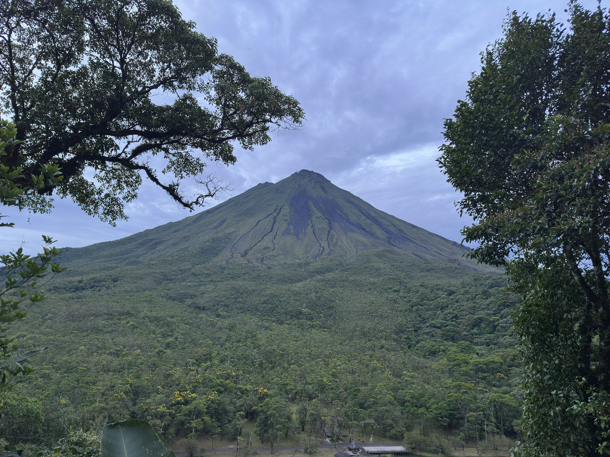
Arenal Volcano National Park encompasses not one but two volcanoes. Arenal itself -- the country's most active -- dominates the landscape with its near-perfect conical form. Beside it sits Cerro Chato, whose crater holds a jade-colored lagoon. Chato has been inactive for approximately 3,500 years, and geologists believe its dormancy coincides with the creation and growth of Arenal itself, as if one volcano traded its fire for the other. Within the park boundaries, the Museum of Volcanicity and a ranger station provide context for visitors. In and around the park, lodges and hotels have sprung up -- some featuring their own hot springs fed by the volcanic geology, others focused on the extraordinary wildlife of the surrounding forests.
Eight Life Zones
The park lies within the Arenal Huetar Norte Conservation Area, which protects eight of Costa Rica's twelve recognized life zones and encompasses sixteen protected reserves in the region between the Guanacaste and Tilaran mountain ranges. This biological richness is staggering. Most of the 850 bird species identified across all of Costa Rica can be found within the park's borders, including the endangered resplendent quetzal -- one of the most beautiful and elusive birds in the Americas, with its iridescent green plumage and long tail feathers. White-faced capuchin monkeys swing through the canopy. Jaguars, deer, and coati move through the understory. Fer-de-lance vipers and parrot snakes inhabit the forest floor. The plant life is equally dense: orchids, heliconias, ferns, bromeliads, palms, and strangler figs compete for light in the layered canopy.
The Lake Below
Lake Arenal stretches along the park's northern boundary, the largest lake in Costa Rica and the site of the country's biggest hydroelectric project, the Lake Arenal Dam. The lake creates a visual counterpoint to the volcano -- still water against the steep, forested slopes of the cone. The park is most directly accessed from the town of La Fortuna, which has grown from a small agricultural village into a full-service tourism hub. It can also be reached from Tilaran and the north shore of Lake Arenal, routes that offer dramatically different approaches: from La Fortuna, the volcano looms directly ahead; from Tilaran, it appears gradually across the lake's expanse, its shape reflected in the water on calm mornings.
Living with Fire
Arenal's 1968 eruption was a reminder that volcanoes operate on timescales that make human memory unreliable. The mountain had been quiet long enough for settlements to grow at its base, for farmers to clear fields on its lower slopes. The eruption changed everything about how Costa Rica related to this landscape -- what had been agricultural land became a conservation priority, and the volcano's ongoing activity became the park's central attraction. Though Arenal's volcanic activity has diminished significantly since 2010, the park's hot springs, fumaroles, and young lava fields remain as evidence of what lies beneath. The park was formally established in 1991, twenty-three years after the eruption that proved dormancy is not permanence.
From the Air
Located at 10.46N, 84.70W in north-central Costa Rica. Arenal Volcano's near-perfect conical shape is a dramatic visual landmark, rising prominently above the surrounding terrain. Lake Arenal, the country's largest lake, stretches to the northwest and is clearly visible from altitude. The town of La Fortuna sits at the volcano's eastern base. Nearest airports include Juan Santamaria International (MROC) in San Jose, approximately 130 km to the southeast, and the La Fortuna airstrip (MRLF). Expect variable cloud cover around the volcano's summit. Best viewed at 8,000-12,000 feet for the full volcano-and-lake panorama.