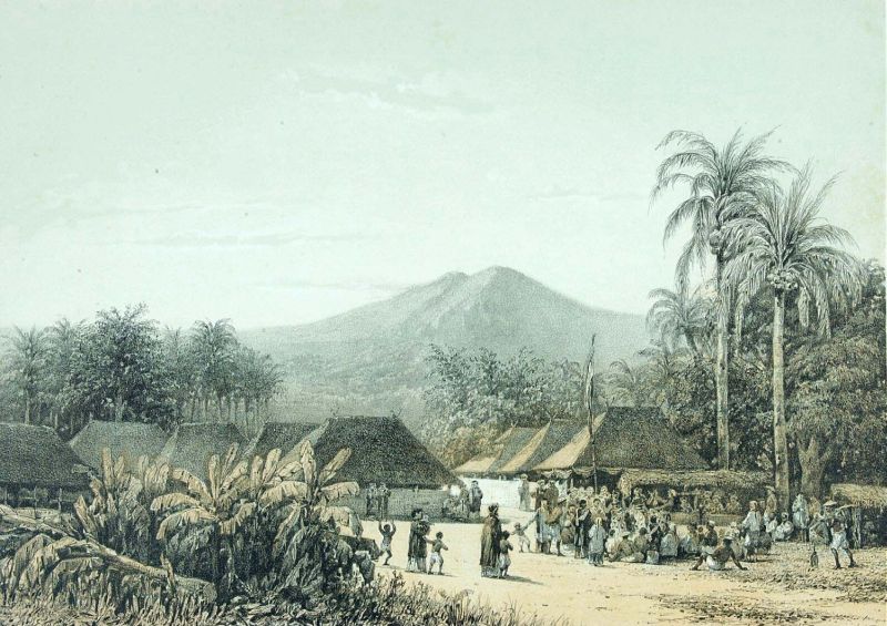
Arjuno-Welirang: The Hero and the Sulfur
The Javanese named their mountains with precision. The taller peak, rising to 3,339 meters as East Java's second-highest point, they called Arjuno -- after the warrior prince of the Mahabharata whose virtue was so complete that even the gods tested it. The shorter twin, reaching 3,156 meters, they called Welirang: sulfur. One name invokes legend. The other states a chemical fact. Together, the Arjuno-Welirang volcanic complex dominates the skyline between Surabaya and Malang, a twin massif straddling the boundary between myth and the sharp yellow reality of an active fumarole field where men still mine brimstone by hand.
Two Peaks, Two Temperaments
Arjuno is dormant and forested. Its slopes carry montane rainforest up to the treeline, where gnarled vegetation gives way to rocky alpine terrain. The summit offers clear-day views across the Java Sea to Madura and south toward Semeru, Java's highest peak. Welirang is another proposition entirely. Its crater vents sulfurous gas in plumes visible from kilometers away, and the ground near the fumaroles is stained yellow-white with crystallized deposits. The barren summit zone smells of rotten eggs and feels like a different planet from the lush forest just a few hundred meters downslope. Between the two peaks, roughly ten pyroclastic cones form a six-kilometer line, evidence of the volcanic system's restless plumbing. The entire complex sits within two older, eroded volcanoes -- Mount Ringgit to the east and Mount Linting to the south -- whose remnant shapes are visible only to geologists reading the landscape.
The Sulfur Carriers
At Welirang's crater, the sulfur deposits are not geological curiosities. They are someone's livelihood. Local miners climb from the village of Tretes -- starting at 760 meters elevation -- up through cloud forest and past a cluster of wooden shelters at 2,450 meters where they sleep before the final push to the crater. There, in air thick with hydrogen sulfide, they break chunks of crystallized sulfur from the fumarole vents, load them into baskets or onto pushcarts, and haul 30 to 40 kilograms back down the mountain. The round trip can take two days. The sulfur is sold for industrial use -- bleaching sugar, vulcanizing rubber, manufacturing matches. It is grueling, poorly paid work performed in conditions that damage lungs and corrode skin, and it has been going on for generations. The miners are a familiar sight on the trail, leaning into their loads on the steep descents, their presence a reminder that volcanoes in Java are not just scenery.
Eruptions and the Quiet Between
Arjuno-Welirang is classified as an active volcano, though its eruption history is modest. A VEI-2 explosive eruption in 1950 sent ash into the air above Welirang. Two years later, in 1952, a smaller event registered VEI-0 -- essentially a strong venting rather than an explosion. Since then, the complex has expressed itself through fumarolic activity rather than eruptions: persistent gas emissions, sulfur deposition, and the occasional increase in seismic tremor that puts local authorities on alert. The quiet does not mean safety. The fumarole field at Welirang is genuinely hazardous -- gas concentrations can spike without warning, and the ground near active vents is unstable. Indonesian volcanological authorities monitor the complex as part of a network that tracks more than 120 active volcanoes across the archipelago, a density that makes Indonesia the most volcanically active nation on Earth.
The Forest and the Safari
Below the barren crater zone, the Arjuno-Welirang complex supports one of East Java's most important forest reserves. The Arjuno Lalijiwo Reserve covers roughly 5,000 hectares of montane habitat, from dense tropical forest at lower elevations to moss-draped cloud forest higher up. On a 300-hectare slope near the Surabaya-Malang road, Taman Safari Indonesia II operates an open-range wildlife park where visitors drive through enclosures housing animals from across Asia and Africa. The juxtaposition is characteristically Javanese: an active volcano, a sacred forest, and a safari park sharing the same mountain. Hikers who start from Tretes pass through the resort town's hotels and guesthouses before entering forest trails. At Cangar, natural hot springs heated by the volcanic system's residual warmth offer bathing pools at 1,628 meters elevation -- a reminder that the mountain's internal heat serves comfort as well as industry.
From the Air
Arjuno-Welirang (7.77S, 112.59E) rises prominently between Surabaya (50 km north) and Malang (20 km south). The twin summits reach 3,339m (Arjuno) and 3,156m (Welirang) -- maintain safe altitude well above these peaks and be alert to mountain weather and turbulence. Sulfur plumes from Welirang's fumaroles may be visible from cruising altitude in clear conditions. Abdul Rachman Saleh Airport (WARA/MLG) lies approximately 25 km to the southeast, and Juanda International Airport (WARR/SUB) is roughly 55 km to the north. The Surabaya-Malang corridor passes along the eastern flank of the complex.