Arroyo Seco Parkway
Before freeways were designed to move traffic, they were designed to move people through landscapes. The Arroyo Seco Parkway, which opened mostly in 1940, was built on the cusp between those two philosophies. It follows the dry Arroyo Seco riverbed north from downtown Los Angeles to Pasadena, curving through oak-shaded ravines and past Depression-era stone bridges—a road that still feels, despite everything the decades have added, like it was built for a different relationship between a driver and the land.
A Different Kind of Road
The Arroyo Seco Parkway is one of the oldest freeways in the United States, representing what planners called the transitional phase between the parkways of the East—scenic roads through preserved landscapes, typically closed to trucks—and the high-speed, high-capacity freeways that came to define postwar California. It conformed to modern standards when it was built, but those standards have since shifted dramatically. The lanes are narrow by contemporary freeway standards. The on-ramps are short. The curves were designed for lower speeds. A 1953 extension brought the southern terminus to the Four Level Interchange in downtown Los Angeles. The road now carries the designation State Route 110, having shed its earlier designation as part of historic U.S. Route 66.
The River It Follows
The Arroyo Seco—"dry stream" in Spanish—is a seasonal watershed that drains the San Gabriel Mountains and empties into the Los Angeles River. For most of the year it carries little water; in heavy rain years it can flood. The decision to route a parkway along its course reflected an earlier California tradition: the Arroyo Seco had already been the subject of park planning, nature preservation efforts, and debates about how to balance development with the relatively wild canyon terrain north of Los Angeles. The Automobile Club of Southern California was among the advocates for a road; naturalists and park advocates wanted the streambed left as open space. The parkway, mediating between those visions, satisfied neither camp entirely.
Monuments Along the Way
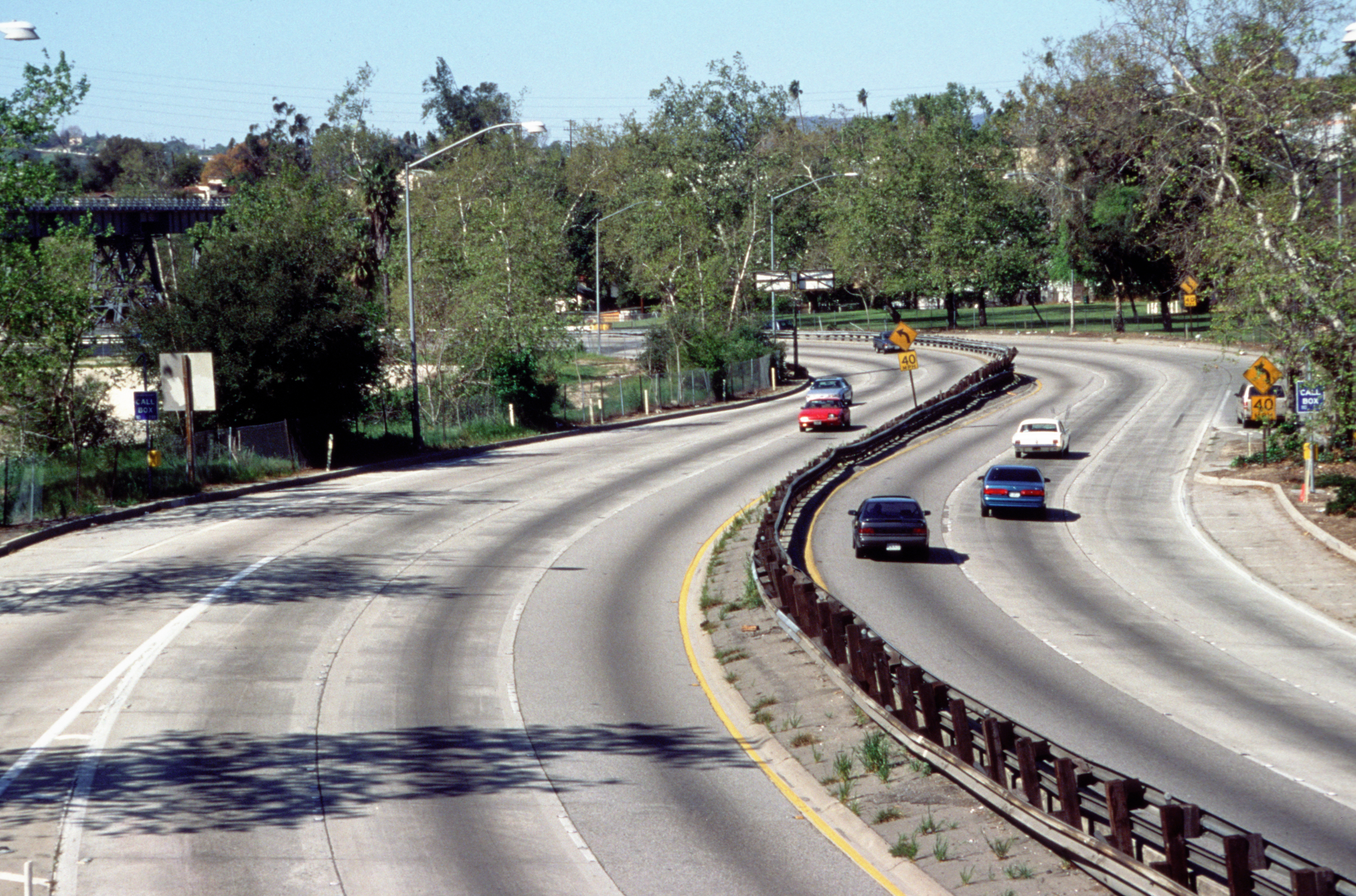
The physical fabric of the Arroyo Seco Parkway is largely unchanged from its opening. The stone retaining walls and bridges are Depression-era work, built by crews whose labor was part of the New Deal public works programs. The landscaping—though the median's original plants have long been replaced by guardrails and then concrete barriers—was originally designed to make the drive feel like passage through a curated natural environment. It is, by any measure, a narrow road. Modern SUVs and pickup trucks barely fit in the lanes that were sized for automobiles of the late 1930s. Driving it today requires a degree of attention and care that modern freeways rarely demand.
A National Landmark
The Arroyo Seco Parkway was designated a National Scenic Byway and a National Historic Civil Engineering Landmark by the American Society of Civil Engineers, and was added to the National Register of Historic Places in 2011 — one of the few operating freeways to receive such recognition. The recognition reflects what the road represents: a moment in the American relationship with the automobile and the landscape, before the freeway became purely a mechanism for moving vehicles at maximum speed. The road remains, in its narrow, curving way, a genuine pleasure to drive—if you are not in a hurry, if you take the curves at the speed they were designed for, and if you can resist the impulse to check your phone while the oak trees go by.
From the Air
The Arroyo Seco Parkway runs from downtown Los Angeles (34.05°N, 118.24°W) north to Pasadena (34.15°N, 118.17°W), following the Arroyo Seco canyon for approximately 8 miles. The parkway is visible from the air at 2,000–3,000 feet MSL as a curving ribbon through the canyon terrain between the urbanized Eastside of Los Angeles and Pasadena. Nearest airports: KBUR (Burbank, ~6 miles north), KPOC (Brackett Field Pomona, ~20 miles east). The Four Level Interchange at the south end is one of the most recognizable freeway structures in LA when viewed from altitude.