Arthur Ravenel Jr. Bridge
Engineers once called the original Cooper River crossing "the first roller-coaster bridge." Its steep grades, narrow lanes built for Ford Model As, and a sharp curve at the dip conspired to terrify every motorist who crossed it. By the 1990s, the 1929 Grace Memorial Bridge scored a 4 out of 100 for structural safety, and its parallel companion, the Pearman Bridge, had neither emergency lanes nor a median between opposing traffic. Charleston needed a new bridge. What it got, after two decades of political wrangling and a $700 million price tag, was one of the most recognizable landmarks in the American South.
The Roller-Coaster Bridges
The first bridge across the lower Cooper River opened in 1929, a double cantilever truss whose main span ranked fifth-longest in the world. Privately owned, it charged a dollar per crossing. The state of South Carolina purchased it in 1943 and dropped the tolls in 1946, but deferred maintenance followed almost immediately. By the 1960s, the Grace Memorial Bridge was functionally obsolete, its two lanes too narrow for modern vehicles and its six-percent grades punishing for trucks. A parallel span, the Silas N. Pearman Bridge, opened alongside it in 1966, adding three lanes at a cost of $15 million. But the Pearman brought its own hazards: a reversible center lane that required drivers to watch for green arrows and red X warnings, and no separation between northbound and southbound traffic. Both bridges lacked emergency shoulders. Worse, their vertical clearance could no longer accommodate the growing container ships bound for Charleston's shipping terminals up the Cooper and Wando rivers.
A Congressman's Crusade
Funding a replacement was a twenty-year ordeal. The state insisted it could not afford the project. Charleston refused to contribute. Proposals for a toll bridge met resistance from mayors on both sides of the river. The breakthrough came when retired U.S. Congressman Arthur Ravenel Jr. ran for the South Carolina Senate in 1995 with a single mission: solve the bridge funding problem. Ravenel helped establish the state's Infrastructure Bank and brokered a complex deal involving $325 million from the state, $96.6 million in federal highway funds, and a $215 million federal loan backstopped by Charleston County's agreement to pay $3 million annually for twenty-five years through a sales tax increase. The total cost reached approximately $700 million. Fellow lawmakers voted to name the bridge after Ravenel, though not without dissent. The head of the state infrastructure bank argued in 1999 that the bridge was "bigger than any one individual."
Diamonds Over the Cooper
The Ravenel Bridge is a cable-stayed design with two diamond-shaped towers rising 575 feet above the river. Its main span stretches 1,546 feet between the towers, the third longest among cable-stayed bridges in the Western Hemisphere. The total structure runs 13,200 feet, with 128 individual cables anchoring the deck 186 feet above the water. Eight lanes carry traffic in both directions, and a dedicated bicycle and pedestrian path runs along the south edge, overlooking Charleston Harbor and the Atlantic. Engineers designed the span to endure wind gusts exceeding those of Hurricane Hugo in 1989 and to survive an earthquake of approximately 7.4 on the Richter scale without total failure -- a nod to the devastating 1886 Charleston earthquake. Rock islands flank each tower to ground errant ships before they can strike the bridge piers.
Built in Five Pieces
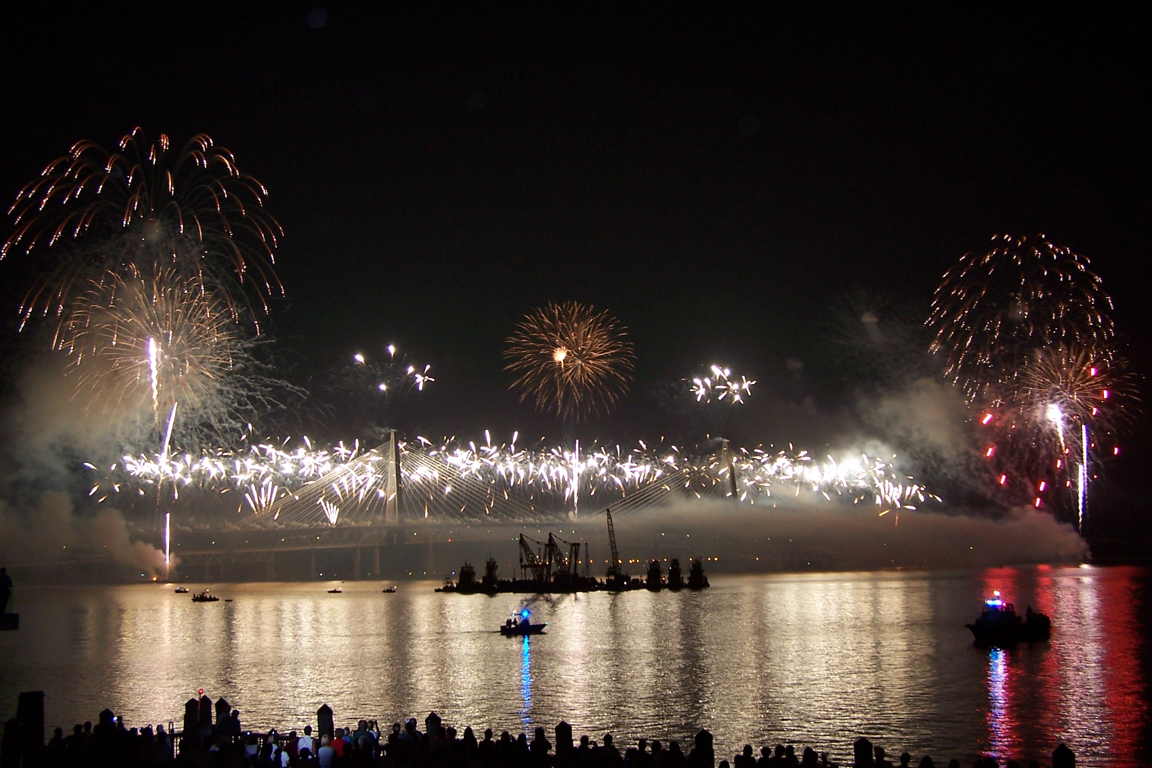
Groundbreaking came in 2001, with Palmetto Bridge Constructors managing the project as five simultaneous sub-projects: two highway interchanges, two approach spans, and the cable-stayed main span. Self-climbing formwork allowed the towers to rise without waiting for tower cranes to reposition after each concrete pour. Cables were hung from the towers in 2004 before the towers were fully complete, a time-saving measure that let deck sections extend outward from each tower in tandem. Parts of the approach roadway were built directly over the old cantilever bridges, which remained open to traffic throughout construction. The bridge opened on July 16, 2005, one year ahead of schedule and under budget, following a week-long celebration of public walks, concerts, and fireworks. Each April, up to 50,000 runners cross the span during the Cooper River Bridge Run, the bridge's most visible annual event.
From the Air
The Arthur Ravenel Jr. Bridge is unmistakable from the air: two diamond-shaped towers with cable fans spanning the Cooper River between the Charleston peninsula and Mount Pleasant. At 32.803N, 79.915W, the bridge is oriented roughly east-west. The 575-foot towers are the tallest structures in the Charleston area. Charleston Executive Airport (KJZI) is 8nm northwest, Charleston AFB/International (KCHS) is 8nm north-northwest. Patriots Point and the USS Yorktown museum ship are visible at the bridge's eastern approach. Best viewed from 1,500-3,000 feet AGL on approach from the south, with Charleston Harbor and Fort Sumter in the background.