Arthur's Pass National Park
The post office opens at ten and closes at ten-thirty. That half-hour window says everything about Arthur's Pass village - a handful of buildings strung along State Highway 73, wedged into a valley of the Southern Alps at an elevation where the weather changes its mind every hour. The village exists because of a road built in desperate haste during the 1860s gold rush, and it endures because the mountains around it are too spectacular to leave unvisited. Arthur's Pass National Park, established in 1929 as New Zealand's third national park and the first in the South Island, covers a landscape split down the middle by the main divide. Beech forest cloaks the eastern slopes, podocarp rainforest drips on the western side, and above them both, graywacke peaks rise to 2,400 meters where kea wait on the summits to steal your lunch.
Dobson's Road to Gold
In 1864, surveyor Arthur Dudley Dobson was tasked with finding the most practical route through the Southern Alps to reach the gold fields of 'West Canterbury' around Hokitika. The pass he surveyed sits at 920 meters - not the lowest crossing of the Alps, but the most direct route from Christchurch. A road was built and opened in 1865, with stagecoaches rattling over it for the next six decades. The route's real transformation came in 1923 with the opening of the Otira Rail Tunnel, which bored 8.5 kilometers through the mountains and held the distinction of being the longest tunnel in the British Empire at the time. The rail line and the road together broke the South Island's geographical isolation, connecting the Canterbury Plains to the West Coast and opening it to settlement, trade, and tourism. Today, State Highway 73 still threads through the pass, majestic but nerve-testing - particularly in winter, when ice glazes the curves and snow chains become mandatory.
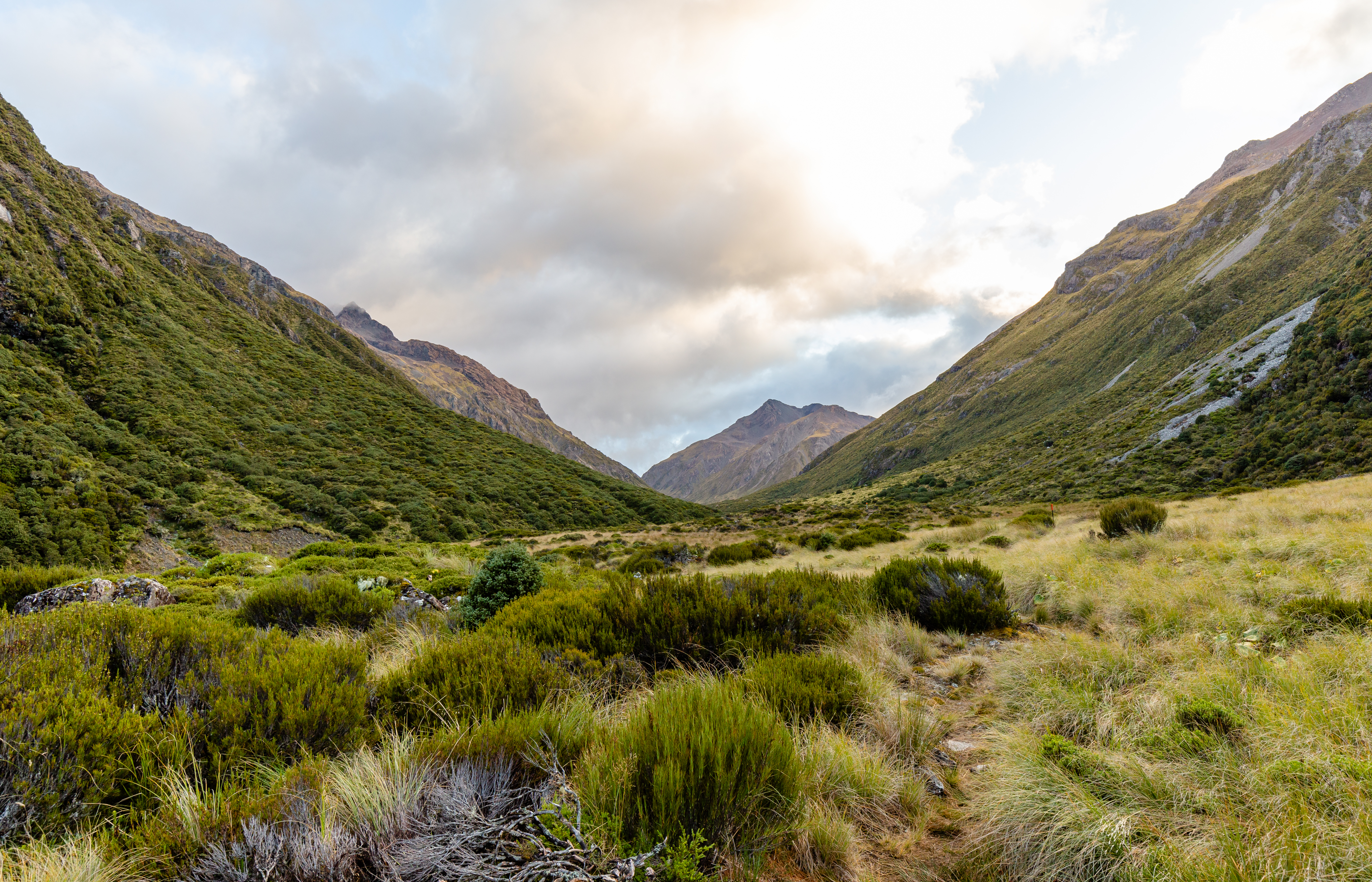
Two Forests, One Divide
The main divide does more than separate river systems flowing to the Tasman Sea from those draining into the Pacific. It creates two entirely different worlds of vegetation, visible even from a car window. On the drier eastern side, mountain beech dominates - silver, red, and black beech filling the valleys in dense stands whose canopy turns golden in autumn. Cross to the western slopes, where annual rainfall can exceed six meters, and the forest shifts to podocarp - a primeval-looking tangle of rimu, kahikatea, and rata draped in mosses and ferns. The rivers differ too. Eastern waterways like the Waimakariri spread into broad, braided channels across alluvial plains. Western rivers carve narrow gorges through the rock, their courses so rugged that travel through them on foot becomes an expedition in itself. The mountains that generate this divide are composed primarily of graywacke, rising between 1,600 and 2,000 meters, with the highest peak - Mount Murchison - topping out at 2,400 meters.
The Avalanche Peak Test
Arthur's Pass earns a grim distinction: a high rate of death and injury among hikers, driven by the collision of genuine alpine danger with easy accessibility. The village sits just a few hours' drive from Christchurch, and the trailheads start right from the car parks - no multi-day approach march required. This convenience lures people unprepared for what waits above the tree line. Day walks involve vertical ascents of a thousand meters on tracks steep enough to demand hand-over-hand scrambling, marked only by poles across rocky terrain. Weather turns without warning. Hypothermia, falls from bluffs, and disorientation in sudden cloud are the recurring scenarios. For experienced hikers, though, the rewards justify the risks. Avalanche Peak's loop track climbs 1,100 meters over six to eight hours, offering summit views across the full sweep of the Southern Alps. The kea - New Zealand's alpine parrot, intelligent and incorrigibly curious - patrol the ridgelines like customs agents, inspecting packs and pocketing anything shiny.
The TranzAlpine Window
Most visitors to Arthur's Pass arrive not by car but by train. The TranzAlpine, regularly ranked among the world's most scenic rail journeys, departs Christchurch each morning and reaches Arthur's Pass by mid-morning, rolling through the Canterbury Plains, then climbing through the Waimakariri River's gorges into alpine country. The train continues to Greymouth on the West Coast before doubling back in the afternoon, making it possible to visit Arthur's Pass as a day trip - the train drops you off around 10:15 and collects you around 4:15, giving five hours to walk to Devil's Punchbowl Falls, explore the visitor center's museum-quality displays about the region's pioneers, or simply sit and watch the cloud shadows move across the mountains. An overnight stay is better, though the village's limited accommodation means booking ahead is essential. There are three places to eat, one small general store charging triple Christchurch prices, and a pub called the Wobbly Kea with happy hours on Tuesdays and Fridays. After that, the mountains have the floor.
From the Air
Arthur's Pass National Park is centered at approximately 42.89S, 171.72E, in the heart of the Southern Alps. The park straddles the main divide of the South Island. Arthur's Pass village sits along State Highway 73 at approximately 920 meters elevation. From the air, look for the distinctive Otira Viaduct on SH73, the braided Waimakariri River system on the eastern side, and the narrow gorges of the Otira River on the western side. Mount Murchison (2,400 m) is the highest peak. The Otira Rail Tunnel portal is visible on the western descent. Nearest airports: Christchurch (NZCH, approximately 150 km east) and Hokitika (NZHK, approximately 100 km west). Weather is highly changeable - mountain waves, turbulence, and rapid cloud buildup are common. Recommended viewing altitude: 8,000-12,000 ft to appreciate the alpine terrain and the divide between eastern and western vegetation zones.