Asirgarh Fort
Every army that marched between northern India and the Deccan had to pass through the Satpura Range, and when it did, it passed under the walls of Asirgarh. The fortress sits on a commanding hilltop 20 kilometers north of Burhanpur, guarding the pass that connects the Narmada and Tapti river valleys -- the most important route between the northern plains and the southern plateau. Whoever held Asirgarh held the key to the Deccan. For over five centuries, the Faruqi sultans, the Mughal emperors, the Marathas, and finally the British fought to possess this single piece of high ground. When the fort finally fell for the last time, on April 9, 1819, it was the last Maratha stronghold in India. Its capture ended not just a siege but an entire war.
The Key to Everything South
The fort's strategic importance was a function of pure geography. The Satpura Range runs east-west across central India, forming a natural barrier between the Indo-Gangetic plains and the Deccan Plateau. The pass at Asirgarh was one of the few practical routes through these mountains, and the fort commanded it absolutely from its hilltop position. The name itself may derive from the Hindi word ashir, meaning sun, fire, or diamond -- all suggestions of something brilliant and unyielding. The fort is traditionally attributed to the Ahir Yadava clan, who controlled the surrounding Nimar region from the 9th through 13th centuries. The historian Firishta mentions a builder named Asa Ahir, though modern scholars consider this likely apocryphal, since no inscriptions or contemporary sources corroborate the account.
Akbar's Trick
For over two centuries, the Faruqi dynasty ruled the Khandesh sultanate from Asirgarh, collecting tolls and controlling the north-south trade route. When Sultan Bahadur Shah declared independence and refused to pay homage to the Mughal emperor Akbar, the confrontation was inevitable. Akbar marched toward Burhanpur in 1599 and occupied the city with relative ease. The fort was another matter. Perched on its hilltop with strong outer walls and natural defenses, Asirgarh resisted conventional siege. So Akbar resorted to trickery, inviting Bahadur Shah to negotiations and then capturing him. The fort fell on January 17, 1601. Akbar commemorated the conquest by issuing special gold coins -- coins that archaeologists have since recovered from excavations around the Tapti River and the fort itself.
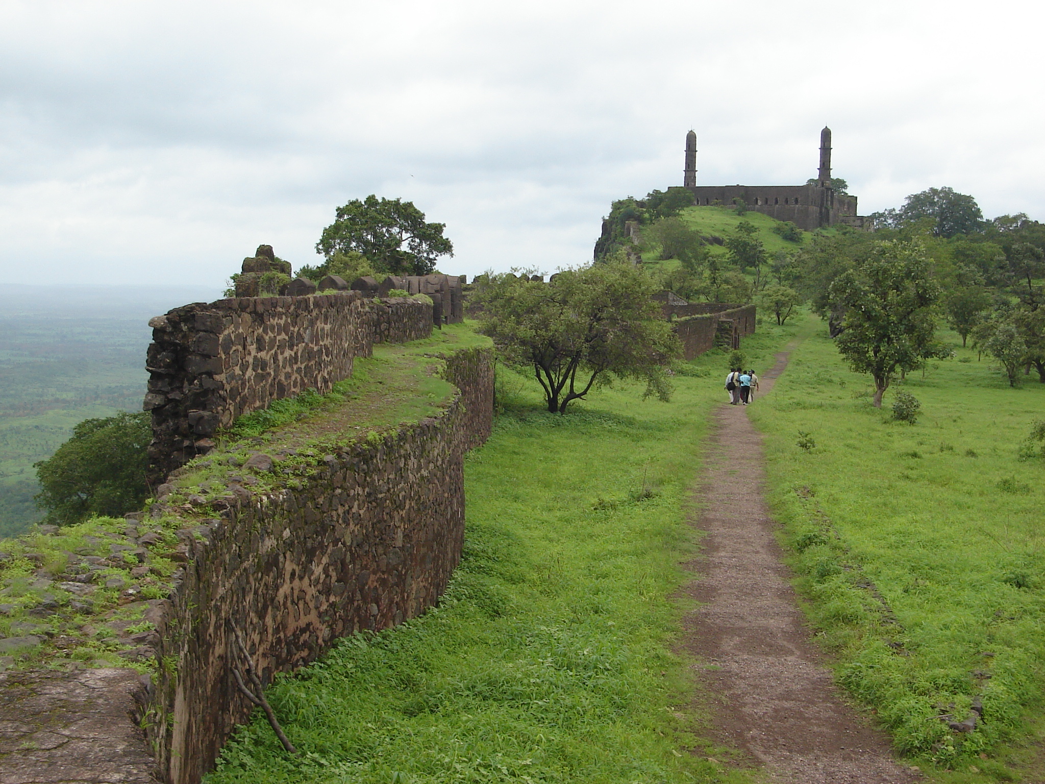
Where the Mahabharata Lingers
The fort's architecture blends Indian, Faruqi, and Mughal styles -- an amalgamation of Islamic, Persian, Turkish, and Hindu building traditions laid down in successive layers. Three man-made ponds provided water to the garrison. Inside the walls stands the Gupteshwar Mahadev Mandir, a temple dedicated to Shiva. Local legend holds that Ashwatthama, the cursed warrior from the Mahabharata who was condemned to wander the earth for eternity, comes to this temple each morning to worship and offer flowers to Lord Shiva. The ruined Asir Masjid, a Faruqi-era mosque with minarets, stands nearby. British graves from the colonial period lie among the older ruins. Hindu temple, Muslim mosque, and Christian cemetery occupy the same hilltop, an inadvertent monument to every civilization that considered this pass worth dying for.
The Last Holdout
During the Second Anglo-Maratha War in 1803, British East India Company forces took the settlement below Asirgarh with minimal casualties -- two killed and five wounded -- and the garrison surrendered after a battery was erected. But the fort's final chapter came during the Third Anglo-Maratha War. By early 1819, the British had captured every other Maratha stronghold. Asirgarh alone held out under its commander, qiladar Jeswant Rao Lar, and its 1,200-strong garrison. In March, a massive British force laid siege, occupying the adjacent town as a base. Constant artillery bombardment preceded the final assault. When the fort fell on April 9, all Maratha military operations ceased. The capture of Asirgarh marked the definitive end of Maratha resistance and the consolidation of British power across central India.
Gold Fever and Empty Ramparts
The fort has been deserted since the British departed India. Its walls still stand, its ponds still hold water in the monsoon, but the garrison quarters and administrative buildings have crumbled. In March 2025, the fort made unexpected headlines when the Bollywood film Chhaava depicted Aurangzeb's armies burying gold looted from Shambhaji's camp within Asirgarh during the Mughal-Maratha wars. The scene was fiction, but viewers took it literally. Locals descended on the fort with shovels, digging through the grounds in a mass treasure hunt. Authorities banned entry and launched an investigation to prevent further damage to the archaeological site. It was a strange echo of the fort's history -- people fighting over Asirgarh once more, this time not for control of a strategic pass but for imaginary gold conjured by a film.
From the Air
Located at 21.47°N, 76.29°E in the Satpura Range, Madhya Pradesh, India. From altitude, Asirgarh Fort is visible as a large fortification on a prominent hilltop commanding the pass between the Narmada and Tapti river valleys. The fort's strong outer walls and hilltop position are clearly identifiable against the surrounding forested Satpura terrain. Burhanpur is visible approximately 20 km to the south along the Tapti River. The Burhanpur-Khandwa Highway passes nearby. The terrain is hilly with the Satpura Range running east-west. The nearest airport is Devi Ahilya Bai Holkar Airport (VAID) at Indore, approximately 170 km northeast. Elevation and mountain weather conditions should be noted.