Assateague Island
DNA testing settled the argument, but the legend persists: somewhere in the 1500s, a Spanish galleon broke apart off the mid-Atlantic coast, and its horses swam to shore. Today their descendants still roam Assateague Island, compact and shaggy, grazing on salt marsh cordgrass and moving in loose bands through the dunes. The horses are what draw visitors to this 37-mile ribbon of sand stretched along the Delmarva Peninsula, but they are only one chapter in a story shaped by hurricanes, shifting sands, and the restless Atlantic.
Born from a Hurricane
Assateague was not always an island. Until 1933, it connected to Fenwick Island at its northern end, one continuous stretch of barrier beach. Then the Chesapeake-Potomac hurricane carved an inlet south of Ocean City, Maryland, and the Army Corps of Engineers built jetties to keep it open for navigation. Those jetties interrupted the natural littoral drift that carried sand from north to south. Starved of sediment, Assateague began migrating westward, and the gap between the two landmasses widened dramatically. The island has been drifting ever since, a textbook case of how human engineering can reshape a coastline. By the 1960s, development plans had stalled and Maryland pushed for federal protection. Congress established Assateague Island National Seashore in 1965, preserving the island before resort towers could take root.
Three Stewards, One Island
Assateague is rare in having three separate government entities managing a single strip of land. The northern two-thirds, in Maryland, falls under the National Park Service as Assateague Island National Seashore, with a smaller Assateague State Park carved out within it offering 350 campsites, the most developed area on the island. South of the Maryland-Virginia state line, the Chincoteague National Wildlife Refuge takes over, established in 1943 primarily to protect habitat for migratory snow geese. A one-mile section of Virginia beach remains under NPS management for recreation. No road connects the Maryland and Virginia ends. You can drive onto the island from either state, but never straight through. The island has no permanent residents; the last private property rights expired in 2006.
The Horses That Named a Culture
A fence at the state line divides the horses into two populations and two identities. On the Maryland side, the National Park Service calls them Assateague horses and manages their numbers through contraceptive vaccines. On the Virginia side, the Chincoteague Volunteer Fire Company owns them, and every July during Pony Penning Days, saltwater cowboys round up the herd at sunrise and swim them across the channel to Chincoteague Island for auction. The tradition has run for nearly a century and inspired Marguerite Henry's beloved 1947 novel "Misty of Chincoteague." Though commonly called wild, these animals had domesticated ancestors. DNA evidence has confirmed they include the closest living descendants of Spanish horses brought to the Americas in the early 1500s. Their small stature comes from a diet of salt marsh grasses and the harsh barrier island environment rather than genetics.
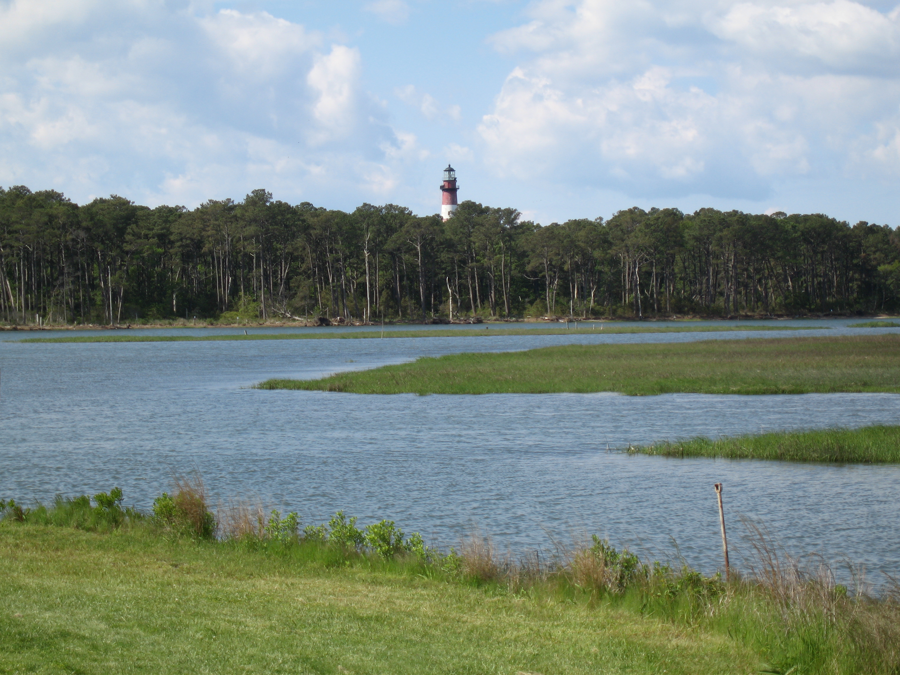
Wings Over the Marsh
More than 320 bird species use Assateague during some portion of the year, making it one of the premier birding destinations on the Atlantic Flyway. Great blue herons stand motionless in the shallows of Toms Cove. Snowy egrets pick through the marsh grass. American oystercatchers patrol the surf line with their bright orange bills. The island provides critical nesting habitat for the piping plover, a threatened shorebird that lays its camouflaged eggs directly on the sand. Kayakers on the calm bay side glide past osprey nests and rafts of waterfowl, though summer visitors quickly learn to respect the island's other famous residents: the mosquitoes and greenhead flies that swarm the marshes from June through August, fierce enough to drive even the most determined beachgoer back to camp.
Sand in Motion
Barrier islands exist in constant negotiation with the sea, and Assateague is no exception. The U.S. Geological Survey has studied how rising sea levels may reshape this island complex in coming decades. Storms regularly overwash low sections, carrying sand from the ocean side to the bay side in a process that slowly rolls the island westward. The humid subtropical climate brings nor'easters in winter that can reshape the beach overnight and warm summers that bake the dunes into a landscape that feels more remote than its proximity to Ocean City suggests. In winter, snow blankets the dunes and the horses huddle in the maritime forest, their thick coats steaming in the cold salt air. It is Assateague at its most solitary, miles of empty beach under gray Atlantic skies, a reminder that this island belongs to the wind and the water, and the horses merely borrow it.
From the Air
Assateague Island stretches along the Delmarva Peninsula at approximately 37.98N, 75.30W. From the air, the narrow barrier island is unmistakable, separated from Ocean City, Maryland by the Ocean City Inlet at its northern tip. The island runs roughly 37 miles north to south. Nearest airports include Ocean City Municipal Airport (KOXB) to the north and Salisbury-Ocean City Wicomico Regional Airport (KSBY) further inland. Best viewed at 2,000-3,000 feet AGL to appreciate the island's narrow profile, the marshes on the bay side, and the contrast with the developed Ocean City coastline just to the north.