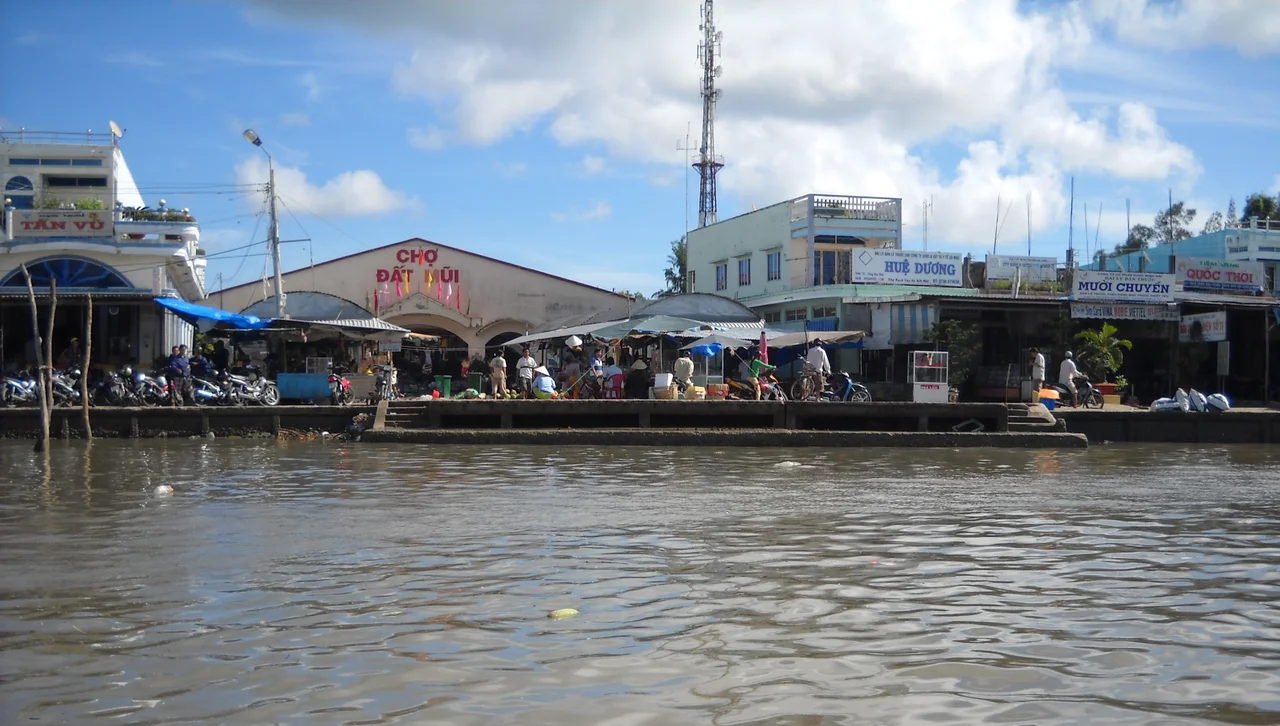

Đất Mũi
Ask for the coordinates of Vietnam's southernmost point and you will get an answer with an expiry date. Đất Mũi is not standing still. Silt washed out of the Mekong system and dragged along this coast settles on the flats here, pushing the land sixty to eighty metres further into the sea each year and laying down more than a hundred and twenty hectares of new ground annually. The commune at the end of the country is, quite literally, still under construction.
A Point With an Expiry Date
Vietnamese maps call the cape Mũi Cà Mau; an older name, Mũi Bãi Bùng, is franker about the raw material, since bãi bùng means the muddy shoal. In 2015 surveyors placed the furthest southern land at roughly 8°33' north, 104°50' east, out at Khai Long beach in Xóm Rẫy hamlet. That fix has already moved. The monument every visitor photographs stands somewhere else entirely, several kilometres to the west at 8°37'30" north, 104°43' east — a coordinate chosen for symbolism rather than geometry. Shaped like a boat under sail, it carries two lines of verse by the poet Xuân Diệu likening the country to a ship with this cape as its prow. Stand beside it and you are not, strictly speaking, at the tip of Vietnam. You are at the place Vietnam agreed to call the tip.
Two Seas, One Doorstep
The commune has an unusual geography: water on three sides, and it is not the same water. East of the point lies the South China Sea, which Vietnamese call Biển Đông, the East Sea. West of it lies the Gulf of Thailand. The two run on different clocks. Along this stretch the tide is irregular and semidiurnal — two floods and two ebbs in a day, currents running between half a metre and a metre per second. Wind then argues with the tide. In the dry season the coastal flow sets west and southwest, hugging the shore until it swings hard west at the cape; in the rains it reverses to the northeast and drifts offshore. Where mud lands and where it is stripped away both follow from that quarrel between two bodies of water.
Kilometre 2,436
For most of its history the cape was reached by boat. The Hồ Chí Minh Highway changed that with its final leg, the 51.3-kilometre Năm Căn–Đất Mũi section: a roadbed seven and a half metres wide carrying six metres of pavement, built for more than 3,540 billion đồng. At the end of it stands a nineteen-metre column, begun on 15 February 2017 and finished on 15 March 2019, inscribed with the words for end point of the Hồ Chí Minh road and the figure Km 2436. The route behind that number runs down from the north through twenty-eight provinces and cities. Close by sit the national coordinate marker GPS0001, fixed in January 1995, and a forty-five-metre replica of the Hanoi Flag Tower begun on 16 January 2016. Somewhere between sixty and seventy thousand people a year come here simply to stand at the end of their own country.
Oysters, Crab and Đước Wood
Daily life follows the water rather than the road. Houses string out along a tangle of creeks and canals, and the economy is drawn straight from the brackish edge. Growers raise milk oysters — hàu sữa — at a commercial yield of around two hundred tonnes a year, and the newest mudflats are seeded with clams. Older trades hold on: sedge mats, chopsticks turned from the wood of the đước mangrove, jars of fermented mắm. The food is unapologetically estuarine. Mudskipper grilled with chilli salt, oysters eaten with mustard, roe-heavy cua gạch son crab, vọp clams steamed with ginger, mắm hotpot served with fronds of rau choại fern. Offshore, under the shelf the silt keeps extending, survey crews have found oil and gas.
The Sea Takes Some Back
Accretion is only half the ledger. The eastern flank erodes, and in 2011 it eroded badly enough that Vietnamese newspapers began asking openly whether Mũi Cà Mau could be lost. In places the sea cut two kilometres inland. Concrete piles from an eighteen-billion-đồng revetment ended up stranded well offshore, and much of the blame fell on the forest cleared to build the tourist monuments in the first place. Emergency work began on 10 July 2012: two parallel rows of spun concrete piles set a metre and a half apart with rock packed between them, three kilometres of it by 2020. In 2016 the province planted 1,300 hectares of protective forest on the flats and committed a further 811 billion đồng to twenty kilometres of sea dyke. In 2019 the ship monument itself was ordered moved, because the tide had begun washing over its footings. On 16 June 2025 the commune was redrawn and enlarged, taking in part of Viên An and — oddly, for a place at war with the sea — the uninhabited Hòn Khoai islands offshore. District government was abolished across Vietnam a fortnight later. Đất Mũi now covers about 271 square kilometres and holds roughly 33,300 people, and its outer edge will be somewhere else by the time you read this.
From the Air
Đất Mũi lies at 8.5636°N, 104.8408°E, the last wedge of dark mangrove green before open water. The cape is unmistakable from the air: a blunt triangle of forest split by silver creeks, the pale crescent of new mudflat trailing off its southwestern shoulder, and the Gulf of Thailand and South China Sea meeting around it. Recommended viewing altitude is 2,000 to 4,000 feet, low enough to read the dendritic channel pattern and pick out the monument cluster and the flag tower near the western shore. Cà Mau Airport (VVCM) is roughly 75 km north-northeast in a straight line, though over 110 km by road; Cần Thơ International (VVCT) lies about 195 km northeast, and Phú Quốc (VVPQ) about 210 km northwest across the gulf. Best visibility comes in the December–April dry season; the southwest monsoon from May to November brings haze, heavy convective build-ups and reduced ceilings over the delta.
Nearby Stories
- Sông Đốc 32 km away
- Bạc Liêu 57 km away
- Tho Chau Islands 117 km away
- Con Son Island 125 km away
- An Thoi Naval Base 172 km away
- Japanese destroyer Shigure (1935) 261 km away
- Zahro Express Disaster 285 km away
- Perhentian Islands 357 km away