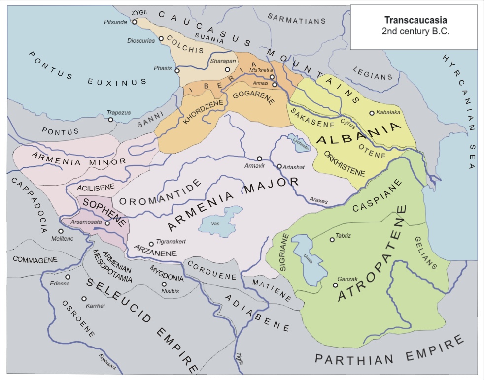
Atropatene
Say the word "Azerbaijan" and you are speaking the name of a man who died more than two thousand years ago. Atropates was a Persian satrap -- a provincial governor -- who served the Achaemenid Empire and then, after Alexander the Great conquered it, made a calculation that would echo through the centuries. He declared his territory independent. The kingdom he founded, Atropatene, would lend its name to a region, then a province, then a modern nation, passing through the forms Aturpatakan and Adarbayjan along the way.
A Satrap's Gambit
At the Battle of Gaugamela in 331 BC, Atropates commanded Medes, Albanians, Sakasens, and Cadusians in the army of the Achaemenid Great King Darius III against Alexander the Great. The Achaemenids lost. Atropates, a practical man, pledged loyalty to Alexander and was rewarded with the governorship of all Media. When Alexander died in 323 BC, his generals carved up the empire at the Partition of Babylon. Greater Media went to Peithon, one of Alexander's bodyguards. But the smaller northern portion -- the sub-satrapy of Matiene -- went to Atropates, who promptly refused allegiance to Seleucus and declared Media Atropatene an independent kingdom. It was a bold act of defiance that created a state lasting centuries.
Between Rome and Parthia
Atropatene occupied dangerous ground between expanding empires. When Antiochus III of the Seleucid Empire attacked in 220 BC, King Artabazanes accepted Seleucid supremacy while preserving internal autonomy. Later, as Rome pushed eastward, Atropatene and Parthia allied against the common threat. The alliance was tested in 36 BC when the Roman general Mark Antony besieged Fraaspa, one of Atropatene's central cities. The city's defenses held. After a prolonged blockade, Antony withdrew, having lost approximately 35,000 soldiers. But Parthia's own ambitions to absorb Atropatene eventually drove the kingdom toward Rome: Ariobarzan II, who took power in 20 BC, spent a decade living in Rome itself. The dynasty Atropates founded endured for centuries, first as independent rulers, then as vassals of the Arsacid Parthians.
Guardian of the Sacred Fire
Atropatene holds a distinction no other Iranian region can claim: it remained under Zoroastrian authority without interruption from the Achaemenid period through the Arab conquest, a span of more than a thousand years. The only break was Alexander's brief rule. Medieval Arab geographers offered an alternative etymology for the region's name, connecting it not to Atropates but to Adorbador, meaning "guardian of the fire" -- a reference to the Zoroastrian sacred flames maintained in temples across the region. The capital city of Ganzak, whose name derives from the Median word for "treasury," stood in a fertile area near Lake Urmia, close to modern Miandoab. From there the Zoroastrian priesthood wielded influence that extended far beyond provincial borders.
The Final Transition
By the early 3rd century AD, the Arsacid Parthian Empire was crumbling. The people of Atropatene -- nobility and peasants alike -- allied themselves with the rising Sasanian prince Ardashir I during his wars against the last Parthian king, Artabanus IV. In 226 AD, after Ardashir killed Artabanus at the Battle of Hormozdgan, Atropatene submitted with little resistance. A rock relief near Salmas, depicting Ardashir and his heir Shapur I, may commemorate the Sasanian takeover. The transition was smooth partly because the Zoroastrian priesthood, alienated by the religiously tolerant Arsacids, welcomed the devoutly Zoroastrian Sasanian family. Atropatene became a Sasanian province governed by a marzban, but its cultural identity endured. The Sasanian monarchs favored Median traditions over Parthian ones, and Atropatene continued to serve as a stronghold of Iranian culture until the Arab conquest finally ended its Zoroastrian continuity.
From the Air
Located at approximately 37.00N, 48.00E, centered in the historic Azerbaijan region of northwestern Iran around Lake Urmia. The ancient capital of Ganzak was near modern Miandoab. Best viewed at 15,000-25,000 ft to appreciate the geographic extent. Nearest major airport is Tabriz (OITT). Lake Urmia is the dominant visual landmark -- a large salt lake visible from high altitude. The terrain includes mountains to the west and fertile plains to the east.