Attabad Lake
From the air, Attabad Lake looks like it has always been here -- a long ribbon of turquoise water curving through the Hunza Valley between walls of brown and grey rock. It has not. On January 4, 2010, a massive landslide above the village of Attabad sent millions of tons of debris crashing into the Hunza River, killing twenty people and creating a natural dam that no one asked for. Over the following months, the river backed up behind that dam, swallowing villages, shops, schools, and nineteen kilometers of the Karakoram Highway. What had been a road connecting Pakistan to China became a dead end at the water's edge.
Five Months of Rising Water
The landslide struck fourteen kilometers east of Karimabad, and the Hunza River simply stopped flowing downstream. For five months, the water rose. The village of Ayeenabad disappeared entirely beneath the surface. Major sections of Shishkat went under. Around forty percent of Gulmit, the administrative headquarters of the Gojal Valley, was submerged, along with significant portions of Hussaini and Ghulkin. By early June 2010 the lake stretched twenty-one kilometers and plunged more than a hundred meters deep. When water finally began spilling over the landslide dam during the first week of June, over 170 houses and 120 shops in Gojal had already been lost. The entire population of central Hunza and Gojal -- up to 25,000 people -- found themselves cut off from markets, hospitals, and the outside world, dependent on helicopter deliveries that bad weather frequently grounded.
A Region Severed
The Karakoram Highway is not simply a road in this part of Pakistan. It is the only road -- the single artery connecting Gilgit-Baltistan to the rest of the country and to China. When the lake swallowed nineteen kilometers of it, communities on either side were stranded. Goods that once moved by truck had to be loaded onto boats, ferried across the lake, and reloaded on the far shore. The economic damage compounded daily: agricultural land flooded, factories ruined, trade routes severed. By mid-June 2010, Dawn News reported 242 houses, 135 shops, four hotels, two schools, and four factories submerged, along with twenty-five kilometers of highway and six bridges destroyed. Victims staged sit-in protests demanding government action. Prime Ministers Yousuf Raza Gillani and Nawaz Sharif both visited; Sharif announced 100 million rupees in aid from the Punjab government. In 2012, the Frontier Works Organization blasted the spillway twice to lower the lake's level by at least thirty-three feet, offering some relief but no solution.
The Friendship Tunnels
The real solution required engineering on an enormous scale. Five tunnels, collectively seven kilometers long, were bored through the mountains along a realigned section of the Karakoram Highway above the lake's waterline. Known as the Pakistan-China Friendship Tunnels, the project cost $275 million and was inaugurated by Prime Minister Nawaz Sharif on September 14, 2015 -- more than five years after the landslide. The reopened highway restored the road link between Pakistan and China, a connection that carries strategic weight far beyond local commerce. The Karakoram Highway is a key segment of the China-Pakistan Economic Corridor, and the tunnels ensured that a natural disaster would not permanently sever one of the most geopolitically significant road connections in Central Asia.
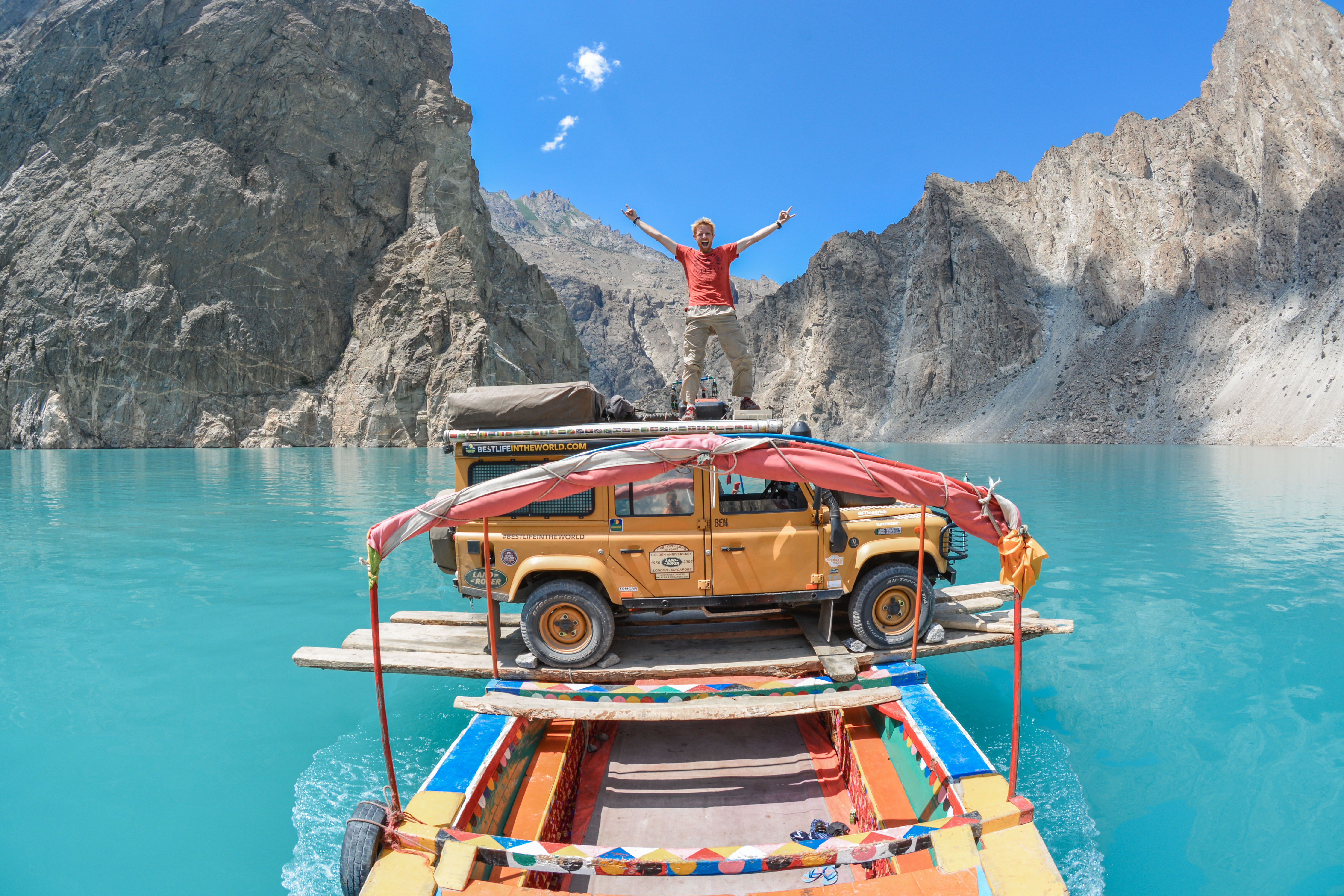
Turquoise Where Villages Were
What strikes visitors today is the color. Attabad Lake glows an almost artificial turquoise, the result of glacial sediment suspended in the water. Boating, jet-skiing, and fishing have turned the lake into a tourist attraction, and winter sports festivals now draw crowds to its frozen surface. The transformation is jarring and incomplete. Somewhere beneath that turquoise water lie the foundations of Ayeenabad, the classrooms of submerged schools, the orchards that generations of families tended along the Hunza River's banks. The lake is beautiful in the way that certain scars are beautiful -- not because the wound was good, but because what grew over it found a way to catch the light. For the communities of Gojal, Attabad Lake is both a destination and a reminder that the Karakoram's geology operates on its own terms, indifferent to the roads, villages, and livelihoods built along its slopes.
From the Air
Located at 36.337N, 74.868E in the upper Hunza Valley, Gojal region, Gilgit-Baltistan, Pakistan. The lake stretches approximately 21 km along the Hunza River valley at roughly 2,500m elevation. It is a striking turquoise water feature clearly visible from altitude, set between steep brown and grey valley walls. The Karakoram Highway runs along the lake's edge, and the five Pakistan-China Friendship Tunnels are visible on the eastern shore. Gilgit Airport (OPGL) lies approximately 110 km to the southwest. Best viewed from 12,000-16,000 ft AGL. The landslide dam that created the lake is visible at the southern end. Look for the dramatic color contrast between the turquoise water and the barren surrounding terrain.