Auckland
Auckland sits on a narrow isthmus between two harbors - the Waitemata opening to the Pacific, the Manukau to the Tasman Sea - the geography that made it New Zealand's largest city even after it lost capital status to Wellington in 1865. The city spreads across 53 volcanic cones, most dormant for centuries, their craters now parks and viewpoints. Maori had settled the isthmus for centuries before European arrival, the volcanic soils and harbors providing resources that supported large populations. Auckland holds 1.7 million people in the metropolitan area - a third of New Zealand's population - a concentration that reflects the jobs and opportunities the largest city offers. The sailing culture that gave Auckland its 'City of Sails' nickname is genuine: on summer weekends, the Waitemata fills with boats whose owners take advantage of winds and waters that few cities can match.
The Volcanoes
Auckland's volcanic field contains 53 cones, the most recent - Rangitoto Island - erupting only 600 years ago in an event Maori witnessed and remembered. The cones that dot the isthmus - One Tree Hill, Mount Eden, Mount Wellington - provide viewpoints where visitors climb to see the city spread beneath them. The craters that cap some cones have become sports fields; the scoria slopes have been quarried for road metal; the volcanic soil supports the gardens that give Auckland its green character.
The volcanic field is not extinct, only dormant. Geologists estimate the next eruption could occur anytime in the next few thousand years, and emergency plans exist for evacuating whichever area an eruption might threaten. The risk is real but distant, accepted as the price of living on dramatic landscape. Aucklanders hike their volcanoes on weekends without thinking about magma.
The Harbors
Auckland's two harbors gave the city its commercial importance before roads and airports made ports less essential. The Waitemata - the 'sparkling waters' - opens northeast to islands that form a protective barrier; the wharves that line its shores handle container ships and cruise liners and the ferries that connect the city to suburbs across the water. The Viaduct Basin, redeveloped for the America's Cup in 2000 and 2003, holds restaurants and apartments where fishing boats once unloaded.
The Manukau Harbor, larger but shallower, serves the city's western and southern suburbs with less dramatic waterfront development. The portage between the harbors - less than a kilometer at the narrowest point - was how Maori moved canoes between the seas before Europeans arrived. The bridges and highways that cross the isthmus now carry traffic that makes Auckland's congestion legendary; the harbors that defined the city's opportunity also constrain its expansion.
The Polynesian City
Auckland holds the largest Polynesian population of any city in the world - Maori, Samoan, Tongan, Cook Island, and other Pacific peoples making up over a quarter of the metropolitan population. The suburbs of South Auckland - Mangere, Otara, Manukau - are majority Polynesian, their churches and community centers serving populations that have migrated from across the Pacific. The Auckland style that emerges from this mix - the Pacific influences in music, food, art, fashion - distinguishes the city from its European heritage.
The Polynesian presence is not always celebrated. South Auckland carries stigma that reflects both racism and real deprivation; the inequality that concentrates poverty in Pacific communities is persistent. But the cultural contribution is undeniable: the Pasifika Festival that draws over 200,000 visitors annually, the musicians whose sounds travel globally, the athletes whose names fill rugby and rugby league rosters. Auckland is becoming more Polynesian as demographics shift, and the city's identity shifts with them.
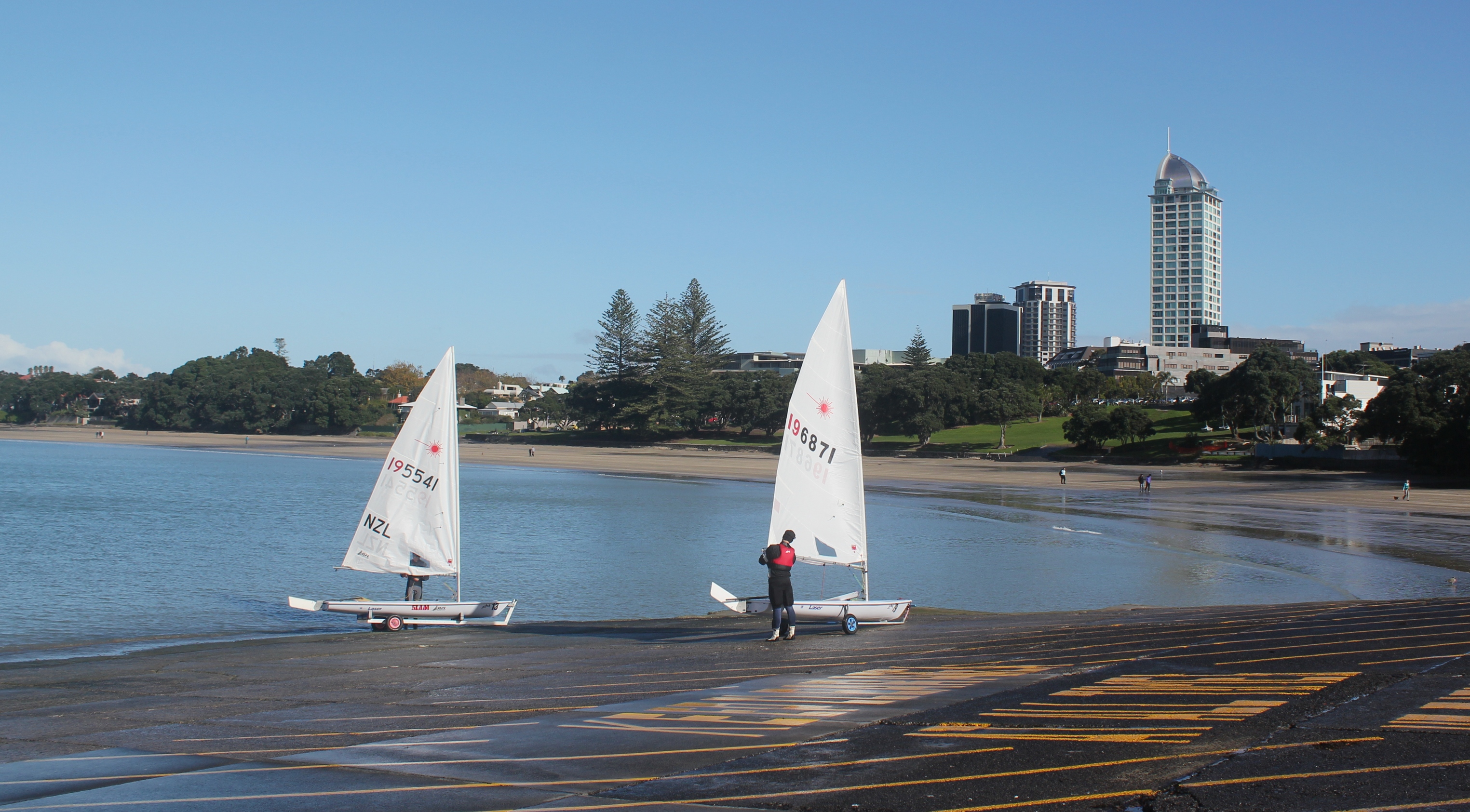
The Sailing City
Auckland earned the 'City of Sails' nickname through genuine sailing culture - an estimated one boat for every eleven residents, marina berths that sell for the price of houses, yacht clubs that serve every skill level and income bracket. The America's Cup victories in 1995 and 2000 cemented the identity, the defense events transforming the waterfront and bringing global attention. The waters of the Hauraki Gulf, protected by islands from ocean swells, provide sailing conditions that beginners and experts both enjoy.
The sailing is not egalitarian - good boats cost serious money, and marina fees are not cheap - but access is broader than in many cities. The dinghy fleets that train young sailors, the keelboats that race on Wednesday evenings, the cruisers who provision and head for the Pacific islands - these represent participation that sports requiring less capital cannot match. The wind and water that Auckland's geography provides are democratic even if the boats are not.
The Islands
The Hauraki Gulf holds dozens of islands accessible by ferry from Auckland, from the volcanic cone of Rangitoto visible from every waterfront viewpoint to Waiheke Island with its wineries and beaches. Waiheke has become Auckland's weekend escape, its ferry crowded with visitors seeking the vineyards and restaurants that have transformed what was once a hippie commune. Great Barrier Island, further out, offers genuine wilderness - no mains power, few cars, darkness that reveals stars the city obscures.
The islands extend Auckland's geography without extending its density. The Department of Conservation manages several as reserves where native birds recover from the mammalian predators that mainland populations cannot escape. The ferries that connect the islands to the city make them suburbs of a sort, their residents commuting to work across water rather than road. Auckland's islands are assets that other cities cannot replicate.
From the Air
Auckland (36.85S, 174.76E) sits on an isthmus between the Waitemata and Manukau Harbors. Auckland Airport (NZAA/AKL) is located 21km south of the city center on the Manukau Harbor shore with one runway 05R/23L (3,635m). The volcanic cones dotting the isthmus are distinctive features - Rangitoto Island's cone is particularly visible in the Hauraki Gulf. The harbor bridge connects the central city to the North Shore. The Sky Tower (328m) is the dominant landmark. Weather is oceanic temperate - mild year-round, rain possible any season. Sea breezes develop on warm days. The volcanic field is monitored for activity.