Aurlandsfjord
On 11 March 2011, a magnitude 9.0 earthquake buckled the seafloor off the coast of Japan. Twelve minutes later, 8,000 kilometers away, the water in a narrow Norwegian fjord began to heave. For several hours, waves 1.5 meters tall rolled back and forth between the granite walls of the Aurlandsfjord, a phenomenon called a seiche, triggered not by wind or tide but by the planet itself vibrating like a struck bell. The fjord that caught those tremors is a 29-kilometer blade of water cutting south from the Sognefjorden, Norway's longest and deepest fjord. At its narrowest, the Aurlandsfjord is barely two kilometers wide. At its deepest, the water reaches 962 meters below sea level, a depth that would swallow most skyscrapers. Mountains rise 1,800 meters on either side, so sheer that for centuries the only practical way to travel here was by boat.
A Branch of the King of Fjords
The Sognefjorden stretches 205 kilometers inland from the Norwegian coast, the longest fjord in Norway and the second longest in the world. About two-thirds of the way along its length, the Aurlandsfjord splits off to the south like a tributary river flowing in reverse. Eleven kilometers down this branch, another arm, the Naeroyfjord, breaks away to the west. The Naeroyfjord is so spectacularly narrow, in places just 250 meters across, that it earned UNESCO World Heritage status in 2005. Large parts of the Aurlandsfjord fall within that same protected area, the West Norwegian Fjords site, recognized for representing the world's finest examples of fjord landscapes. The geology here is a record of ice age sculpture. Glaciers carved these valleys over millions of years, grinding down through bedrock to create the characteristic U-shaped profiles: vertical walls dropping to flat, deep floors. When the ice retreated, the sea flooded in.
Villages at the Water's Edge
Three settlements mark the Aurlandsfjord's shoreline, each occupying the rare patches of level ground where rivers have deposited alluvial fans at the base of the mountains. Flam sits at the innermost point, where the fjord ends and the valley of Flamsdalen begins its steep climb toward the mountain plateau. Flam is famous less for the village itself than for the railway that departs from it: the Flamsbana, one of the steepest standard-gauge rail lines in the world, climbing 863 meters in just 20 kilometers. Cruise ships anchor here in summer, their white hulls dwarfed by the walls on either side. Aurlandsvangen occupies a slightly wider delta a few kilometers north, serving as the administrative center of Aurland Municipality. And then there is Undredal, population roughly 100, reachable by road only since 1988. Before the road tunnel connected it to the outside world, Undredal was accessed by boat or by a footpath along the cliffs. The village is known for its brown goat cheese and for what is believed to be the smallest stave church still in use in Scandinavia.
The Stegastein View
In 2006, architects Todd Saunders and Tommie Wilhelmsen completed a viewing platform that juts 30 meters out over the fjord from the Aurland mountain road, 650 meters above the water. The Stegastein viewpoint is a flat steel-and-wood plank that narrows to a point, ending at a glass panel angled slightly inward to give visitors the unsettling impression that they might simply slide off into the abyss. The platform was part of Norway's National Tourist Routes program, an effort to turn remote scenic roads into architectural destinations. From Stegastein, the Aurlandsfjord unfolds below as a dark ribbon of water hemmed by forested slopes and bare rock faces. On clear days, the eye can trace the fjord north to where it meets the Sognefjorden, and south to the rooftops of Flam. The road itself, the Aurland mountain road, climbs through hairpin turns to nearly 1,300 meters before descending to Laerdal on the other side, though it is closed in winter when snow buries it meters deep.
Silence Between the Walls
What strikes visitors about the Aurlandsfjord is not its depth or its height but its quiet. The mountains absorb sound. The water, dark blue-green from glacial minerals and the shadows of the walls above, lies flat most days, disturbed only by the wake of a ferry or the occasional kayak. In winter, when the cruise ships are gone, the fjord can feel like a place the modern world has not quite reached. Waterfalls thread down the cliff faces, some named, most not, fed by snowmelt that begins in May and tapers off by September. The UNESCO designation has brought both protection and attention: visitor numbers have grown steadily, and the balance between accessibility and preservation is an ongoing negotiation in a landscape that feels wild precisely because so few people live in it. Fewer than 1,800 people inhabit all of Aurland Municipality, spread across a territory of 1,488 square kilometers, most of it vertical rock and ice.
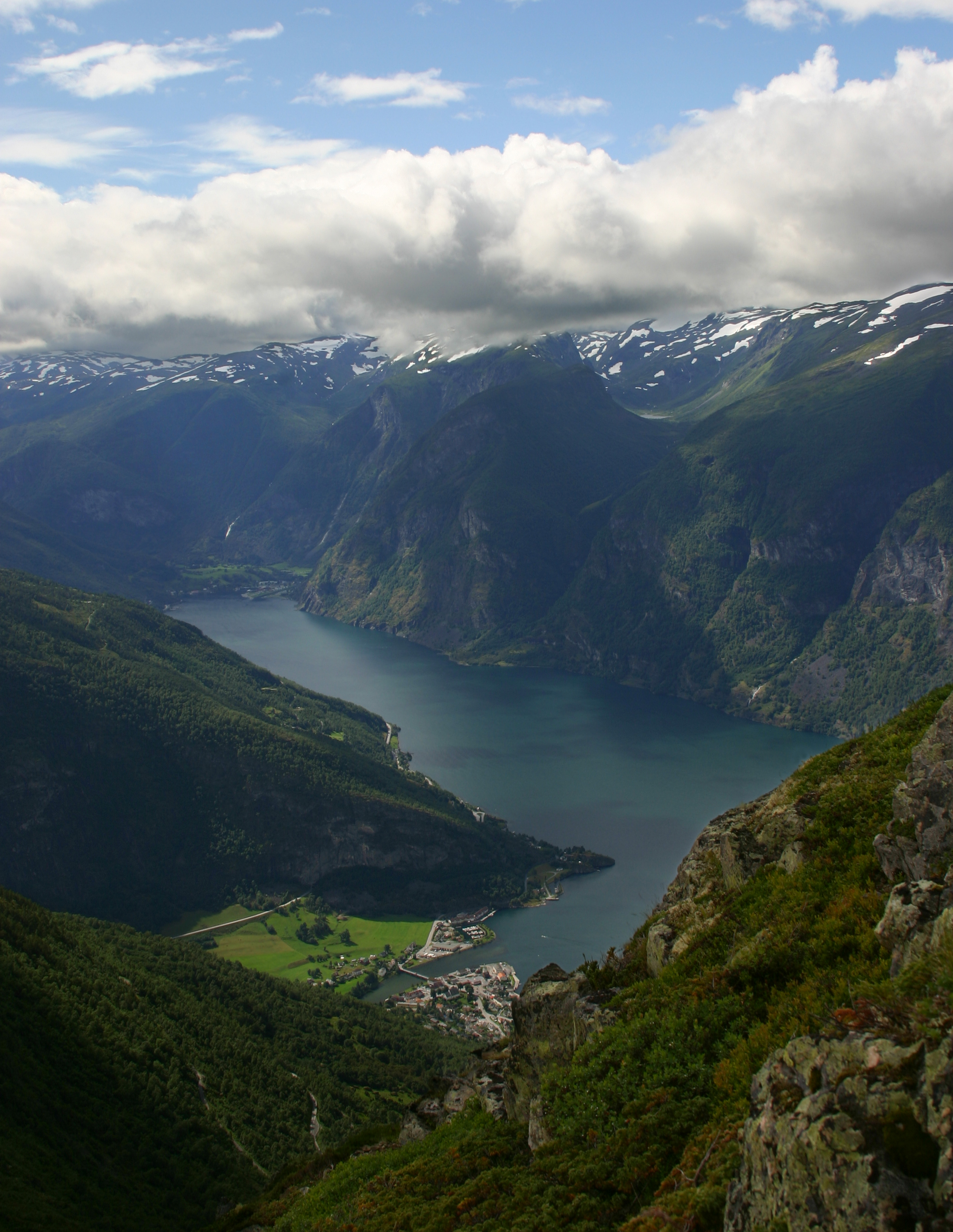
From the Air
Located at 61.01N, 7.05E in Vestland county, Norway. The Aurlandsfjord runs roughly north-south as a branch off the main Sognefjorden. From the air, the fjord appears as a narrow dark-water slot cut between steep mountain walls reaching 1,800 meters. The village of Flam at the southern end and cruise ships in summer are key visual landmarks. Nearest airports: Sogndal/Haukasen (ENSG) approximately 45 km north, Bergen/Flesland (ENBR) approximately 160 km southwest. Best viewed at 5,000-8,000 feet AGL to appreciate the fjord's depth and the narrowness of the valley.