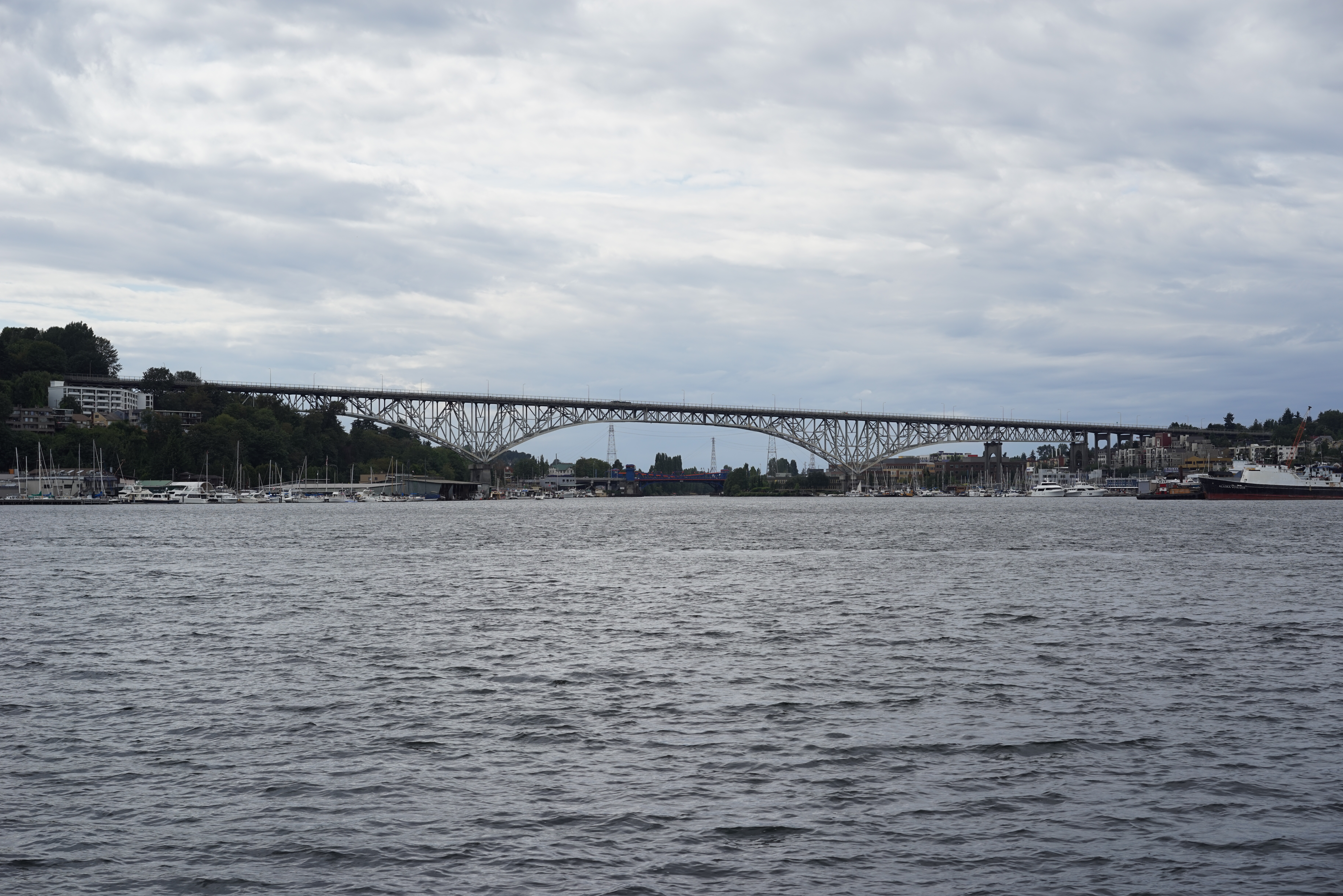
Aurora Bridge
On February 22, 1932 -- George Washington's bicentennial birthday -- Seattle dedicated the bridge that bore his name. The George Washington Memorial Bridge, known to everyone simply as the Aurora Bridge, was the final link in the Pacific Highway, an unbroken road from Canada to Mexico. Its designers at Jacobs & Ober had solved an elegant problem: by building high enough to clear the Lake Washington Ship Canal, they eliminated the need for yet another drawbridge on a waterway already crowded with them. Lead engineer Ralph Ober never saw its completion. He died of a brain hemorrhage in August 1931, while the cantilever trusses were still rising above Lake Union.
The Last Link in a Continental Road
Before the Aurora Bridge existed, crossing the Ship Canal meant waiting for a drawbridge to close. Seattle's growing automobile traffic demanded something faster. Construction on the bridge piers began in 1929, and the superstructure followed in 1931. Federal funding was unavailable, so Seattle, King County, and Washington State split the cost themselves. The bridge's 57-foot deck carried six lanes of what was then called the Pacific Highway -- later U.S. Route 99 -- connecting the Queen Anne and Fremont neighborhoods across the west end of Lake Union. Building the highway's connecting roads through Woodland Park Zoo generated considerable controversy in 1930, but the bridge itself was celebrated as a triumph of local engineering and civic ambition. It joined the National Register of Historic Places in 1982.
A Troll Under the Bridge
In 1990, something unexpected appeared beneath the bridge's north end: an 18-foot concrete troll clutching a real Volkswagen Beetle in one massive hand. The Fremont Troll was a neighborhood art project, funded partly through Seattle's Neighborhood Matching Fund, which contributed $20,000 toward its $133,000 total cost. Vandals attacked it relentlessly in its first year, prompting the installation of floodlights on the bridge above. The Troll survived. It became one of Seattle's most photographed landmarks, a piece of public art that transformed the dark space beneath a highway overpass into a destination. Fremont, the self-proclaimed "Center of the Universe," had found its guardian.
Aging Steel and Narrow Lanes
By the twenty-first century, the bridge was showing its age. After the catastrophic collapse of Minneapolis's I-35W bridge in 2007, Washington State inspected all cantilever bridges with gusset plates, including the Aurora Bridge. That same year, the Federal Highway Administration rated it "functionally obsolete" with a sufficiency score of just 55.2 percent. In October 2019, engineers found that a stringer beam on the southbound side had corroded so badly it created a visible sag in the roadway. A $500,000 emergency repair narrowed southbound traffic to two lanes for seven days. The bridge's lanes remain remarkably narrow at 9.5 feet, with no median barrier separating opposing traffic -- a design limitation that contributed to a devastating 2015 collision when an amphibious tour vehicle crossed the center line and struck a charter bus, killing five international students from North Seattle College and injuring sixty-nine others.
Confronting the Darkness
The bridge's height and pedestrian access brought a grim distinction: more than 230 people have died by suicide from it since its opening, with nearly 50 deaths in the decade between 1995 and 2005 alone. The first occurred on January 20, 1932, before the bridge was even finished, when a shoe salesman leapt from the incomplete span. For decades, the city struggled with how to respond. In 2006, emergency phones and crisis signs were installed. The following year, Governor Christine Gregoire allocated $1.4 million for a suicide-prevention fence, though construction didn't begin until spring 2010. The eight-foot barrier was completed in February 2011 at a total cost of $4.8 million -- an investment in the principle that making it harder to act on a moment of despair can save lives.
From the Air
Located at 47.646N, 122.347W, the Aurora Bridge spans the western end of Lake Union, connecting Queen Anne to Fremont. Best viewed from 1,500-2,000 feet AGL approaching from the south or east, where the cantilever structure is visible against the water. The Fremont Cut and Fremont Bridge are immediately to the west. Nearest airport: Boeing Field/King County International (KBFI), approximately 6 nm south. Seattle-Tacoma International (KSEA) is 11 nm to the south.