Awash National Park
Steam rises from the ground at Filwoha, drifting through groves of doum palms that have no business growing in this parched landscape. The hot springs bubble up where geothermal energy meets the Awash River valley, creating oases of improbable green against the dry acacia scrub. Awash National Park, established in 1966 as one of Ethiopia's first protected areas, sits squarely on the floor of the Great Rift Valley, where the African continent is slowly tearing itself apart. It is a place of contrasts: a dormant volcano rising above sun-scorched plains, waterfalls crashing through gorges in a region that can go ten months without rain, and some of Africa's most diverse wildlife sharing space with the Karayyu Oromo pastoralists whose livelihoods the park's creation disrupted.
Volcano on the Rift
Mount Fentale dominates the park's western skyline, a dormant stratovolcano whose flanks define the boundary between the acacia woodlands below and the open sky above. The Addis Ababa to Dire Dawa highway cuts through the park, splitting it into two distinct landscapes. To the south lie the Illala Saha Plains, flat grasslands stretching toward the Awash River. To the north, the Kudu Valley climbs toward Fentale's slopes, where wildlife finds refuge in the broken terrain. The Awash River itself forms the park's southern boundary before plunging through a gorge with waterfalls that seem extravagant in a land of chronic drought. This is the Rift Valley at work, the geological engine that created hot springs, shaped the terrain, and produced the volcanic soils that sustain the park's four distinct ecosystems: arid acacia woodlands, thorned bushlands, grazing savannas, and riverine wetlands.
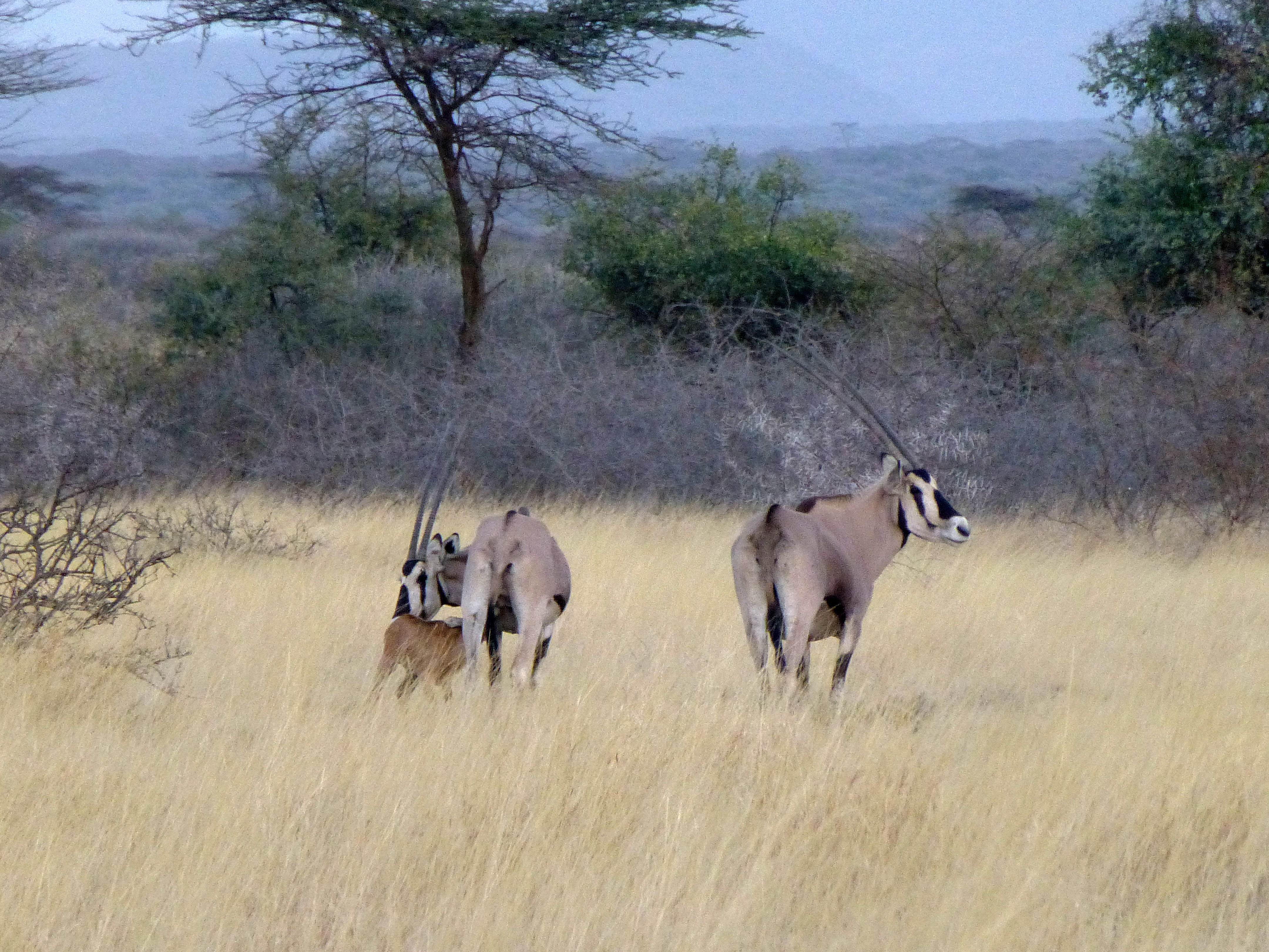
The Oryx and the Vanished
Beisa oryx are the park's signature animal, their straight horns and painted faces common across the grasslands. They share the landscape with more than 81 mammal species: aardvarks and aardwolves hunting in the scrub, leopards and cheetahs stalking the plains, hippos wallowing in the river stretches, and spotted hyenas calling through the night. Troops of hamadryas baboons, their silver capes unmistakable, are among the most visible residents, alongside olive baboons, guerezas, and grivets. But the park also tells a story of loss. Elephants, rhinos, zebras, and Cape buffalo were all present when the park was established in the 1960s. All have since been extirpated by hunting, habitat loss, and population decline. Swayne's hartebeests were translocated here for repopulation, but their survival remains uncertain. The Awash River harbors Nile crocodiles in its gorges, and visitors must be wary of six venomous snake species, including black mambas and puff adders.
A Sky Full of Wings
With 453 recorded bird species, Awash is one of Ethiopia's premier birding destinations. Somali ostriches stride across the grasslands. Kori bustards, the heaviest flying birds in Africa, pick through the scrub. Northern carmine bee-eaters flash crimson overhead, while Abyssinian ground hornbills stalk the savanna with deliberate, almost judicial gravity. Seven of these species are endemic to Ethiopia, found nowhere else on the planet: the wattled ibis, black-winged lovebird, banded barbet, yellow-throated seedeater, Abyssinian woodpecker, white-billed starling, and thick-billed raven. For birders, these endemics alone justify the journey east from Addis Ababa. The park's position along the Rift Valley, where highlands meet lowlands and wet ecosystems border dry ones, creates the overlapping habitat zones that support such extraordinary avian diversity.
The People Who Were Here First
The park's creation came at a cost that the Ethiopian government originally intended to avoid. The Karayyu Oromo are indigenous pastoralists who have grazed their cattle across these lands for generations. When the park was established in 1966, and the neighboring Metehara Sugar Plantation was built to the south, the Karayyu found their traditional grazing routes severed and their livelihoods endangered. The formal act authorizing the park was not fully passed for another three years, and the tension between conservation and indigenous land use remains unresolved. The bimodal rainfall pattern that defines the region, with a brief rainy season followed by a dry period lasting up to ten months, makes every acre of grazing land precious. For the Karayyu, the park boundaries represent not abstract conservation goals but the loss of specific pastures, water sources, and seasonal routes that sustained their way of life. Their story is a reminder that national parks, however necessary for biodiversity, are never drawn on empty land.
From the Air
Located at 9.0N, 40.0E on the floor of the Great Rift Valley, approximately 130 miles east of Addis Ababa. Mount Fentale is a prominent visual landmark from altitude. The Awash River gorge and waterfalls are visible at lower altitudes. The Addis Ababa to Dire Dawa highway bisects the park. Nearest major airport is Addis Ababa Bole (HAAB). The terrain is flat to gently rolling with the volcanic cone of Fentale rising in the west. Best visibility in the dry season (October-May).