Bahla Fort
Somewhere beneath layers of cement and modern plaster, the original mud-brick walls of Bahla Fort are still trying to breathe. This massive fortress at the foot of the Jebel Akhdar highlands was Oman's first site inscribed on UNESCO's World Heritage List, in 1987, yet it spent the next seventeen years on the List of World Heritage in Danger. The irony cuts deep: what nearly destroyed Bahla Fort was not neglect but an overzealous attempt to save it.
Frankincense Lords
Between the 12th and 15th centuries, the Banu Nebhan tribe controlled this stretch of interior Oman and, with it, the trade routes that carried frankincense from the Dhofar coast to markets across the ancient world. They built Bahla Fort as a statement of that power. The complex includes not just the fortress itself but an adjacent citadel oasis and a defensive wall that once stretched 13 kilometres across the landscape. Parts of that wall still stand, tracing a perimeter that enclosed an entire community. The oasis is mostly ruins now, but its bones remain visible, houses and structures reduced to outlines in the dust that hint at the scale of settlement the fort once protected.
Three Forts in One
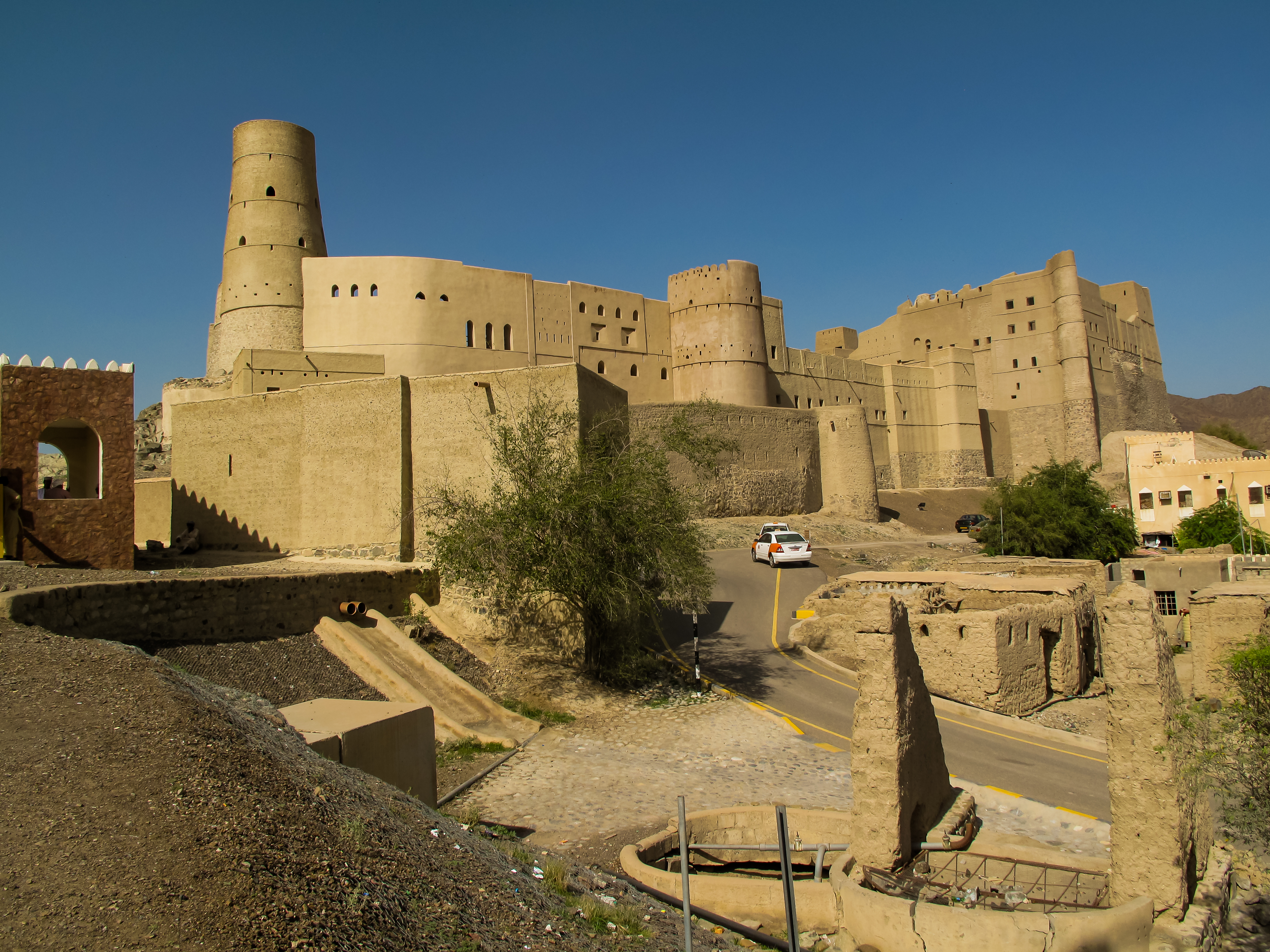
Bahla is not a single building but a layered accumulation of centuries. Al-Qasabah forms the oldest core, the original Nebhani stronghold. Bait al-Hadith, the 'new house,' was added by the Ya'riba dynasty between 1624 and 1743, the same rulers who made Oman a maritime power. Bait Al-Jabal arrived in the 18th century. Each addition used the same basic material: bricks made of mud and straw, packed and dried under the desert sun. This technique gave the fort its warm, earth-toned appearance but also made it vulnerable. Without constant maintenance, unfired mud brick decays. Water seeps in, walls soften, corners crumble. The fort's survival has always depended on the hands of the people living around it.
The Restoration That Wasn't
Bahla Fort was placed on UNESCO's List of World Heritage in Danger in 1988, just one year after its inscription, largely due to development plans threatening the site's integrity. The early 1990s brought an attempt to address this — and made things worse. Workers covered the original mud-brick and mortar walls so thoroughly with stone and cement that the historic surfaces vanished beneath a modern shell. No archaeological surveys had been conducted beforehand. No architectural documentation existed. The aim, investigators later concluded, was not restoration but renovation: they wanted the fort to look new. The original walls, sealed under cement, could no longer be studied or even seen. Drainage remained poor. The surrounding souk was rebuilt with modern materials that clashed with the historic fabric. It was not until 2004 that Bahla was removed from the Danger List, and not until 2012 that the fort reopened after a more careful rehabilitation.
Legends in the Dust
Locals will tell you stories about Bahla that no guidebook records. The fort and its oasis have accumulated legends the way its walls accumulate sand. In 2013, the ArCHIAM Centre at the University of Liverpool, led by Professor Soumyen Bandyopadhyay, developed a heritage management plan for Bahla Fort and the neighbouring oasis settlement of Harat al-Aqr. The plan aimed to balance preservation with the living community that still depends on the area. Today the fort stands open but largely unexplained. There are no exhibits, no interpretive panels, no resident guides. Visitors wander its corridors and courtyards in silence, left to make their own sense of the mud-colored spaces. It is an oddly fitting experience for a place whose story has always been about what lies beneath the surface.
From the Air
Located at 22.96N, 57.30E in Oman's Ad Dakhiliyah Governorate at the foot of the Jebel Akhdar highlands. Best viewed from 3,000-5,000 feet AGL. The fort and its 13 km wall are visible against the arid landscape. Nearest major airport is Muscat International (OOMS), approximately 200 km northeast. Nizwa is 40 km to the southeast.