Bair Island
Bair Island is not really an island, and it is not really three islands either. The 3,000-acre marsh area in Redwood City consists of three sections -- Inner, Middle, and Outer -- separated by sloughs and connected to the mainland by levees. What it is, without ambiguity, is one of the most significant wetland habitats remaining on San Francisco Bay, a place where the salt marsh ecosystem that once ringed the entire bay still functions at meaningful scale.
Marshland and Memory
The bay's original shoreline was fringed with tens of thousands of acres of tidal marsh. Development consumed most of it. Salt ponds replaced much of what development missed. Bair Island represents one of the largest remaining patches, a place where pickleweed, cordgrass, and marsh grasses support populations of shorebirds, waterfowl, and the endangered salt marsh harvest mouse. The restoration of Bair Island to tidal marsh from former salt pond use has been one of the South Bay's major ecological achievements.
Three Islands, One Ecosystem
Inner Bair Island is closest to the Redwood City shoreline and the most accessible, with trails that allow visitors to walk the levees and observe the marsh. Middle and Outer Bair Island extend further into the bay, less accessible but more wild. The three sections function as a single ecosystem, with tidal flows connecting them through a network of sloughs. At high tide, the marsh is submerged; at low tide, mudflats teem with invertebrates that feed the birds.
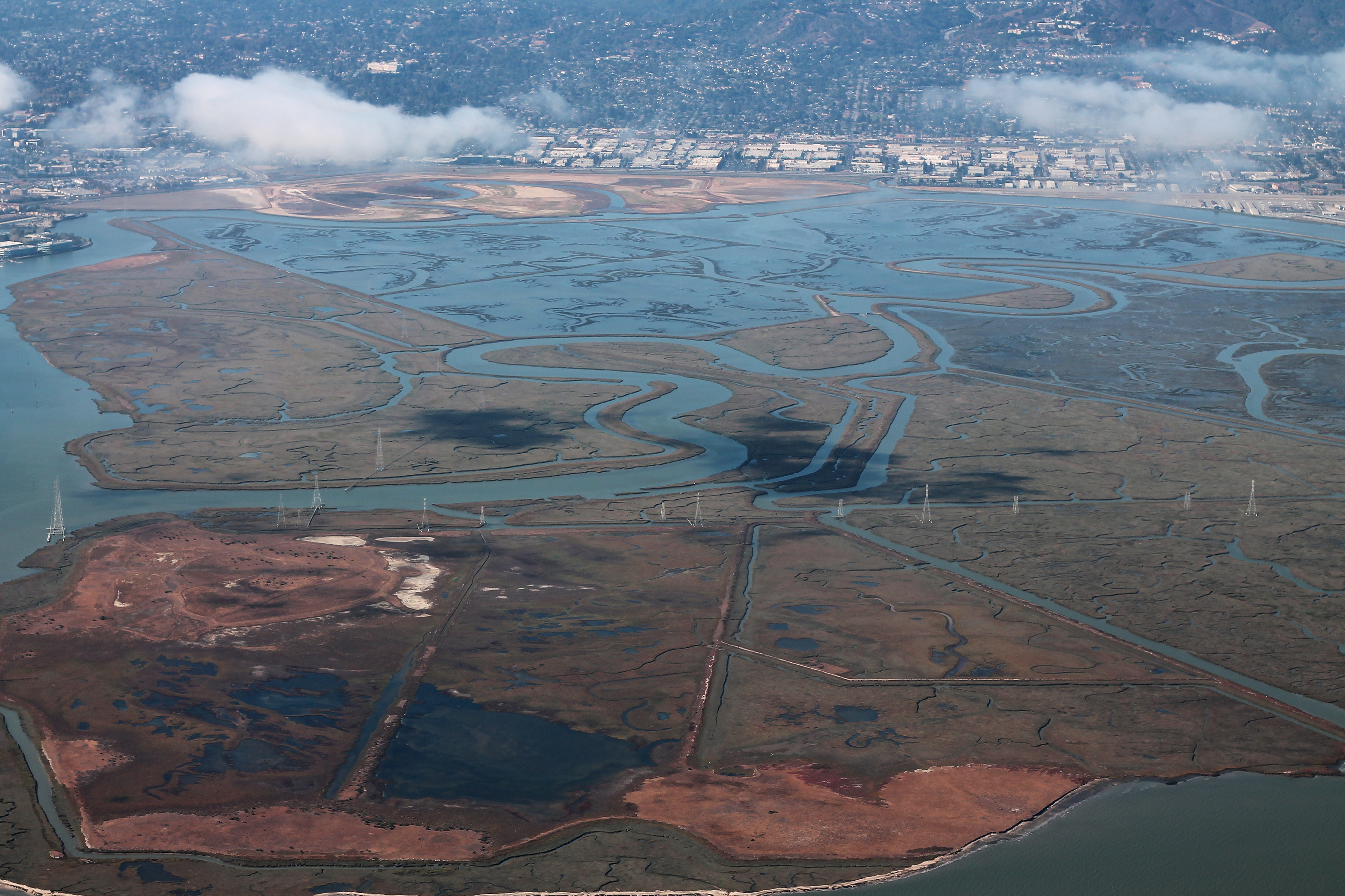
Visible from Above
From the air, Bair Island's three sections are clearly visible as green-brown patches against the geometric patterns of salt ponds and the developed shoreline of Redwood City. The contrast between the marsh and the adjacent commercial development is stark -- a reminder of what the entire bay shoreline once looked like, and what a handful of protected areas are working to preserve.
From the Air
Bair Island is at 37.530°N, 122.222°W, visible from altitude as marshland patches adjacent to the Redwood City shoreline. The salt ponds and sloughs create distinctive patterns. Nearest airports: San Carlos (KSQL) 2 nm west, Palo Alto (KPAO) 5 nm south.