Bakr Awa
Seventeen layers. That is how many distinct periods of occupation archaeologists have counted at Bakr Awa, a tell rising 40 meters above the Shahrizor Plain near Halabja in Iraqi Kurdistan. From the bottom -- pottery shards of the Uruk period, the late fourth millennium BC, when the world's first cities were forming in southern Mesopotamia -- to the top, where people still live today, this single mound compresses more than five thousand years of human habitation into a column of earth and stone. The site consists of a central citadel measuring 277 by 216 meters, surrounded by a lower city extending 800 meters. It sits in the foothills of the Zagros Mountains, not far from the headwaters of the Diyala River, at a crossroads where highland and lowland civilizations met, traded, and fought.
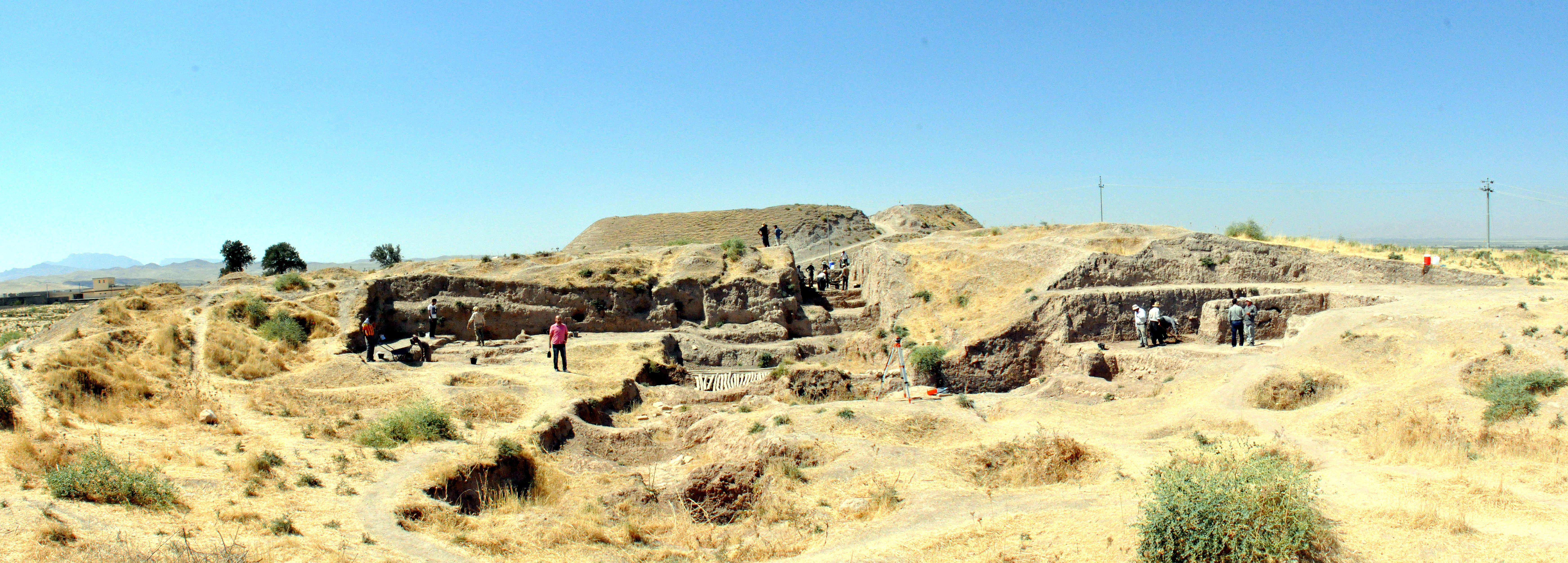
Explorers, Trenches, and the Passage of Time
The tell was first documented by British naval officer James Felix Jones in 1844, who described the prominent mound in detail during a regional survey. The first trench was dug by the geologist George Martin Lees sometime around the 1920s. In 1927, Ephraim Speiser visited as part of a broader survey of the region and proposed identifying the site as Atlila, a name later revised to Dur-Assur. Iraqi archaeologists from the Directorate-General of Antiquities excavated in 1960 and 1961, expanding the trench Lees had dug four decades earlier. Then the site went quiet for nearly half a century. When a University of Heidelberg team led by Peter A. Miglus arrived in 2009 to survey and begin new excavations in 2010, they found that the intervening years had not been kind. The mound was pockmarked with looters' pits, evidence of systematic illegal digging that had disturbed layers spanning millennia.
Tablets from Displaced Earth
Forty-one cuneiform tablets and fragments have been recovered from Bakr Awa across multiple excavation campaigns. Twenty-four were found during the Iraqi excavations; seventeen more surfaced during Belgian fieldwork in 2013 and 2014. None were found in their original context. Instead, they turned up in disturbed soil from Islamic-period construction, their original archive scattered and reburied by later builders who had no idea what lay beneath their foundations. Palaeography and radiocarbon dating place the tablets in the 15th century BC. The texts include administrative documents, sealed clay bullae, a legal witness list, a letter, a hemerology, extispicy omens, prayers, and a fragment of the Weidner God-list. Some fragments preserve text in the Hurrian language. With almost none of the tablets yet formally published, Bakr Awa holds a scholarly treasure still largely unread.
Empires That Passed Through
The seventeen citadel levels at Bakr Awa record the passage of empire after empire. During the Akkadian period, roughly 2350 to 2150 BC, the economy shifted from nomadic patterns toward more sedentary life, introducing pig and poultry breeding alongside wild animal hunting. Iron Age occupation dates to the Neo-Assyrian period, from the 9th to 7th century BC, when the site fell within the Assyrian province of Zamua. The Achaemenid Persians followed, then the Sassanians. Islamic-period habitation spans the Abbasid caliphate through the Ottoman era. Each layer built atop the ruins of what came before, sometimes cannibalizing older structures for building material, sometimes burying them under new foundations. The result is a vertical timeline of every major power that shaped Mesopotamia and the Zagros highlands.
The Wound of Looting
Photographs from November 2022 tell a grim story. The tell's surface and surrounding area are riddled with pits -- not archaeological trenches but the irregular, destructive holes left by illegal excavators. Looting at Bakr Awa has been heavy, particularly during periods of political instability when the site lacked protection. Each pit represents not just a stolen artifact but destroyed context: the spatial relationships between objects, the soil layers that allow dating, the architectural associations that give meaning to individual finds. The cuneiform tablets found out of context in Islamic fill may themselves have been displaced by earlier, undocumented looting. DNA analysis conducted on 18 Bronze and Iron Age skeletal samples from the site represents one of the few scientific studies completed, offering a biological counterpart to the cultural record. But much of what Bakr Awa could have told us has been lost to shovels wielded not by archaeologists but by treasure hunters.
From the Air
Located at 35.22N, 45.94E in the Shahrizor Plain near Halabja, Kurdistan Region of Iraq. The tell rises 40 meters above the surrounding plain and may be visible from moderate altitude as a distinct mound. Elevation approximately 700 meters above sea level. The site is near the headwaters of the Diyala River in the Zagros foothills. Nearest airport is Sulaymaniyah International Airport (ORSU), approximately 65 km to the northwest. The Iranian border lies roughly 15 km to the east.