Bandai-Asahi National Park: Where Poets, Pilgrims, and Peaks Converge
In 1689, the haiku master Matsuo Basho climbed Mount Gassan and looked out over the peaks of what would become Bandai-Asahi National Park. He composed a single verse: "Kumo no mine / ikutsu kuzure te / tsuki no yama" -- roughly, "How many cloud peaks have crumbled to reveal the Moon Mountain." More than three centuries later, those same cloud peaks still crumble and reform above 186,404 hectares of volcanic summits, beech forests, alpine marshes, and sacred shrines spread across three prefectures in northern Honshu. Designated in 1950, Bandai-Asahi is Japan's third-largest national park, and it is not one landscape but three -- the Dewasanzan-Asahi region, the Iide region, and the Bandaiazuma-Inawashiro region -- each with its own geology, its own wildlife, and its own claim on Japan's spiritual imagination.
The Three Sacred Mountains of Dewa
The park's northern unit holds its most storied ground. Mount Gassan, Mount Haguro, and Mount Yudono -- the Three Mountains of Dewa -- have been sacred to the ascetic religion of Shugendo since the seventh century. Yamabushi mountain priests still train here, practicing fasting, meditation under waterfalls, and fire ceremonies in pursuit of spiritual power. Pilgrims climb stone stairways to the shrines at each summit, though most visitors today are tourists drawn by the drama of the landscape rather than the rigors of the doctrine. Mount Gassan is a stratovolcano rising to 1,984 meters, its slopes blanketed in subalpine marshes and alpine meadows where ermine and alpine accentors move through low vegetation. Snow falls so heavily here that skiers ride the slopes into mid-July. The name Dewa itself recalls the old province -- present-day Yamagata and Akita prefectures -- and the mountains form a natural wall between the Shonai Plain to the west and the Yamagata Basin to the east.
The Asahi Range and Its Hidden Waters
South of the Dewa peaks, the Asahi Range forms a massive wall stretching 60 kilometers north to south and 30 kilometers east to west. The main summit, Oasahi Dake, rises to 1,870 meters and ranks among Japan's 100 Famous Mountains. This is one of the snowiest places in Japan -- snowpacks survive into summer on the higher ridges, feeding deep canyons lined with alpine plants above and pristine Japanese beech forests below. The Sagae River, famous for its clear water, flows from the slopes of Oasahi Dake into the Gassan Reservoir, impounded behind a 112-meter dam that took 19 years of contentious negotiation before it began operation in 1990. The reservoir's fountain shoots water 112 meters into the air on the hour from April through November. The village of Sagae, nearby, became known throughout Japan as the setting for the NHK television drama Oshin. In 1984, the government designated the area a wildlife refuge -- home to Japanese dormouse, Japanese serow, Asian black bear, golden eagle, and peregrine falcon.
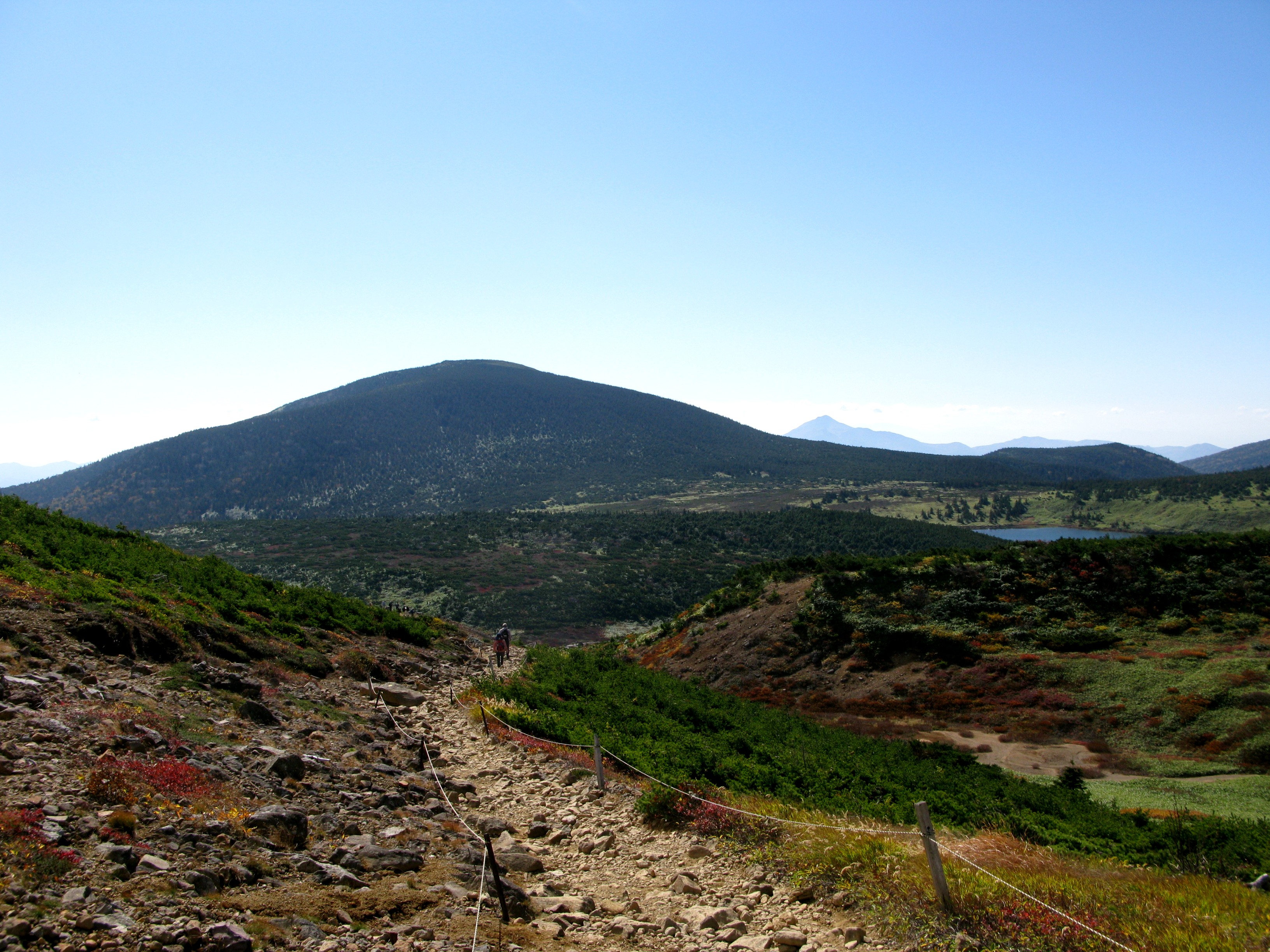
The Tohoku Alps and the Coming-of-Age Mountain
The park's southwestern unit, the Iide Range, carries its own name for grandeur: the Tohoku Alps. Five peaks break the 2,000-meter mark, led by Mount Dainichi at 2,128 meters and the range's spiritual namesake, Mount Iide, at 2,105 meters. Snowpacks cling to many summits year-round, and in summer the ridgelines blaze with alpine wildflowers that draw hikers from across Japan. But Iide is more than a hiking destination. In 652, the legendary ascetic En no Ozunu is said to have founded the practice of Shugendo on this mountain, and generations of Yamabushi followed. The Iide Shrine stands at the summit. Until the Pacific War, women were forbidden to climb. A local custom held that only boys who had reached the peak before age fifteen could be considered men. From the ridge on clear days, the view stretches from the Asahi Range to Mount Azuma, across the Aizu Basin to Mount Nasu, and all the way to the Sea of Japan -- a panorama that encompasses the park's full sweep.
A Park in Three Pieces
Bandai-Asahi's unusual structure -- three separate mountain systems governed as one park -- reflects the geological and cultural connections running through the Tohoku region. The Dewasanzan-Asahi and Iide units share roots in the Echigo Range and the Shugendo tradition. National Route 112 threads between them, carrying modern traffic along a corridor that has connected Japan's interior with the Sea of Japan coast for centuries. The beech forests that blanket the lower slopes of all three units shift to shrubs above 1,200 meters, then to alpine meadows and bare rock. Golden eagles hunt above treeline. Black bears forage in the beech groves below. The park receives some of the heaviest snowfall in Japan, and that snow -- measured in meters, not centimeters -- shapes everything from the vegetation to the local calendar. Trails are accessible from all sides of each mountain unit, but the season is short and the weather changes fast. The mountains give generously, but they set the terms.
From the Air
Located at 37.82°N, 139.73°E in the Tohoku region of northern Honshu, Japan. The park's three units span a wide area across Fukushima, Yamagata, and Niigata prefectures. From altitude, the Dewa peaks (Mount Gassan at 1,984 m) and the Iide Range (Mount Dainichi at 2,128 m) are prominent terrain features with year-round snow visible on higher ridges. The Gassan Reservoir is a clear water landmark in the Asahi unit. Best viewed at 5,000-8,000 feet AGL for mountain relief. Yamagata Airport (RJSC) lies to the east, Niigata Airport (RJSN) to the southwest, and Fukushima Airport (RJSF) to the southeast. Mountain weather conditions can change rapidly -- expect turbulence and reduced visibility near ridgelines.